Property Record
3660 Maco Rd Ne, Leland, NC 28451

Property Detail
3660 Maco Rd Ne
Wilmington, NC
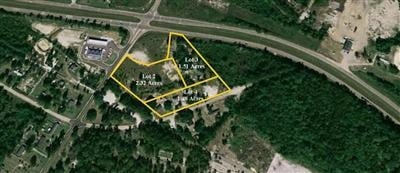
L-2B 1.08 AC PL 94/66 NC 87
0210003904
Brunswick
Vacantlandnec
North Carolina
CLD
2b
B and X Area of moderate flood hazard, usually the area between the limits of the 100-year and 500-year floods.
1.08 AC
2025
Leland
2025
Wilmington
020602
NEARBY LISTINGS FOR SALE OR LEASE
-
-
View all Leland listings for sale on LoopNet.com
DEMOGRAPHICS near 3660 Maco Rd Ne
1 mile
3 mile
5 mile
2025 Total Population
606
4,071
10,908
2030 Population
701
4,693
12,485
Pop Growth 2025-2030
+ 15.68%
+ 15.28%
+ 14.46%
Average Age
42
44
43
2025 Total Households
236
1,631
4,339
HH Growth 2025-2030
+ 15.25%
+ 15.08%
+ 14.29%
Median Household Inc
$77,678
$78,931
$73,680
Avg Household Size
2.40
2.40
2.40
2025 Avg HH Vehicles
2.00
2.00
2.00
Median Home Value
$278,030
$309,434
$279,034
Median Year Built
1998
2008
2007
Nearby Places
Map Layers
Map Styles
 Street
 Aerial
Layers
 Traffic
 Biking
Places
Listings with unknown addresses are not visible on the map
- Restaurants
- Banks
- Shops
- Fitness
- Groceries
PUBLIC TRANSPORTATION
AIRPORT
Wilmington International
Drive
Walk
Distance
Wilmington International
29 min
19.8 mi
Freight Ports
Port of Wilmington
Drive
Walk
Distance
Port of Wilmington
23 min
15.0 mi
SALE & LEASE HISTORY
LISTING DATE
SALE/LEASE

Sep 24, 2016
For Sale
Nearby Properties
Address
Land Use
TOTAL SIZE
Lot Size
Zoning
Address
Land Use
TOTAL SIZE
Lot Size
Zoning
127,256 SF
7 AC
CLD
Address
Land Use
TOTAL SIZE
Lot Size
Zoning
17,364 SF
200 AC
RR
Address
Land Use
TOTAL SIZE
Lot Size
Zoning
5,256 SF
23.74 AC
R60
Address
Land Use
TOTAL SIZE
Lot Size
Zoning
505,480 SF
29.02 AC
CI
Address
Land Use
TOTAL SIZE
Lot Size
Zoning
494.09 AC
Address
Land Use
TOTAL SIZE
Lot Size
Zoning
31,250 SF
175.80 AC
RR
Address
Land Use
TOTAL SIZE
Lot Size
Zoning
750.80 AC
HI
Address
Land Use
TOTAL SIZE
Lot Size
Zoning
6,553 SF
2.63 AC
CLD
Address
Land Use
TOTAL SIZE
Lot Size
Zoning
15,359 SF
22.55 AC
SBR6
Address
Land Use
TOTAL SIZE
Lot Size
Zoning
4,528 SF
3.65 AC
CLD
Address
Land Use
TOTAL SIZE
Lot Size
Zoning
8,698 SF
8.31 AC
SBR6
Address
Land Use
TOTAL SIZE
Lot Size
Zoning
7,369 SF
1.24 AC
CLD
Address
Land Use
TOTAL SIZE
Lot Size
Zoning
5,000 SF
1.36 AC
CLD
Address
Land Use
TOTAL SIZE
Lot Size
Zoning
5,256 SF
8.71 AC
R60
Address
Land Use
TOTAL SIZE
Lot Size
Zoning
3,202 SF
1.43 AC
CLD
Address
Land Use
TOTAL SIZE
Lot Size
Zoning
2,520 SF
3.21 AC
RR
Address
Land Use
TOTAL SIZE
Lot Size
Zoning
116.82 AC
C1
Address
Land Use
TOTAL SIZE
Lot Size
Zoning
7,680 SF
1.01 AC
B1
Address
Land Use
TOTAL SIZE
Lot Size
Zoning
8,760 SF
4.90 AC
CI
Address
Land Use
TOTAL SIZE
Lot Size
Zoning
5,102 SF
1.02 AC
RR
Address
Land Use
TOTAL SIZE
Lot Size
Zoning
5,448 SF
0.99 AC
RR
Address
Land Use
TOTAL SIZE
Lot Size
Zoning
28.69 AC
CI
Address
Land Use
TOTAL SIZE
Lot Size
Zoning
5,580 SF
1.51 AC
CLD
Address
Land Use
TOTAL SIZE
Lot Size
Zoning
6,000 SF
11 AC
IG
Address
Land Use
TOTAL SIZE
Lot Size
Zoning
4,528 SF
0.47 AC
RR
Address
Land Use
TOTAL SIZE
Lot Size
Zoning
32.98 AC
SBR6
Address
Land Use
TOTAL SIZE
Lot Size
Zoning
59.17 AC
RR
The World's #1 Commercial Real Estate Marketplace
Connect with us
© 2026 CoStar Group
The information above has been obtained from sources believed reliable. While we do not doubt its accuracy we have not verified it and make no guarantee, warranty or representation about it. It is your responsibility to independently confirm its accuracy and completeness. Any projections, opinions, assumptions, or estimates used are for example only and do not represent the current or future performance of the property. The value of this transaction to you depends on tax and other factors which should be evaluated by your tax, financial, and legal advisors. You and your advisors should conduct a careful, independent investigation of the property to determine to your satisfaction the suitability of the property for your needs.