Property Record
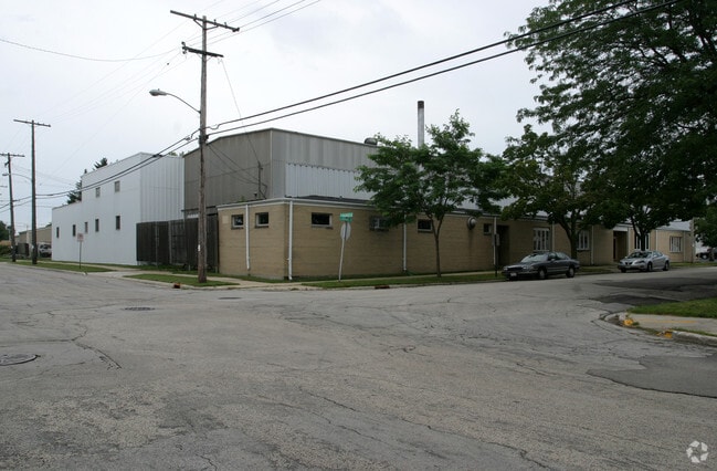
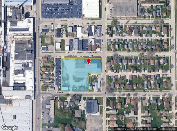
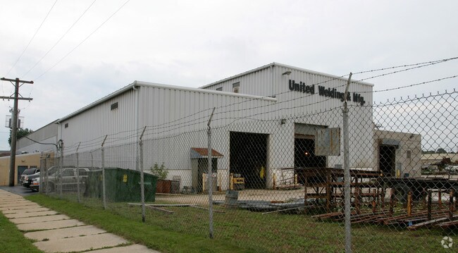
3665 E Adams Ave, Cudahy, WI 53110
NEARBY LISTINGS FOR SALE OR LEASE
Property Detail
3665 E Adams Ave
635-0534-001
Francis Heights
Industrialgeneral
CERTIFIED SURVEY MAP NO 2187 PARCEL 1
X
Milwaukee
55079C0178E
Wisconsin
2024
2.45 AC
2024
Milwaukee SE
180300
Milwaukee/Madison
37,280 SF
Milwaukee-Waukesha-West Allis, WI
DEMOGRAPHICS near 3665 E Adams Ave
1 Mile
3 Mile
5 Mile
2024 Total Population
11,142
49,956
135,590
2029 Population
10,825
48,559
131,963
Pop Growth 2024-2029
(2.85%)
(2.80%)
(2.67%)
Average Age
42
42
40
2024 Total Households
5,041
23,009
58,310
HH Growth 2024-2029
(2.96%)
(2.83%)
(2.72%)
Median Household Inc
$59,349
$63,192
$65,308
Avg Household Size
2.20
2.10
2.30
2024 Avg HH Vehicles
2.00
2.00
2.00
Median Home Value
$172,348
$191,395
$197,276
Median Year Built
1960
1956
1957
Nearby Places
Map Layers
Map Styles
 Street
 Aerial
- Restaurants
- Banks
- Shops
- Fitness
- Groceries
PUBLIC TRANSPORTATION
COMMUTER RAIL
DRIVE
WALK
Distance
14 min
5.3 mi
DRIVE
WALK
Distance
17 min
8.5 mi
AIRPORT
General Mitchell International
DRIVE
WALK
Distance
General Mitchell International
12 min
4.5 mi
Freight Ports
Port Milwaukee
DRIVE
WALK
Distance
Port Milwaukee
14 min
5.8 mi
Nearby Properties
Address
Land Use
TOTAL SIZE
Lot Size
Zoning
Address
Land Use
TOTAL SIZE
Lot Size
Zoning
Address
Land Use
TOTAL SIZE
Lot Size
Zoning
11.09 AC
Address
Land Use
TOTAL SIZE
Lot Size
Zoning
Address
Land Use
TOTAL SIZE
Lot Size
Zoning
26.21 AC
Address
Land Use
TOTAL SIZE
Lot Size
Zoning
360,000 SF
14.60 AC
IL1
Address
Land Use
TOTAL SIZE
Lot Size
Zoning
378,000 SF
19.24 AC
M-1PUD
Address
Land Use
TOTAL SIZE
Lot Size
Zoning
94.05 AC
PK
Address
Land Use
TOTAL SIZE
Lot Size
Zoning
153,300 SF
7.39 AC
M-1PUD
Address
Land Use
TOTAL SIZE
Lot Size
Zoning
85,264 SF
3.67 AC
PD
Address
Land Use
TOTAL SIZE
Lot Size
Zoning
216,281 SF
5.99 AC
RESIDENTIA
Address
Land Use
TOTAL SIZE
Lot Size
Zoning
Address
Land Use
TOTAL SIZE
Lot Size
Zoning
Address
Land Use
TOTAL SIZE
Lot Size
Zoning
Address
Land Use
TOTAL SIZE
Lot Size
Zoning
Address
Land Use
TOTAL SIZE
Lot Size
Zoning
Address
Land Use
TOTAL SIZE
Lot Size
Zoning
Address
Land Use
TOTAL SIZE
Lot Size
Zoning
Address
Land Use
TOTAL SIZE
Lot Size
Zoning
153,000 SF
8.22 AC
M-1PUD
Address
Land Use
TOTAL SIZE
Lot Size
Zoning
149,489 SF
7.43 AC
M-1PUD
Address
Land Use
TOTAL SIZE
Lot Size
Zoning
142,210 SF
14.70 AC
M-1PUD
Address
Land Use
TOTAL SIZE
Lot Size
Zoning
Address
Land Use
TOTAL SIZE
Lot Size
Zoning
36.60 AC
Address
Land Use
TOTAL SIZE
Lot Size
Zoning
405,764 SF
12.70 AC
M-2
Address
Land Use
TOTAL SIZE
Lot Size
Zoning
169,128 SF
8.92 AC
M-1PUD
Address
Land Use
TOTAL SIZE
Lot Size
Zoning
Address
Land Use
TOTAL SIZE
Lot Size
Zoning
126,791 SF
8.81 AC
RESIDENTIA
Address
Land Use
TOTAL SIZE
Lot Size
Zoning
87,963 SF
3.10 AC
RM2
Address
Land Use
TOTAL SIZE
Lot Size
Zoning
118,320 SF
6.29 AC
M-1PUD
Address
Land Use
TOTAL SIZE
Lot Size
Zoning
Address
Land Use
TOTAL SIZE
Lot Size
Zoning
62,194 SF
2.85 AC
PD
The World's #1 Commercial Real Estate Marketplace
Connect with us
© 2025 CoStar Group
The information above has been obtained from sources believed reliable. While we do not doubt its accuracy we have not verified it and make no guarantee, warranty or representation about it. It is your responsibility to independently confirm its accuracy and completeness. Any projections, opinions, assumptions, or estimates used are for example only and do not represent the current or future performance of the property. The value of this transaction to you depends on tax and other factors which should be evaluated by your tax, financial, and legal advisors. You and your advisors should conduct a careful, independent investigation of the property to determine to your satisfaction the suitability of the property for your needs.