Property Record
3666 Carrollton Rd, Carrollton, MI 48724

NEARBY LISTINGS FOR SALE OR LEASE
Property Detail
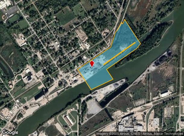
3666 Carrollton Rd
Industrialgeneral
PART OF PETER RILEY RESERVE & PART OF SEC 7 DESC AS FOLLOWS COM AT NE CORN OF SEC TH N87DEG W 764.92 FT TO INTERSECTION WITH C/L OF CARROLLTON RD TH S17DEG W 418.46 FT TH S16DEG W 919.06 FT TH S33DEG E 190.91 FT TO POB OF THIS DESC TH CONT S33DEG E 7
AE
Saginaw
26145C0183E
Michigan
2024
50.53 AC
2025
Other Market Areas
010700
Saginaw, MI
14,505 SF
11125073025000
DEMOGRAPHICS near 3666 Carrollton Rd
1 Mile
3 Mile
5 Mile
2024 Total Population
1,658
32,478
86,110
2029 Population
1,649
32,565
85,837
Pop Growth 2024-2029
(0.54%)
+ 0.27%
(0.32%)
Average Age
38
39
40
2024 Total Households
652
13,969
36,172
HH Growth 2024-2029
(0.61%)
+ 0.10%
(0.44%)
Median Household Inc
$23,836
$32,221
$37,685
Avg Household Size
2.40
2.20
2.20
2024 Avg HH Vehicles
2.00
2.00
2.00
Median Home Value
$54,709
$62,974
$77,649
Median Year Built
1953
1955
1958
Nearby Places
Map Layers
Map Styles
 Street
 Aerial
- Restaurants
- Banks
- Shops
- Fitness
- Groceries
PUBLIC TRANSPORTATION
AIRPORT
MBS International
DRIVE
WALK
Distance
MBS International
33 min
22.2 mi
Freight Ports
Port of Toledo
DRIVE
WALK
Distance
Port of Toledo
174 min
149.2 mi
Nearby Properties
Address
Land Use
TOTAL SIZE
Lot Size
Zoning
Address
Land Use
TOTAL SIZE
Lot Size
Zoning
551,744 SF
33.92 AC
B-3
Address
Land Use
TOTAL SIZE
Lot Size
Zoning
96,487 SF
8.47 AC
B-3
Address
Land Use
TOTAL SIZE
Lot Size
Zoning
177,778 SF
13.16 AC
Address
Land Use
TOTAL SIZE
Lot Size
Zoning
191,272 SF
19.80 AC
R-3
Address
Land Use
TOTAL SIZE
Lot Size
Zoning
164,040 SF
11.80 AC
R-3
Address
Land Use
TOTAL SIZE
Lot Size
Zoning
172,573 SF
19.07 AC
R-3
Address
Land Use
TOTAL SIZE
Lot Size
Zoning
213,500 SF
Address
Land Use
TOTAL SIZE
Lot Size
Zoning
70,050 SF
2.25 AC
B-4
Address
Land Use
TOTAL SIZE
Lot Size
Zoning
162,161 SF
12.61 AC
R-3
Address
Land Use
TOTAL SIZE
Lot Size
Zoning
134,571 SF
12.23 AC
B-3
Address
Land Use
TOTAL SIZE
Lot Size
Zoning
62,124 SF
3.15 AC
B-2
Address
Land Use
TOTAL SIZE
Lot Size
Zoning
88,901 SF
5.21 AC
RMU
Address
Land Use
TOTAL SIZE
Lot Size
Zoning
199,696 SF
27.42 AC
B-2
Address
Land Use
TOTAL SIZE
Lot Size
Zoning
189,360 SF
15.62 AC
B-3
Address
Land Use
TOTAL SIZE
Lot Size
Zoning
26,792 SF
7.89 AC
B-3
Address
Land Use
TOTAL SIZE
Lot Size
Zoning
111,372 SF
7.99 AC
M-1 IND
Address
Land Use
TOTAL SIZE
Lot Size
Zoning
141,231 SF
16.35 AC
B-4
Address
Land Use
TOTAL SIZE
Lot Size
Zoning
54,851 SF
2.30 AC
B-2
Address
Land Use
TOTAL SIZE
Lot Size
Zoning
49,452 SF
2.48 AC
B-2
Address
Land Use
TOTAL SIZE
Lot Size
Zoning
83,156 SF
15.19 AC
Address
Land Use
TOTAL SIZE
Lot Size
Zoning
57.28 AC
M-2
Address
Land Use
TOTAL SIZE
Lot Size
Zoning
105,424 SF
7.49 AC
B-2
Address
Land Use
TOTAL SIZE
Lot Size
Zoning
46,573 SF
1.46 AC
B-2
Address
Land Use
TOTAL SIZE
Lot Size
Zoning
90,811 SF
10.95 AC
R-3
Address
Land Use
TOTAL SIZE
Lot Size
Zoning
208,935 SF
19.87 AC
M-1
Address
Land Use
TOTAL SIZE
Lot Size
Zoning
115,962 SF
10.11 AC
B-3
Address
Land Use
TOTAL SIZE
Lot Size
Zoning
172,319 SF
20 AC
B-3
Address
Land Use
TOTAL SIZE
Lot Size
Zoning
132,969 SF
14.50 AC
B-2
Address
Land Use
TOTAL SIZE
Lot Size
Zoning
174,000 SF
40.03 AC
Address
Land Use
TOTAL SIZE
Lot Size
Zoning
45,256 SF
3.95 AC
B-4
The World's #1 Commercial Real Estate Marketplace
Connect with us
© 2025 CoStar Group
The information above has been obtained from sources believed reliable. While we do not doubt its accuracy we have not verified it and make no guarantee, warranty or representation about it. It is your responsibility to independently confirm its accuracy and completeness. Any projections, opinions, assumptions, or estimates used are for example only and do not represent the current or future performance of the property. The value of this transaction to you depends on tax and other factors which should be evaluated by your tax, financial, and legal advisors. You and your advisors should conduct a careful, independent investigation of the property to determine to your satisfaction the suitability of the property for your needs.