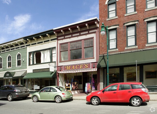
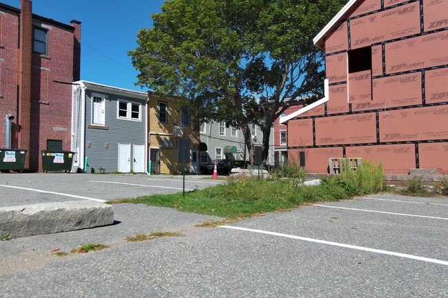
Property Record
367 Main St, Thomaston, ME 04861
Property Detail
367 Main St
THON-000106-000000-039000
Knox
Vacantlandnec
Maine
R3
39-0
B and X Area of moderate flood hazard, usually the area between the limits of the 100-year and 500-year floods.
0.64 AC
2025
Maine Midcoast
2025
Other Market Areas
970402
NEARBY LISTINGS FOR SALE OR LEASE
-
-
View all Thomaston listings for sale on LoopNet.com
DEMOGRAPHICS near 367 Main St
1 mile
3 mile
5 mile
2025 Total Population
5,209
9,154
13,826
2030 Population
5,208
9,159
13,781
Pop Growth 2025-2030
(0.02%)
+ 0.05%
(0.33%)
Average Age
46
47
47
2025 Total Households
2,578
4,399
6,472
HH Growth 2025-2030
0.00%
+ 0.05%
(0.36%)
Median Household Inc
$56,919
$61,115
$65,562
Avg Household Size
1.90
2.00
2.10
2025 Avg HH Vehicles
1.00
2.00
2.00
Median Home Value
$273,561
$303,167
$299,793
Median Year Built
1949
1963
1967
Nearby Places
Map Layers
Map Styles
 Street
 Aerial
Layers
 Traffic
 Biking
Places
Listings with unknown addresses are not visible on the map
- Restaurants
- Banks
- Shops
- Fitness
- Groceries
SALE & LEASE HISTORY
LISTING DATE
SALE/LEASE

Oct 10, 2025
For Sale
Jul 19, 2017
For Sale
Nearby Properties
Address
Land Use
TOTAL SIZE
Lot Size
Zoning
Address
Land Use
TOTAL SIZE
Lot Size
Zoning
31.46 AC
IN
Address
Land Use
TOTAL SIZE
Lot Size
Zoning
2,555 SF
574 AC
SEASON
Address
Land Use
TOTAL SIZE
Lot Size
Zoning
145,347 SF
30.22 AC
HC
Address
Land Use
TOTAL SIZE
Lot Size
Zoning
142,400 SF
19.68 AC
HC
Address
Land Use
TOTAL SIZE
Lot Size
Zoning
859 SF
21.28 AC
SEASON
Address
Land Use
TOTAL SIZE
Lot Size
Zoning
50,910 SF
2.15 AC
HC
Address
Land Use
TOTAL SIZE
Lot Size
Zoning
98,105 SF
51.16 AC
R3
Address
Land Use
TOTAL SIZE
Lot Size
Zoning
22,110 SF
22.61 AC
HC
Address
Land Use
TOTAL SIZE
Lot Size
Zoning
108,537 SF
9.07 AC
SC
Address
Land Use
TOTAL SIZE
Lot Size
Zoning
203.31 AC
IN
Address
Land Use
TOTAL SIZE
Lot Size
Zoning
Address
Land Use
TOTAL SIZE
Lot Size
Zoning
21,831 SF
7.84 AC
HC
Address
Land Use
TOTAL SIZE
Lot Size
Zoning
252.52 AC
R1
Address
Land Use
TOTAL SIZE
Lot Size
Zoning
20,646 SF
1.79 AC
R3
Address
Land Use
TOTAL SIZE
Lot Size
Zoning
11,468 SF
2 AC
HC
Address
Land Use
TOTAL SIZE
Lot Size
Zoning
23,091 SF
R3
Address
Land Use
TOTAL SIZE
Lot Size
Zoning
6,223 SF
1.45 AC
HC
Address
Land Use
TOTAL SIZE
Lot Size
Zoning
253 SF
173.15 AC
IN
Address
Land Use
TOTAL SIZE
Lot Size
Zoning
26,898 SF
10.08 AC
R3
Address
Land Use
TOTAL SIZE
Lot Size
Zoning
8,598 SF
1.63 AC
HC
Address
Land Use
TOTAL SIZE
Lot Size
Zoning
12,344 SF
6.06 AC
IN
Address
Land Use
TOTAL SIZE
Lot Size
Zoning
19,312 SF
6.80 AC
HC
Address
Land Use
TOTAL SIZE
Lot Size
Zoning
15,400 SF
1.56 AC
HC
Address
Land Use
TOTAL SIZE
Lot Size
Zoning
36,718 SF
35.54 AC
R1
Address
Land Use
TOTAL SIZE
Lot Size
Zoning
18,000 SF
6.20 AC
SEASON
Address
Land Use
TOTAL SIZE
Lot Size
Zoning
31,511 SF
0.86 AC
VC
Address
Land Use
TOTAL SIZE
Lot Size
Zoning
11,317 SF
3.25 AC
R3
Address
Land Use
TOTAL SIZE
Lot Size
Zoning
20,592 SF
9.24 AC
R2
Address
Land Use
TOTAL SIZE
Lot Size
Zoning
12,357 SF
0.33 AC
VC
Address
Land Use
TOTAL SIZE
Lot Size
Zoning
10,080 SF
2.45 AC
IN
The World's #1 Commercial Real Estate Marketplace
Connect with us
© 2026 CoStar Group
The information above has been obtained from sources believed reliable. While we do not doubt its accuracy we have not verified it and make no guarantee, warranty or representation about it. It is your responsibility to independently confirm its accuracy and completeness. Any projections, opinions, assumptions, or estimates used are for example only and do not represent the current or future performance of the property. The value of this transaction to you depends on tax and other factors which should be evaluated by your tax, financial, and legal advisors. You and your advisors should conduct a careful, independent investigation of the property to determine to your satisfaction the suitability of the property for your needs.