Property Record
367 Mayfield Rd, Duncan, SC 29334
NEARBY LISTINGS FOR SALE OR LEASE
Property Detail
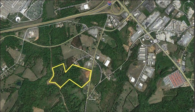
367 Mayfield Rd
5-29-00-081.00
Eunice P Miller
Commercialnec
W SIDE RD 133 S OF I 85 PB 135-211 DB 76M-69 PB 135-210 DB 76M-65 DB 88T-241 PB 152-848
X
Spartanburg
45083C0218D
South Carolina
0
17.32 AC
2025
Rt 101 Corridor
023202
Greenville/Spartanburg
199,188 SF
Spartanburg, SC
DEMOGRAPHICS near 367 Mayfield Rd
1 mile
3 mile
5 mile
2024 Total Population
1,061
12,788
57,558
2029 Population
1,244
14,740
65,292
Pop Growth 2024-2029
+ 17.25%
+ 15.26%
+ 13.44%
Average Age
40
37
38
2024 Total Households
415
4,530
21,330
HH Growth 2024-2029
+ 17.35%
+ 15.52%
+ 13.60%
Median Household Inc
$88,646
$85,069
$72,478
Avg Household Size
2.50
2.80
2.70
2024 Avg HH Vehicles
2.00
2.00
2.00
Median Home Value
$240,666
$256,187
$253,687
Median Year Built
2010
2007
2001
Nearby Places
Map Layers
Map Styles
 Street
 Aerial
Transit
 Traffic
 Biking
Places
Listings with unknown addresses are not visible on the map
- Restaurants
- Banks
- Shops
- Fitness
- Groceries
PUBLIC TRANSPORTATION
AIRPORT
Greenville Spartanburg International
Drive
Walk
Distance
Greenville Spartanburg International
13 min
5.8 mi
Freight Ports
North Charleston Terminal
Drive
Walk
Distance
North Charleston Terminal
230 min
199.8 mi
SALE & LEASE HISTORY
LISTING DATE
SALE/LEASE

Sep 24, 2016
For Sale
Nearby Properties
Address
Land Use
TOTAL SIZE
Lot Size
Zoning
Address
Land Use
TOTAL SIZE
Lot Size
Zoning
380,932 SF
30.39 AC
Address
Land Use
TOTAL SIZE
Lot Size
Zoning
241,696 SF
15.12 AC
Address
Land Use
TOTAL SIZE
Lot Size
Zoning
235,600 SF
14.48 AC
Address
Land Use
TOTAL SIZE
Lot Size
Zoning
214,064 SF
16.18 AC
Address
Land Use
TOTAL SIZE
Lot Size
Zoning
95.88 AC
Address
Land Use
TOTAL SIZE
Lot Size
Zoning
1,320,000 SF
130.98 AC
Address
Land Use
TOTAL SIZE
Lot Size
Zoning
86,884 SF
5.31 AC
Address
Land Use
TOTAL SIZE
Lot Size
Zoning
111.08 AC
Address
Land Use
TOTAL SIZE
Lot Size
Zoning
66.99 AC
Address
Land Use
TOTAL SIZE
Lot Size
Zoning
2,417 SF
115.88 AC
Address
Land Use
TOTAL SIZE
Lot Size
Zoning
1,281 SF
41.23 AC
Address
Land Use
TOTAL SIZE
Lot Size
Zoning
177,675 SF
39.88 AC
Address
Land Use
TOTAL SIZE
Lot Size
Zoning
1,218 SF
34.73 AC
Address
Land Use
TOTAL SIZE
Lot Size
Zoning
2,497 SF
12.36 AC
Address
Land Use
TOTAL SIZE
Lot Size
Zoning
736,169 SF
24.99 AC
Address
Land Use
TOTAL SIZE
Lot Size
Zoning
15.17 AC
Address
Land Use
TOTAL SIZE
Lot Size
Zoning
33.34 AC
Address
Land Use
TOTAL SIZE
Lot Size
Zoning
33.40 AC
Address
Land Use
TOTAL SIZE
Lot Size
Zoning
215,006 SF
25.51 AC
Address
Land Use
TOTAL SIZE
Lot Size
Zoning
1,176 SF
20.13 AC
Address
Land Use
TOTAL SIZE
Lot Size
Zoning
107.32 AC
Address
Land Use
TOTAL SIZE
Lot Size
Zoning
8,543 SF
13.14 AC
Address
Land Use
TOTAL SIZE
Lot Size
Zoning
297,700 SF
23.64 AC
Address
Land Use
TOTAL SIZE
Lot Size
Zoning
137.18 AC
Address
Land Use
TOTAL SIZE
Lot Size
Zoning
72.04 AC
Address
Land Use
TOTAL SIZE
Lot Size
Zoning
7,776 SF
29.90 AC
Address
Land Use
TOTAL SIZE
Lot Size
Zoning
56,769 SF
14.71 AC
Address
Land Use
TOTAL SIZE
Lot Size
Zoning
204,457 SF
47.28 AC
Address
Land Use
TOTAL SIZE
Lot Size
Zoning
2,501 SF
38.08 AC
Address
Land Use
TOTAL SIZE
Lot Size
Zoning
10.08 AC
The World's #1 Commercial Real Estate Marketplace
Connect with us
© 2026 CoStar Group
The information above has been obtained from sources believed reliable. While we do not doubt its accuracy we have not verified it and make no guarantee, warranty or representation about it. It is your responsibility to independently confirm its accuracy and completeness. Any projections, opinions, assumptions, or estimates used are for example only and do not represent the current or future performance of the property. The value of this transaction to you depends on tax and other factors which should be evaluated by your tax, financial, and legal advisors. You and your advisors should conduct a careful, independent investigation of the property to determine to your satisfaction the suitability of the property for your needs.