Property Record
367 W 2Nd St, Dayton, OH 45402
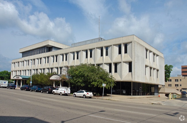
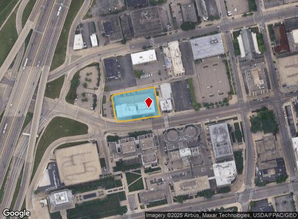
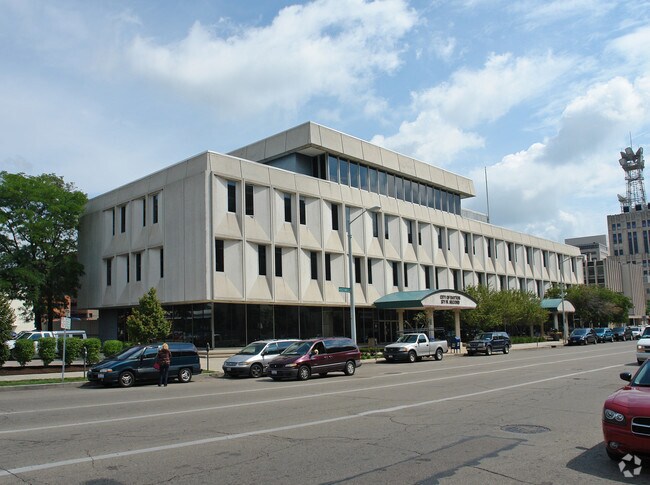
Property Detail
367 W 2Nd St
Dayton, OH
Center City West
R72-00104-0036
77858PT
Municipalproperty
Montgomery
X
Ohio
39113C0164E
36
2024
1.09 AC
2025
Dayton CBD
001501
Cincinnati/Dayton
102,322 SF
NEARBY LISTINGS FOR SALE OR LEASE
DEMOGRAPHICS near 367 W 2Nd St
1 mile
3 mile
5 mile
2024 Total Population
10,827
111,682
230,215
2029 Population
11,089
114,585
232,376
Pop Growth 2024-2029
+ 2.42%
+ 2.60%
+ 0.94%
Average Age
42
37
38
2024 Total Households
5,908
45,592
98,231
HH Growth 2024-2029
+ 2.27%
+ 2.73%
+ 0.89%
Median Household Inc
$36,040
$37,260
$42,479
Avg Household Size
1.60
2.20
2.20
2024 Avg HH Vehicles
1.00
1.00
1.00
Median Home Value
$141,415
$77,026
$94,254
Median Year Built
1951
1948
1953
Nearby Places
Map Layers
Map Styles
 Street
 Aerial
Transit
 Traffic
 Biking
Places
Listings with unknown addresses are not visible on the map
- Restaurants
- Banks
- Shops
- Fitness
- Groceries
PUBLIC TRANSPORTATION
AIRPORT
James M Cox Dayton International
Drive
Walk
Distance
James M Cox Dayton International
21 min
13.0 mi
Freight Ports
Port of Toledo
Drive
Walk
Distance
Port of Toledo
176 min
153.1 mi
Nearby Properties
Address
Land Use
TOTAL SIZE
Lot Size
Zoning
Address
Land Use
TOTAL SIZE
Lot Size
Zoning
1,570,433 SF
13.34 AC
Address
Land Use
TOTAL SIZE
Lot Size
Zoning
154,360 SF
19.35 AC
Address
Land Use
TOTAL SIZE
Lot Size
Zoning
634,753 SF
54 AC
Address
Land Use
TOTAL SIZE
Lot Size
Zoning
127,232 SF
7.96 AC
Address
Land Use
TOTAL SIZE
Lot Size
Zoning
11.64 AC
Address
Land Use
TOTAL SIZE
Lot Size
Zoning
29,760 SF
5.13 AC
Address
Land Use
TOTAL SIZE
Lot Size
Zoning
767,771 SF
1.32 AC
Address
Land Use
TOTAL SIZE
Lot Size
Zoning
188,584 SF
2.83 AC
Address
Land Use
TOTAL SIZE
Lot Size
Zoning
1.95 AC
Address
Land Use
TOTAL SIZE
Lot Size
Zoning
23,031 SF
63.14 AC
Address
Land Use
TOTAL SIZE
Lot Size
Zoning
5.42 AC
Address
Land Use
TOTAL SIZE
Lot Size
Zoning
5.41 AC
Address
Land Use
TOTAL SIZE
Lot Size
Zoning
23.35 AC
Address
Land Use
TOTAL SIZE
Lot Size
Zoning
375,053 SF
7.27 AC
Address
Land Use
TOTAL SIZE
Lot Size
Zoning
761,679 SF
5.09 AC
Address
Land Use
TOTAL SIZE
Lot Size
Zoning
222,197 SF
1.80 AC
Address
Land Use
TOTAL SIZE
Lot Size
Zoning
11.83 AC
Address
Land Use
TOTAL SIZE
Lot Size
Zoning
200,150 SF
1.81 AC
Address
Land Use
TOTAL SIZE
Lot Size
Zoning
3.76 AC
Address
Land Use
TOTAL SIZE
Lot Size
Zoning
255,494 SF
4.64 AC
Address
Land Use
TOTAL SIZE
Lot Size
Zoning
45,583 SF
4.91 AC
Address
Land Use
TOTAL SIZE
Lot Size
Zoning
128,859 SF
5.31 AC
Address
Land Use
TOTAL SIZE
Lot Size
Zoning
4.86 AC
Address
Land Use
TOTAL SIZE
Lot Size
Zoning
158,144 SF
4.16 AC
Address
Land Use
TOTAL SIZE
Lot Size
Zoning
296,568 SF
3.60 AC
Address
Land Use
TOTAL SIZE
Lot Size
Zoning
268,166 SF
2.12 AC
Address
Land Use
TOTAL SIZE
Lot Size
Zoning
41.38 AC
Address
Land Use
TOTAL SIZE
Lot Size
Zoning
0.74 AC
Address
Land Use
TOTAL SIZE
Lot Size
Zoning
357,800 SF
1.22 AC
Address
Land Use
TOTAL SIZE
Lot Size
Zoning
88,479 SF
4.43 AC
The World's #1 Commercial Real Estate Marketplace
Connect with us
© 2026 CoStar Group
The information above has been obtained from sources believed reliable. While we do not doubt its accuracy we have not verified it and make no guarantee, warranty or representation about it. It is your responsibility to independently confirm its accuracy and completeness. Any projections, opinions, assumptions, or estimates used are for example only and do not represent the current or future performance of the property. The value of this transaction to you depends on tax and other factors which should be evaluated by your tax, financial, and legal advisors. You and your advisors should conduct a careful, independent investigation of the property to determine to your satisfaction the suitability of the property for your needs.