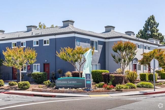
Property Record
3675 Edison St, San Mateo, CA 94403

Property Detail
3675 Edison St
San Francisco-San Mateo-Redwood City, CA
LOTS 1 THRU 4 BLOCK 5 HILLSDALE UNIT NO 5 RSM 29/17
042-122-050
SAN MATEO
Multifamilydwelling
California
B and X Area of moderate flood hazard, usually the area between the limits of the 100-year and 500-year floods.
1-4
2024
4.77 AC
2025
Sugarloaf
607200
San Francisco
146,038 SF
NEARBY LISTINGS FOR SALE OR LEASE
DEMOGRAPHICS near 3675 Edison St
1 mile
3 mile
5 mile
2025 Total Population
28,417
167,766
255,853
2030 Population
28,578
169,102
257,874
Pop Growth 2025-2030
+ 0.57%
+ 0.80%
+ 0.79%
Average Age
41
42
42
2025 Total Households
10,715
63,795
97,726
HH Growth 2025-2030
+ 0.52%
+ 0.80%
+ 0.79%
Median Household Inc
$187,581
$178,777
$179,697
Avg Household Size
2.60
2.50
2.50
2025 Avg HH Vehicles
2.00
2.00
2.00
Median Home Value
$1,125,979
$1,116,639
$1,120,364
Median Year Built
1960
1970
1968
Nearby Places
Map Layers
Map Styles
 Street
 Aerial
Layers
 Traffic
 Biking
Places
Listings with unknown addresses are not visible on the map
- Restaurants
- Banks
- Shops
- Fitness
- Groceries
PUBLIC TRANSPORTATION
COMMUTER RAIL
Hillsdale Caltrain Station Southbound (Express - Caltrain (Caltrain), Limited - Caltrain (Caltrain), Local Weekday - Caltrain (Caltrain), Local Weekend - Caltrain (Caltrain))
Drive
Walk
Distance
Hillsdale Caltrain Station Southbound (Express - Caltrain (Caltrain), Limited - Caltrain (Caltrain), Local Weekday - Caltrain (Caltrain), Local Weekend - Caltrain (Caltrain))
3 min
16 min
0.8 mi
Belmont Caltrain Station Southbound (Local Weekday - Caltrain (Caltrain), Local Weekend - Caltrain (Caltrain))
Drive
Walk
Distance
Belmont Caltrain Station Southbound (Local Weekday - Caltrain (Caltrain), Local Weekend - Caltrain (Caltrain))
4 min
1.7 mi
AIRPORT
San Francisco International
Drive
Walk
Distance
San Francisco International
15 min
9.9 mi
Norman Y Mineta San Jose International
Drive
Walk
Distance
Norman Y Mineta San Jose International
33 min
25.4 mi
Metro Oakland International
Drive
Walk
Distance
Metro Oakland International
34 min
25.6 mi
Freight Ports
Port of Redwood City
Drive
Walk
Distance
Port of Redwood City
14 min
8.3 mi
Nearby Properties
Address
Land Use
TOTAL SIZE
Lot Size
Zoning
Address
Land Use
TOTAL SIZE
Lot Size
Zoning
1,068,445 SF
39.82 AC
Address
Land Use
TOTAL SIZE
Lot Size
Zoning
239,107 SF
2.37 AC
Address
Land Use
TOTAL SIZE
Lot Size
Zoning
354,800 SF
6 AC
Address
Land Use
TOTAL SIZE
Lot Size
Zoning
738,000 SF
56.46 AC
TP0000
Address
Land Use
TOTAL SIZE
Lot Size
Zoning
215,318 SF
3.42 AC
Address
Land Use
TOTAL SIZE
Lot Size
Zoning
568,423 SF
16.07 AC
Address
Land Use
TOTAL SIZE
Lot Size
Zoning
311,952 SF
3.68 AC
Address
Land Use
TOTAL SIZE
Lot Size
Zoning
399,422 SF
5.94 AC
Address
Land Use
TOTAL SIZE
Lot Size
Zoning
260,547 SF
2.23 AC
Address
Land Use
TOTAL SIZE
Lot Size
Zoning
223,321 SF
8.39 AC
M10000
Address
Land Use
TOTAL SIZE
Lot Size
Zoning
397,793 SF
10.48 AC
CL00C1
Address
Land Use
TOTAL SIZE
Lot Size
Zoning
295,000 SF
4.02 AC
Address
Land Use
TOTAL SIZE
Lot Size
Zoning
400,000 SF
4.39 AC
C10000
Address
Land Use
TOTAL SIZE
Lot Size
Zoning
417,200 SF
29.07 AC
R300PD
Address
Land Use
TOTAL SIZE
Lot Size
Zoning
219,318 SF
4.77 AC
Address
Land Use
TOTAL SIZE
Lot Size
Zoning
190,245 SF
16.88 AC
M10000
Address
Land Use
TOTAL SIZE
Lot Size
Zoning
2,020 SF
2.64 AC
Address
Land Use
TOTAL SIZE
Lot Size
Zoning
337,459 SF
17.16 AC
EA0000
Address
Land Use
TOTAL SIZE
Lot Size
Zoning
2,024 SF
2.07 AC
Address
Land Use
TOTAL SIZE
Lot Size
Zoning
326,432 SF
10.27 AC
CL0C21
Address
Land Use
TOTAL SIZE
Lot Size
Zoning
245,260 SF
9.08 AC
Address
Land Use
TOTAL SIZE
Lot Size
Zoning
218,249 SF
2.15 AC
Address
Land Use
TOTAL SIZE
Lot Size
Zoning
150,806 SF
5.86 AC
Address
Land Use
TOTAL SIZE
Lot Size
Zoning
177,000 SF
6.24 AC
Address
Land Use
TOTAL SIZE
Lot Size
Zoning
1,849 SF
4.72 AC
CB0000
Address
Land Use
TOTAL SIZE
Lot Size
Zoning
395,010 SF
15.11 AC
R003S3
Address
Land Use
TOTAL SIZE
Lot Size
Zoning
Address
Land Use
TOTAL SIZE
Lot Size
Zoning
12,944 SF
12.37 AC
Address
Land Use
TOTAL SIZE
Lot Size
Zoning
0.93 AC
CL00C2
Address
Land Use
TOTAL SIZE
Lot Size
Zoning
196,504 SF
1.98 AC
The World's #1 Commercial Real Estate Marketplace
Connect with us
© 2026 CoStar Group
The information above has been obtained from sources believed reliable. While we do not doubt its accuracy we have not verified it and make no guarantee, warranty or representation about it. It is your responsibility to independently confirm its accuracy and completeness. Any projections, opinions, assumptions, or estimates used are for example only and do not represent the current or future performance of the property. The value of this transaction to you depends on tax and other factors which should be evaluated by your tax, financial, and legal advisors. You and your advisors should conduct a careful, independent investigation of the property to determine to your satisfaction the suitability of the property for your needs.