Property Record
368 Maxwell Rd, Alpharetta, GA 30009
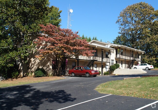

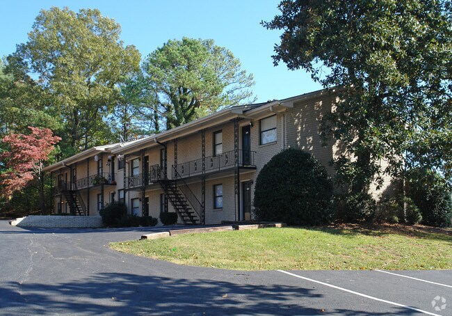

Property Detail
368 Maxwell Rd
12-2581-0693-064-6
370-372 MAXWELL RD
Apartment
FULTON
C2
Georgia
B and X Area of moderate flood hazard, usually the area between the limits of the 100-year and 500-year floods.
693
2025
2.68 AC
2025
Outlying Fulton County
011647
Atlanta
11,664 SF
Atlanta-Sandy Springs-Roswell, GA
NEARBY LISTINGS FOR SALE OR LEASE
DEMOGRAPHICS near 368 Maxwell Rd
1 mile
3 mile
5 mile
2025 Total Population
6,530
65,390
175,826
2030 Population
6,787
66,603
178,139
Pop Growth 2025-2030
+ 3.94%
+ 1.86%
+ 1.32%
Average Age
42
40
40
2025 Total Households
2,958
25,625
66,849
HH Growth 2025-2030
+ 3.89%
+ 1.93%
+ 1.24%
Median Household Inc
$119,141
$125,867
$132,980
Avg Household Size
2.20
2.50
2.60
2025 Avg HH Vehicles
2.00
2.00
2.00
Median Home Value
$688,849
$618,560
$626,379
Median Year Built
2005
1994
1993
Nearby Places
Map Layers
Map Styles
 Street
 Aerial
Layers
 Traffic
 Biking
Places
Listings with unknown addresses are not visible on the map
- Restaurants
- Banks
- Shops
- Fitness
- Groceries
Nearby Properties
Address
Land Use
TOTAL SIZE
Lot Size
Zoning
Address
Land Use
TOTAL SIZE
Lot Size
Zoning
1,080,765 SF
36.65 AC
MIX
Address
Land Use
TOTAL SIZE
Lot Size
Zoning
14,832,179 SF
50.89 AC
OI
Address
Land Use
TOTAL SIZE
Lot Size
Zoning
699,024 SF
6.79 AC
MIX
Address
Land Use
TOTAL SIZE
Lot Size
Zoning
4,705,880 SF
8.55 AC
OI
Address
Land Use
TOTAL SIZE
Lot Size
Zoning
415,701 SF
6.75 AC
OI
Address
Land Use
TOTAL SIZE
Lot Size
Zoning
3,459,339 SF
26.51 AC
OI
Address
Land Use
TOTAL SIZE
Lot Size
Zoning
330,549 SF
68.46 AC
CUP
Address
Land Use
TOTAL SIZE
Lot Size
Zoning
434,804 SF
4.96 AC
Address
Land Use
TOTAL SIZE
Lot Size
Zoning
11.82 AC
Address
Land Use
TOTAL SIZE
Lot Size
Zoning
604,953 SF
3.30 AC
MIX
Address
Land Use
TOTAL SIZE
Lot Size
Zoning
260,648 SF
34.20 AC
C3C
Address
Land Use
TOTAL SIZE
Lot Size
Zoning
1,672,146 SF
21.21 AC
R4
Address
Land Use
TOTAL SIZE
Lot Size
Zoning
241,349 SF
35 AC
OI
Address
Land Use
TOTAL SIZE
Lot Size
Zoning
1,159,560 SF
7.12 AC
CUP
Address
Land Use
TOTAL SIZE
Lot Size
Zoning
2,674,992 SF
28.94 AC
R4C
Address
Land Use
TOTAL SIZE
Lot Size
Zoning
7,788,760 SF
46.55 AC
R4
Address
Land Use
TOTAL SIZE
Lot Size
Zoning
303,485 SF
1.44 AC
C2
Address
Land Use
TOTAL SIZE
Lot Size
Zoning
2,109,527 SF
70.17 AC
OP
Address
Land Use
TOTAL SIZE
Lot Size
Zoning
666,599 SF
24.20 AC
PSC
Address
Land Use
TOTAL SIZE
Lot Size
Zoning
247,639 SF
0.68 AC
MIX
Address
Land Use
TOTAL SIZE
Lot Size
Zoning
761,850 SF
4.77 AC
OI
Address
Land Use
TOTAL SIZE
Lot Size
Zoning
308,494 SF
2.64 AC
OI
Address
Land Use
TOTAL SIZE
Lot Size
Zoning
1,854,951 SF
33.30 AC
CUP
Address
Land Use
TOTAL SIZE
Lot Size
Zoning
367,876 SF
41.40 AC
PSC
Address
Land Use
TOTAL SIZE
Lot Size
Zoning
2,101,414 SF
11 AC
CUP
Address
Land Use
TOTAL SIZE
Lot Size
Zoning
2,480,205 SF
37.86 AC
C1
Address
Land Use
TOTAL SIZE
Lot Size
Zoning
588,244 SF
11.80 AC
R4
Address
Land Use
TOTAL SIZE
Lot Size
Zoning
253,296 SF
1.34 AC
MIX
Address
Land Use
TOTAL SIZE
Lot Size
Zoning
396,000 SF
43.42 AC
C1
Address
Land Use
TOTAL SIZE
Lot Size
Zoning
2,289 SF
84.27 AC
AG1
The World's #1 Commercial Real Estate Marketplace
Connect with us
© 2026 CoStar Group
The information above has been obtained from sources believed reliable. While we do not doubt its accuracy we have not verified it and make no guarantee, warranty or representation about it. It is your responsibility to independently confirm its accuracy and completeness. Any projections, opinions, assumptions, or estimates used are for example only and do not represent the current or future performance of the property. The value of this transaction to you depends on tax and other factors which should be evaluated by your tax, financial, and legal advisors. You and your advisors should conduct a careful, independent investigation of the property to determine to your satisfaction the suitability of the property for your needs.