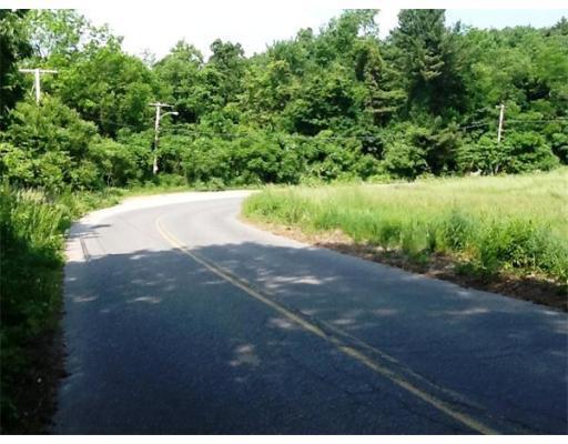
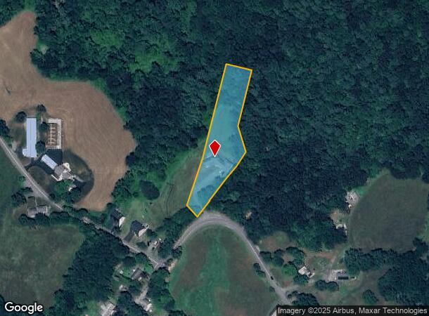
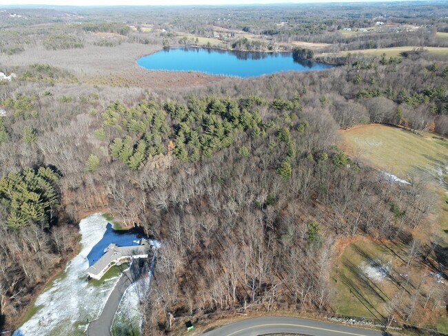
Property Record
368 Pierce St, Leominster, MA 01453
NEARBY LISTINGS FOR SALE OR LEASE
Property Detail
368 Pierce St
Worcester, MA-CT
Worcester
LEOM-000575-000006-000005
Massachusetts
Sfr
1.64 AC
X
Fitchburg/Leominster
25027C0286F
Boston
2,151 SF
DEMOGRAPHICS near 368 Pierce St
1 Mile
3 Mile
5 Mile
2024 Total Population
3,700
39,035
92,720
2029 Population
3,692
38,870
92,349
Pop Growth 2024-2029
(0.22%)
(0.42%)
(0.40%)
Average Age
41
41
41
2024 Total Households
1,334
15,856
35,987
HH Growth 2024-2029
(0.22%)
(0.47%)
(0.41%)
Median Household Inc
$103,712
$73,085
$75,209
Avg Household Size
2.60
2.40
2.40
2024 Avg HH Vehicles
2.00
2.00
2.00
Median Home Value
$355,580
$337,374
$334,105
Median Year Built
1965
1961
1961
Nearby Places
Map Layers
Map Styles
 Street
 Aerial
- Restaurants
- Banks
- Shops
- Fitness
- Groceries
PUBLIC TRANSPORTATION
COMMUTER RAIL
North Leominster (Fitchburg/South Acton Line - Massachusetts Bay Transportation Authority Commuter Rail (Purple Line))
DRIVE
WALK
Distance
North Leominster (Fitchburg/South Acton Line - Massachusetts Bay Transportation Authority Commuter Rail (Purple Line))
3 min
1.1 mi
Fitchburg (Fitchburg/South Acton Line - Massachusetts Bay Transportation Authority Commuter Rail (Purple Line))
DRIVE
WALK
Distance
Fitchburg (Fitchburg/South Acton Line - Massachusetts Bay Transportation Authority Commuter Rail (Purple Line))
12 min
5.9 mi
AIRPORT
Worcester Regional
DRIVE
WALK
Distance
Worcester Regional
41 min
28.0 mi
Freight Ports
Port of Boston
DRIVE
WALK
Distance
Port of Boston
70 min
44.6 mi
SALE & LEASE HISTORY
LISTING DATE
SALE/LEASE

Oct 13, 2022
For Sale
Nearby Properties
Address
Land Use
TOTAL SIZE
Lot Size
Zoning
Address
Land Use
TOTAL SIZE
Lot Size
Zoning
39.94 AC
Address
Land Use
TOTAL SIZE
Lot Size
Zoning
20.19 AC
Address
Land Use
TOTAL SIZE
Lot Size
Zoning
65.15 AC
Address
Land Use
TOTAL SIZE
Lot Size
Zoning
20,188 SF
18.86 AC
Address
Land Use
TOTAL SIZE
Lot Size
Zoning
41,182 SF
339 AC
AI
Address
Land Use
TOTAL SIZE
Lot Size
Zoning
35.43 AC
RA
Address
Land Use
TOTAL SIZE
Lot Size
Zoning
372,000 SF
30.33 AC
Address
Land Use
TOTAL SIZE
Lot Size
Zoning
30,078 SF
19.66 AC
Address
Land Use
TOTAL SIZE
Lot Size
Zoning
47,173 SF
0.76 AC
Address
Land Use
TOTAL SIZE
Lot Size
Zoning
77,758 SF
7.78 AC
Address
Land Use
TOTAL SIZE
Lot Size
Zoning
51,492 SF
9.34 AC
Address
Land Use
TOTAL SIZE
Lot Size
Zoning
Address
Land Use
TOTAL SIZE
Lot Size
Zoning
56.75 AC
Address
Land Use
TOTAL SIZE
Lot Size
Zoning
11.14 AC
Address
Land Use
TOTAL SIZE
Lot Size
Zoning
Address
Land Use
TOTAL SIZE
Lot Size
Zoning
125,461 SF
11.27 AC
Address
Land Use
TOTAL SIZE
Lot Size
Zoning
66.70 AC
Address
Land Use
TOTAL SIZE
Lot Size
Zoning
135,070 SF
6 AC
Address
Land Use
TOTAL SIZE
Lot Size
Zoning
74,060 SF
7.98 AC
Address
Land Use
TOTAL SIZE
Lot Size
Zoning
Address
Land Use
TOTAL SIZE
Lot Size
Zoning
118,587 SF
22.30 AC
Address
Land Use
TOTAL SIZE
Lot Size
Zoning
106,576 SF
16.65 AC
AI
Address
Land Use
TOTAL SIZE
Lot Size
Zoning
9.95 AC
Address
Land Use
TOTAL SIZE
Lot Size
Zoning
36,386 SF
2.77 AC
Address
Land Use
TOTAL SIZE
Lot Size
Zoning
12.51 AC
Address
Land Use
TOTAL SIZE
Lot Size
Zoning
4.02 AC
Address
Land Use
TOTAL SIZE
Lot Size
Zoning
5.72 AC
Address
Land Use
TOTAL SIZE
Lot Size
Zoning
34.23 AC
I
Address
Land Use
TOTAL SIZE
Lot Size
Zoning
4.30 AC
Address
Land Use
TOTAL SIZE
Lot Size
Zoning
88,566 SF
29.46 AC
The World's #1 Commercial Real Estate Marketplace
Connect with us
© 2025 CoStar Group
The information above has been obtained from sources believed reliable. While we do not doubt its accuracy we have not verified it and make no guarantee, warranty or representation about it. It is your responsibility to independently confirm its accuracy and completeness. Any projections, opinions, assumptions, or estimates used are for example only and do not represent the current or future performance of the property. The value of this transaction to you depends on tax and other factors which should be evaluated by your tax, financial, and legal advisors. You and your advisors should conduct a careful, independent investigation of the property to determine to your satisfaction the suitability of the property for your needs.