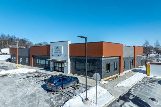
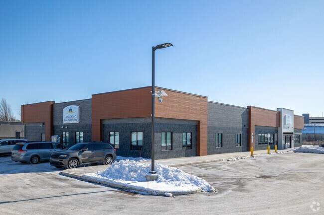
Property Record
368 W Main St, Ephrata, PA 17522
NEARBY LISTINGS FOR SALE OR LEASE
Property Detail
368 W Main St
360-71730-0-0000
Lancaster
Governmentalpublicusegeneral
Pennsylvania
2024
1.36 AC
2025
Lancaster County
012302
Philadelphia
11,787 SF
Lancaster, PA
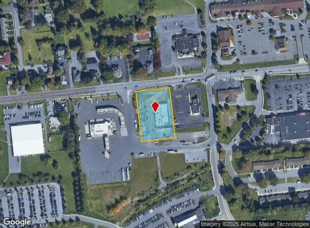
DEMOGRAPHICS near 368 W Main St
1 Mile
3 Mile
5 Mile
2024 Total Population
4,111
18,765
81,544
2029 Population
4,133
18,822
82,098
Pop Growth 2024-2029
+ 0.54%
+ 0.30%
+ 0.68%
Average Age
37
40
42
2024 Total Households
1,410
6,769
30,182
HH Growth 2024-2029
+ 0.57%
+ 0.34%
+ 0.77%
Median Household Inc
$80,050
$86,432
$81,750
Avg Household Size
2.80
2.70
2.50
2024 Avg HH Vehicles
2.00
2.00
2.00
Median Home Value
$327,321
$296,708
$263,786
Median Year Built
1978
1979
1976
Nearby Places
Map Layers
Map Styles
 Street
 Aerial
- Restaurants
- Banks
- Shops
- Fitness
- Groceries
PUBLIC TRANSPORTATION
COMMUTER RAIL
Lancaster (Keystone Service - Amtrak, Pennsylvanian - Amtrak)
DRIVE
WALK
Distance
Lancaster (Keystone Service - Amtrak, Pennsylvanian - Amtrak)
13 min
6.3 mi
AIRPORT
Harrisburg International
DRIVE
WALK
Distance
Harrisburg International
48 min
36.3 mi
Freight Ports
Port of Wilmington, RI
DRIVE
WALK
Distance
Port of Wilmington, RI
88 min
50.1 mi
Nearby Properties
Address
Land Use
TOTAL SIZE
Lot Size
Zoning
Address
Land Use
TOTAL SIZE
Lot Size
Zoning
403,771 SF
106.93 AC
Address
Land Use
TOTAL SIZE
Lot Size
Zoning
2,615,989 SF
147.50 AC
I
Address
Land Use
TOTAL SIZE
Lot Size
Zoning
419,136 SF
34.11 AC
Address
Land Use
TOTAL SIZE
Lot Size
Zoning
333,301 SF
24.15 AC
MU
Address
Land Use
TOTAL SIZE
Lot Size
Zoning
233,738 SF
34.10 AC
Address
Land Use
TOTAL SIZE
Lot Size
Zoning
21.41 AC
Address
Land Use
TOTAL SIZE
Lot Size
Zoning
74,841 SF
16.20 AC
R-1
Address
Land Use
TOTAL SIZE
Lot Size
Zoning
137,933 SF
16.11 AC
Address
Land Use
TOTAL SIZE
Lot Size
Zoning
111,896 SF
8.30 AC
Address
Land Use
TOTAL SIZE
Lot Size
Zoning
19.29 AC
Address
Land Use
TOTAL SIZE
Lot Size
Zoning
83,728 SF
2.70 AC
C-2
Address
Land Use
TOTAL SIZE
Lot Size
Zoning
128,516 SF
20.40 AC
R2
Address
Land Use
TOTAL SIZE
Lot Size
Zoning
246,116 SF
16.30 AC
R-2
Address
Land Use
TOTAL SIZE
Lot Size
Zoning
142,393 SF
22 AC
I
Address
Land Use
TOTAL SIZE
Lot Size
Zoning
109,200 SF
12.97 AC
R-2
Address
Land Use
TOTAL SIZE
Lot Size
Zoning
142,463 SF
12.70 AC
SM
Address
Land Use
TOTAL SIZE
Lot Size
Zoning
82,420 SF
3.17 AC
C-2
Address
Land Use
TOTAL SIZE
Lot Size
Zoning
82,718 SF
7.85 AC
I
Address
Land Use
TOTAL SIZE
Lot Size
Zoning
107,154 SF
11.90 AC
MU
Address
Land Use
TOTAL SIZE
Lot Size
Zoning
122,854 SF
11.40 AC
R-2
Address
Land Use
TOTAL SIZE
Lot Size
Zoning
105,946 SF
30.23 AC
I
Address
Land Use
TOTAL SIZE
Lot Size
Zoning
73,648 SF
10.20 AC
R-1
Address
Land Use
TOTAL SIZE
Lot Size
Zoning
155,342 SF
7.38 AC
Address
Land Use
TOTAL SIZE
Lot Size
Zoning
59,160 SF
8.40 AC
C-2
Address
Land Use
TOTAL SIZE
Lot Size
Zoning
15,687 SF
118.50 AC
R-2
Address
Land Use
TOTAL SIZE
Lot Size
Zoning
57,416 SF
4.20 AC
C-2
Address
Land Use
TOTAL SIZE
Lot Size
Zoning
100,645 SF
5.60 AC
I
Address
Land Use
TOTAL SIZE
Lot Size
Zoning
76,238 SF
11.20 AC
MU
Address
Land Use
TOTAL SIZE
Lot Size
Zoning
66,600 SF
24.43 AC
B-4
Address
Land Use
TOTAL SIZE
Lot Size
Zoning
118,400 SF
7.90 AC
I
The World's #1 Commercial Real Estate Marketplace
Connect with us
© 2026 CoStar Group
The information above has been obtained from sources believed reliable. While we do not doubt its accuracy we have not verified it and make no guarantee, warranty or representation about it. It is your responsibility to independently confirm its accuracy and completeness. Any projections, opinions, assumptions, or estimates used are for example only and do not represent the current or future performance of the property. The value of this transaction to you depends on tax and other factors which should be evaluated by your tax, financial, and legal advisors. You and your advisors should conduct a careful, independent investigation of the property to determine to your satisfaction the suitability of the property for your needs.