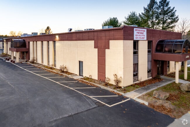
Property Record
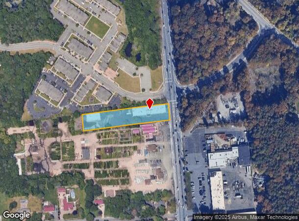
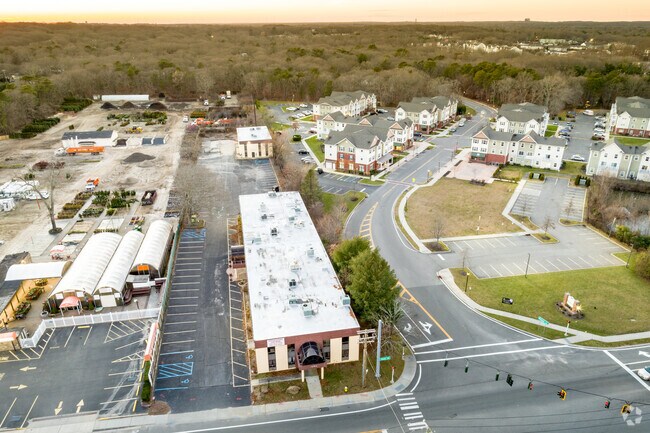
3680 Route 112, Coram, NY 11727
NEARBY LISTINGS FOR SALE OR LEASE
Property Detail
3680 Route 112
Nassau County-Suffolk County, NY
Coram
0200-476-00-02-00-028-005
N UNITED ARTISTS E RTE 112 T-107 S
Officebuilding
Suffolk
X
New York
36103C0685H
28
2024
1.28 AC
2024
Central Suffolk
158715
Long Island (New York)
DEMOGRAPHICS near 3680 Route 112
1 mile
3 mile
5 mile
2024 Total Population
9,489
76,860
182,358
2029 Population
9,345
75,492
179,612
Pop Growth 2024-2029
(1.52%)
(1.78%)
(1.51%)
Average Age
41
41
41
2024 Total Households
3,833
26,817
62,268
HH Growth 2024-2029
(1.70%)
(2.05%)
(1.72%)
Median Household Inc
$80,210
$94,839
$106,153
Avg Household Size
2.40
2.70
2.80
2024 Avg HH Vehicles
2.00
2.00
2.00
Median Home Value
$297,493
$381,404
$415,121
Median Year Built
1984
1976
1975
Nearby Places
Map Layers
Map Styles
 Street
 Aerial
Transit
 Traffic
 Biking
Places
Listings with unknown addresses are not visible on the map
- Restaurants
- Banks
- Shops
- Fitness
- Groceries
PUBLIC TRANSPORTATION
COMMUTER RAIL
Medford Station (Greenport Branch - Long Island Rail Road)
Drive
Walk
Distance
Medford Station (Greenport Branch - Long Island Rail Road)
7 min
3.5 mi
Yaphank Station (Greenport Branch - Long Island Rail Road)
Drive
Walk
Distance
Yaphank Station (Greenport Branch - Long Island Rail Road)
12 min
6.2 mi
AIRPORT
Long Island MacArthur
Drive
Walk
Distance
Long Island MacArthur
22 min
13.3 mi
Tweed/New Haven
Drive
Walk
Distance
Tweed/New Haven
126 min
47.0 mi
Freight Ports
Port of New Haven
Drive
Walk
Distance
Port of New Haven
121 min
44.2 mi
SALE & LEASE HISTORY
LISTING DATE
SALE/LEASE

Sep 25, 2016
For Lease
Jul 15, 2024
For Lease
Feb 09, 2018
For Lease
Nearby Properties
Address
Land Use
TOTAL SIZE
Lot Size
Zoning
Address
Land Use
TOTAL SIZE
Lot Size
Zoning
9,686 SF
2.50 AC
R60
Address
Land Use
TOTAL SIZE
Lot Size
Zoning
5,302 SF
0.63 AC
VILLA
Address
Land Use
TOTAL SIZE
Lot Size
Zoning
26,576 SF
2.30 AC
LI40
Address
Land Use
TOTAL SIZE
Lot Size
Zoning
5,209 SF
0.42 AC
R15
Address
Land Use
TOTAL SIZE
Lot Size
Zoning
5,101 SF
0.59 AC
VILLA
Address
Land Use
TOTAL SIZE
Lot Size
Zoning
5,994 SF
1.38 AC
R60
Address
Land Use
TOTAL SIZE
Lot Size
Zoning
25.90 AC
Address
Land Use
TOTAL SIZE
Lot Size
Zoning
4,360 SF
0.57 AC
R1
Address
Land Use
TOTAL SIZE
Lot Size
Zoning
4,422 SF
1 AC
VILLA
Address
Land Use
TOTAL SIZE
Lot Size
Zoning
3,510 SF
1.72 AC
VILLA
Address
Land Use
TOTAL SIZE
Lot Size
Zoning
3,431 SF
0.80 AC
R1
Address
Land Use
TOTAL SIZE
Lot Size
Zoning
960 SF
13 AC
R80
Address
Land Use
TOTAL SIZE
Lot Size
Zoning
2,748 SF
0.32 AC
R10
Address
Land Use
TOTAL SIZE
Lot Size
Zoning
21,554 SF
1.03 AC
HC
Address
Land Use
TOTAL SIZE
Lot Size
Zoning
1,208 SF
0.57 AC
VILLA
Address
Land Use
TOTAL SIZE
Lot Size
Zoning
2,937 SF
1.16 AC
R40
Address
Land Use
TOTAL SIZE
Lot Size
Zoning
3,800 SF
0.63 AC
R1
Address
Land Use
TOTAL SIZE
Lot Size
Zoning
2,084 SF
0.93 AC
VILLA
Address
Land Use
TOTAL SIZE
Lot Size
Zoning
3,859 SF
0.58 AC
R40
Address
Land Use
TOTAL SIZE
Lot Size
Zoning
3,405 SF
0.46 AC
R20
Address
Land Use
TOTAL SIZE
Lot Size
Zoning
3,879 SF
0.57 AC
R1
Address
Land Use
TOTAL SIZE
Lot Size
Zoning
2,914 SF
0.57 AC
VILLA
Address
Land Use
TOTAL SIZE
Lot Size
Zoning
5,530 SF
0.44 AC
R1
Address
Land Use
TOTAL SIZE
Lot Size
Zoning
608 SF
0.36 AC
R20
Address
Land Use
TOTAL SIZE
Lot Size
Zoning
1,712 SF
0.78 AC
R40
Address
Land Use
TOTAL SIZE
Lot Size
Zoning
2,891 SF
1.01 AC
VILLA
Address
Land Use
TOTAL SIZE
Lot Size
Zoning
2,535 SF
1.04 AC
VILLA
Address
Land Use
TOTAL SIZE
Lot Size
Zoning
2,682 SF
1.05 AC
R40
Address
Land Use
TOTAL SIZE
Lot Size
Zoning
3,442 SF
0.77 AC
R40
Address
Land Use
TOTAL SIZE
Lot Size
Zoning
4,752 SF
0.27 AC
R10
The World's #1 Commercial Real Estate Marketplace
Connect with us
© 2026 CoStar Group
The information above has been obtained from sources believed reliable. While we do not doubt its accuracy we have not verified it and make no guarantee, warranty or representation about it. It is your responsibility to independently confirm its accuracy and completeness. Any projections, opinions, assumptions, or estimates used are for example only and do not represent the current or future performance of the property. The value of this transaction to you depends on tax and other factors which should be evaluated by your tax, financial, and legal advisors. You and your advisors should conduct a careful, independent investigation of the property to determine to your satisfaction the suitability of the property for your needs.