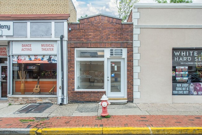
Property Record
369 Bloomfield Ave, Caldwell, NJ 07006

NEARBY LISTINGS FOR SALE OR LEASE
Property Detail
369 Bloomfield Ave
03-00026-0000-00013-05
11X50
Storebuilding
Essex
X
New Jersey
34013C0084F
13.5
2023
0.01 AC
2025
Suburban Essex/Rt 280
021701
Northern New Jersey
308 SF
Newark, NJ-PA
DEMOGRAPHICS near 369 Bloomfield Ave
1 Mile
3 Mile
5 Mile
2024 Total Population
17,183
79,122
241,017
2029 Population
16,976
78,630
238,670
Pop Growth 2024-2029
(1.20%)
(0.62%)
(0.97%)
Average Age
41
43
42
2024 Total Households
6,423
29,526
87,840
HH Growth 2024-2029
(1.42%)
(0.84%)
(1.13%)
Median Household Inc
$117,122
$134,831
$129,183
Avg Household Size
2.50
2.60
2.60
2024 Avg HH Vehicles
2.00
2.00
2.00
Median Home Value
$596,588
$605,381
$612,756
Median Year Built
1955
1960
1957
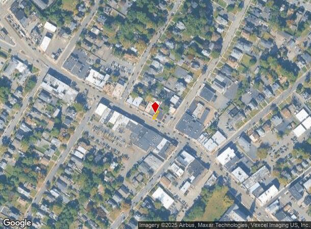
Nearby Places
Map Layers
Map Styles
 Street
 Aerial
- Restaurants
- Banks
- Shops
- Fitness
- Groceries
PUBLIC TRANSPORTATION
COMMUTER RAIL
Walnut Street (Montclair-Boonton Line - NJ Transit Commuter Rail (NJ Transit))
DRIVE
WALK
Distance
Walnut Street (Montclair-Boonton Line - NJ Transit Commuter Rail (NJ Transit))
12 min
4.3 mi
Watchung Avenue (Montclair-Boonton Line - NJ Transit Commuter Rail (NJ Transit))
DRIVE
WALK
Distance
Watchung Avenue (Montclair-Boonton Line - NJ Transit Commuter Rail (NJ Transit))
12 min
4.7 mi
AIRPORT
Newark Liberty International
DRIVE
WALK
Distance
Newark Liberty International
30 min
20.9 mi
LaGuardia
DRIVE
WALK
Distance
LaGuardia
51 min
34.3 mi
John F Kennedy International
DRIVE
WALK
Distance
John F Kennedy International
64 min
45.4 mi
Freight Ports
Maher Terminal
DRIVE
WALK
Distance
Maher Terminal
34 min
19.5 mi
SALE & LEASE HISTORY
LISTING DATE
SALE/LEASE

May 17, 2024
For Lease
Nearby Properties
Address
Land Use
TOTAL SIZE
Lot Size
Zoning
Address
Land Use
TOTAL SIZE
Lot Size
Zoning
74.58 AC
S
Address
Land Use
TOTAL SIZE
Lot Size
Zoning
37.70 AC
R-6
Address
Land Use
TOTAL SIZE
Lot Size
Zoning
48.85 AC
R-3B
Address
Land Use
TOTAL SIZE
Lot Size
Zoning
98.27 AC
AH1
Address
Land Use
TOTAL SIZE
Lot Size
Zoning
13 AC
RM
Address
Land Use
TOTAL SIZE
Lot Size
Zoning
31.36 AC
P-6
Address
Land Use
TOTAL SIZE
Lot Size
Zoning
101.44 AC
OB-1
Address
Land Use
TOTAL SIZE
Lot Size
Zoning
32.34 AC
RA
Address
Land Use
TOTAL SIZE
Lot Size
Zoning
55.77 AC
OB-1
Address
Land Use
TOTAL SIZE
Lot Size
Zoning
4.60 AC
Address
Land Use
TOTAL SIZE
Lot Size
Zoning
51.24 AC
OB-2
Address
Land Use
TOTAL SIZE
Lot Size
Zoning
8,600 SF
27.27 AC
L3
Address
Land Use
TOTAL SIZE
Lot Size
Zoning
84.70 AC
Address
Land Use
TOTAL SIZE
Lot Size
Zoning
17.90 AC
B-2
Address
Land Use
TOTAL SIZE
Lot Size
Zoning
25.88 AC
Address
Land Use
TOTAL SIZE
Lot Size
Zoning
41.84 AC
OB-1
Address
Land Use
TOTAL SIZE
Lot Size
Zoning
67.49 AC
Address
Land Use
TOTAL SIZE
Lot Size
Zoning
61.69 AC
Address
Land Use
TOTAL SIZE
Lot Size
Zoning
1,760 SF
189.03 AC
R-2
Address
Land Use
TOTAL SIZE
Lot Size
Zoning
27.50 AC
M-2
Address
Land Use
TOTAL SIZE
Lot Size
Zoning
6.01 AC
OB-2
Address
Land Use
TOTAL SIZE
Lot Size
Zoning
5.74 AC
B-2
Address
Land Use
TOTAL SIZE
Lot Size
Zoning
31.56 AC
R-3
Address
Land Use
TOTAL SIZE
Lot Size
Zoning
38.40 AC
Address
Land Use
TOTAL SIZE
Lot Size
Zoning
28.06 AC
OB-3
Address
Land Use
TOTAL SIZE
Lot Size
Zoning
Address
Land Use
TOTAL SIZE
Lot Size
Zoning
7,507 SF
18.82 AC
L-1
Address
Land Use
TOTAL SIZE
Lot Size
Zoning
4.08 AC
Address
Land Use
TOTAL SIZE
Lot Size
Zoning
32.99 AC
R-4
Address
Land Use
TOTAL SIZE
Lot Size
Zoning
10.69 AC
M-2
The World's #1 Commercial Real Estate Marketplace
Connect with us
© 2025 CoStar Group
The information above has been obtained from sources believed reliable. While we do not doubt its accuracy we have not verified it and make no guarantee, warranty or representation about it. It is your responsibility to independently confirm its accuracy and completeness. Any projections, opinions, assumptions, or estimates used are for example only and do not represent the current or future performance of the property. The value of this transaction to you depends on tax and other factors which should be evaluated by your tax, financial, and legal advisors. You and your advisors should conduct a careful, independent investigation of the property to determine to your satisfaction the suitability of the property for your needs.