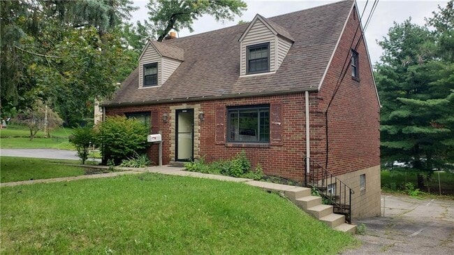
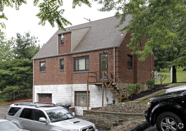
Property Record
369 Mansfield Ave, Pittsburgh, PA 15220
NEARBY LISTINGS FOR SALE OR LEASE
Property Detail
369 Mansfield Ave
Pittsburgh, PA
Keane Plan
0038-H-00018-0000-00
KEANE PLAN 2 LOT= 75X95.12X65.84 MANSFIELD AVE 1 1/2 STY BRK HSE GAR #369
Officebuilding
Allegheny
X
Pennsylvania
42003C0341H
18
2024
0.15 AC
2025
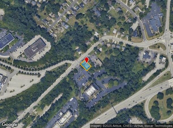
Parkway West Corridor
469000
Pittsburgh
1,469 SF
DEMOGRAPHICS near 369 Mansfield Ave
1 Mile
3 Mile
5 Mile
2024 Total Population
9,790
115,875
299,269
2029 Population
9,518
113,316
294,355
Pop Growth 2024-2029
(2.78%)
(2.21%)
(1.64%)
Average Age
42
42
41
2024 Total Households
4,659
54,247
137,058
HH Growth 2024-2029
(2.90%)
(2.29%)
(1.65%)
Median Household Inc
$77,378
$68,846
$65,370
Avg Household Size
2.00
2.10
2.10
2024 Avg HH Vehicles
2.00
1.00
1.00
Median Home Value
$182,274
$172,329
$178,118
Median Year Built
1958
1951
1952
Nearby Places
Map Layers
Map Styles
 Street
 Aerial
- Restaurants
- Banks
- Shops
- Fitness
- Groceries
PUBLIC TRANSPORTATION
COMMUTER RAIL
DRIVE
WALK
Distance
9 min
4.7 mi
AIRPORT
Pittsburgh International
DRIVE
WALK
Distance
Pittsburgh International
22 min
13.9 mi
SALE & LEASE HISTORY
LISTING DATE
SALE/LEASE

Oct 25, 2021
For Sale
May 06, 2022
For Sale
Nearby Properties
Address
Land Use
TOTAL SIZE
Lot Size
Zoning
Address
Land Use
TOTAL SIZE
Lot Size
Zoning
10.41 AC
Address
Land Use
TOTAL SIZE
Lot Size
Zoning
13.75 AC
Address
Land Use
TOTAL SIZE
Lot Size
Zoning
3.91 AC
Address
Land Use
TOTAL SIZE
Lot Size
Zoning
Address
Land Use
TOTAL SIZE
Lot Size
Zoning
6.55 AC
Address
Land Use
TOTAL SIZE
Lot Size
Zoning
1.60 AC
Address
Land Use
TOTAL SIZE
Lot Size
Zoning
16.08 AC
Address
Land Use
TOTAL SIZE
Lot Size
Zoning
0.81 AC
Address
Land Use
TOTAL SIZE
Lot Size
Zoning
Address
Land Use
TOTAL SIZE
Lot Size
Zoning
5.60 AC
Address
Land Use
TOTAL SIZE
Lot Size
Zoning
33.06 AC
Address
Land Use
TOTAL SIZE
Lot Size
Zoning
14.32 AC
Address
Land Use
TOTAL SIZE
Lot Size
Zoning
Address
Land Use
TOTAL SIZE
Lot Size
Zoning
1.76 AC
Address
Land Use
TOTAL SIZE
Lot Size
Zoning
Address
Land Use
TOTAL SIZE
Lot Size
Zoning
6.40 AC
Address
Land Use
TOTAL SIZE
Lot Size
Zoning
1.22 AC
Address
Land Use
TOTAL SIZE
Lot Size
Zoning
5.24 AC
Address
Land Use
TOTAL SIZE
Lot Size
Zoning
1.11 AC
Address
Land Use
TOTAL SIZE
Lot Size
Zoning
1.33 AC
Address
Land Use
TOTAL SIZE
Lot Size
Zoning
16.54 AC
Address
Land Use
TOTAL SIZE
Lot Size
Zoning
1,556 SF
36.30 AC
Address
Land Use
TOTAL SIZE
Lot Size
Zoning
Address
Land Use
TOTAL SIZE
Lot Size
Zoning
Address
Land Use
TOTAL SIZE
Lot Size
Zoning
Address
Land Use
TOTAL SIZE
Lot Size
Zoning
1.25 AC
Address
Land Use
TOTAL SIZE
Lot Size
Zoning
Address
Land Use
TOTAL SIZE
Lot Size
Zoning
16.01 AC
Address
Land Use
TOTAL SIZE
Lot Size
Zoning
1.06 AC
Address
Land Use
TOTAL SIZE
Lot Size
Zoning
1.26 AC
The World's #1 Commercial Real Estate Marketplace
Connect with us
© 2025 CoStar Group
The information above has been obtained from sources believed reliable. While we do not doubt its accuracy we have not verified it and make no guarantee, warranty or representation about it. It is your responsibility to independently confirm its accuracy and completeness. Any projections, opinions, assumptions, or estimates used are for example only and do not represent the current or future performance of the property. The value of this transaction to you depends on tax and other factors which should be evaluated by your tax, financial, and legal advisors. You and your advisors should conduct a careful, independent investigation of the property to determine to your satisfaction the suitability of the property for your needs.