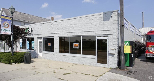
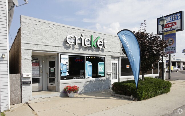
Property Record
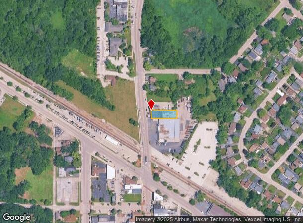
369 N Cedar Lake Rd, Round Lake, IL 60073
NEARBY LISTINGS FOR SALE OR LEASE
Property Detail
369 N Cedar Lake Rd
Chicago-Naperville-Elgin, IL-IN-WI
W.H.Smith S 2Nd Add
06-29-104-005
W.H.SMITH S 2ND ADD LOT 8
Commercialbuilding
Lake
X
Illinois
17097C0127L
8
2023
0.17 AC
2024
Central Northwest
861403
Chicago
3,250 SF
DEMOGRAPHICS near 369 N Cedar Lake Rd
1 Mile
3 Mile
5 Mile
2024 Total Population
11,532
71,445
125,981
2029 Population
11,398
70,219
124,400
Pop Growth 2024-2029
(1.16%)
(1.72%)
(1.25%)
Average Age
35
37
38
2024 Total Households
3,594
23,829
44,277
HH Growth 2024-2029
(1.31%)
(1.83%)
(1.29%)
Median Household Inc
$65,407
$86,680
$91,720
Avg Household Size
3.10
2.90
2.80
2024 Avg HH Vehicles
2.00
2.00
2.00
Median Home Value
$150,679
$199,445
$222,380
Median Year Built
1977
1990
1992
Nearby Places
Map Layers
Map Styles
 Street
 Aerial
- Restaurants
- Banks
- Shops
- Fitness
- Groceries
PUBLIC TRANSPORTATION
COMMUTER RAIL
Round Lake Station (Milwaukee District North Line - Northeast Illinois Regional Commuter Railroad (Metra))
DRIVE
WALK
Distance
Round Lake Station (Milwaukee District North Line - Northeast Illinois Regional Commuter Railroad (Metra))
0 min
2 min
0.1 mi
Long Lake Station (Milwaukee District North Line - Northeast Illinois Regional Commuter Railroad (Metra))
DRIVE
WALK
Distance
Long Lake Station (Milwaukee District North Line - Northeast Illinois Regional Commuter Railroad (Metra))
4 min
2.2 mi
AIRPORT
Chicago O'Hare International
DRIVE
WALK
Distance
Chicago O'Hare International
50 min
37.7 mi
Freight Ports
Port Milwaukee
DRIVE
WALK
Distance
Port Milwaukee
70 min
56.5 mi
Nearby Properties
Address
Land Use
TOTAL SIZE
Lot Size
Zoning
Address
Land Use
TOTAL SIZE
Lot Size
Zoning
4,022,130 SF
22.22 AC
Address
Land Use
TOTAL SIZE
Lot Size
Zoning
30.60 AC
Address
Land Use
TOTAL SIZE
Lot Size
Zoning
194,075 SF
14.84 AC
Address
Land Use
TOTAL SIZE
Lot Size
Zoning
1,407,234 SF
12.09 AC
Address
Land Use
TOTAL SIZE
Lot Size
Zoning
1,656,984 SF
11.84 AC
Address
Land Use
TOTAL SIZE
Lot Size
Zoning
83.45 AC
Address
Land Use
TOTAL SIZE
Lot Size
Zoning
26.09 AC
Address
Land Use
TOTAL SIZE
Lot Size
Zoning
25.89 AC
Address
Land Use
TOTAL SIZE
Lot Size
Zoning
41,308 SF
4.48 AC
Address
Land Use
TOTAL SIZE
Lot Size
Zoning
70,256 SF
33.85 AC
Address
Land Use
TOTAL SIZE
Lot Size
Zoning
17,484 SF
3.52 AC
Address
Land Use
TOTAL SIZE
Lot Size
Zoning
58,922 SF
71.36 AC
Address
Land Use
TOTAL SIZE
Lot Size
Zoning
86,920 SF
6.89 AC
Address
Land Use
TOTAL SIZE
Lot Size
Zoning
62,821 SF
6.79 AC
Address
Land Use
TOTAL SIZE
Lot Size
Zoning
104,143 SF
11.96 AC
Address
Land Use
TOTAL SIZE
Lot Size
Zoning
45,772 SF
89.95 AC
Address
Land Use
TOTAL SIZE
Lot Size
Zoning
41,925 SF
5.15 AC
Address
Land Use
TOTAL SIZE
Lot Size
Zoning
87,233 SF
7.72 AC
Address
Land Use
TOTAL SIZE
Lot Size
Zoning
102,750 SF
4.84 AC
Address
Land Use
TOTAL SIZE
Lot Size
Zoning
43,777 SF
5.49 AC
Address
Land Use
TOTAL SIZE
Lot Size
Zoning
21.62 AC
Address
Land Use
TOTAL SIZE
Lot Size
Zoning
14.80 AC
Address
Land Use
TOTAL SIZE
Lot Size
Zoning
188,183 SF
17.16 AC
Address
Land Use
TOTAL SIZE
Lot Size
Zoning
29,707 SF
7.12 AC
Address
Land Use
TOTAL SIZE
Lot Size
Zoning
16,252 SF
2.23 AC
Address
Land Use
TOTAL SIZE
Lot Size
Zoning
Address
Land Use
TOTAL SIZE
Lot Size
Zoning
33,158 SF
16.45 AC
Address
Land Use
TOTAL SIZE
Lot Size
Zoning
74,850 SF
4.27 AC
Address
Land Use
TOTAL SIZE
Lot Size
Zoning
31,657 SF
30.97 AC
Address
Land Use
TOTAL SIZE
Lot Size
Zoning
28,956 SF
3.27 AC
The World's #1 Commercial Real Estate Marketplace
Connect with us
© 2025 CoStar Group
The information above has been obtained from sources believed reliable. While we do not doubt its accuracy we have not verified it and make no guarantee, warranty or representation about it. It is your responsibility to independently confirm its accuracy and completeness. Any projections, opinions, assumptions, or estimates used are for example only and do not represent the current or future performance of the property. The value of this transaction to you depends on tax and other factors which should be evaluated by your tax, financial, and legal advisors. You and your advisors should conduct a careful, independent investigation of the property to determine to your satisfaction the suitability of the property for your needs.