Property Record
369 Spook Rock Rd, Suffern, NY 10901
NEARBY LISTINGS FOR SALE OR LEASE
Property Detail
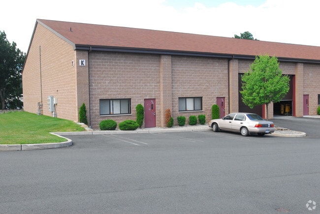
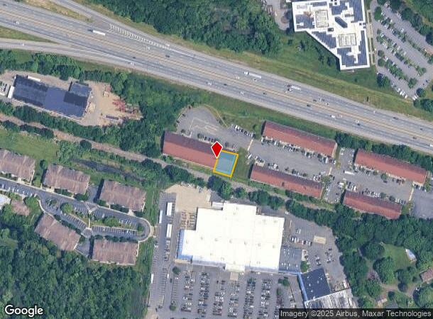
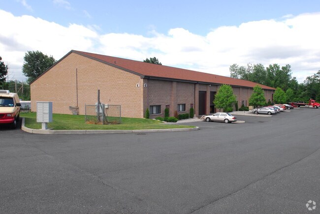
369 Spook Rock Rd
New York-Jersey City-White Plains, NY-NJ
Spook Rock Industrial Park Condominium I
392621-055-012-0001-004-000-6010
CONDO K BLDG 5400 SQ FT
Warehouse
Rockland
X
New York
34003C0076H
4.000
2023
0.16 AC
2024
Rockland County
011602
Northern New Jersey
5,400 SF
DEMOGRAPHICS near 369 Spook Rock Rd
1 Mile
3 Mile
5 Mile
2024 Total Population
7,442
101,467
208,246
2029 Population
7,480
100,996
207,612
Pop Growth 2024-2029
+ 0.51%
(0.46%)
(0.30%)
Average Age
41
33
35
2024 Total Households
2,342
28,041
59,523
HH Growth 2024-2029
+ 0.51%
(0.39%)
(0.23%)
Median Household Inc
$97,249
$84,671
$95,121
Avg Household Size
2.90
3.40
3.30
2024 Avg HH Vehicles
2.00
2.00
2.00
Median Home Value
$727,932
$626,841
$615,413
Median Year Built
1984
1975
1975
Nearby Places
- Restaurants
- Banks
- Shops
- Fitness
- Groceries
PUBLIC TRANSPORTATION
COMMUTER RAIL
Suffern (Bergen County/Port Jervis Line - NJ Transit Commuter Rail (NJ Transit), Main/Port Jervis Line - NJ Transit Commuter Rail (NJ Transit))
DRIVE
WALK
Distance
Suffern (Bergen County/Port Jervis Line - NJ Transit Commuter Rail (NJ Transit), Main/Port Jervis Line - NJ Transit Commuter Rail (NJ Transit))
8 min
3.6 mi
Mahwah (Bergen County/Port Jervis Line - NJ Transit Commuter Rail (NJ Transit), Main/Port Jervis Line - NJ Transit Commuter Rail (NJ Transit))
DRIVE
WALK
Distance
Mahwah (Bergen County/Port Jervis Line - NJ Transit Commuter Rail (NJ Transit), Main/Port Jervis Line - NJ Transit Commuter Rail (NJ Transit))
10 min
4.8 mi
AIRPORT
Westchester County
DRIVE
WALK
Distance
Westchester County
43 min
28.2 mi
LaGuardia
DRIVE
WALK
Distance
LaGuardia
57 min
37.6 mi
New York Stewart International
DRIVE
WALK
Distance
New York Stewart International
53 min
39.0 mi
Freight Ports
Port Newark Container Terminal
DRIVE
WALK
Distance
Port Newark Container Terminal
56 min
39.9 mi
Nearby Properties
Address
Land Use
TOTAL SIZE
Lot Size
Zoning
Address
Land Use
TOTAL SIZE
Lot Size
Zoning
1,056 SF
99.35 AC
OP200
Address
Land Use
TOTAL SIZE
Lot Size
Zoning
23.32 AC
Address
Land Use
TOTAL SIZE
Lot Size
Zoning
14.09 AC
B200
Address
Land Use
TOTAL SIZE
Lot Size
Zoning
Address
Land Use
TOTAL SIZE
Lot Size
Zoning
68.78 AC
OP20
Address
Land Use
TOTAL SIZE
Lot Size
Zoning
609,540 SF
174.09 AC
R-50
Address
Land Use
TOTAL SIZE
Lot Size
Zoning
19.60 AC
OP200
Address
Land Use
TOTAL SIZE
Lot Size
Zoning
539,911 SF
38.80 AC
05
Address
Land Use
TOTAL SIZE
Lot Size
Zoning
33.50 AC
GI80
Address
Land Use
TOTAL SIZE
Lot Size
Zoning
68,905 SF
7.28 AC
LO
Address
Land Use
TOTAL SIZE
Lot Size
Zoning
219,765 SF
29.88 AC
07
Address
Land Use
TOTAL SIZE
Lot Size
Zoning
60,222 SF
17.39 AC
LO
Address
Land Use
TOTAL SIZE
Lot Size
Zoning
5.30 AC
GA200
Address
Land Use
TOTAL SIZE
Lot Size
Zoning
0.44 AC
OP20
Address
Land Use
TOTAL SIZE
Lot Size
Zoning
7.26 AC
GA200
Address
Land Use
TOTAL SIZE
Lot Size
Zoning
5.31 AC
GA200
Address
Land Use
TOTAL SIZE
Lot Size
Zoning
3.65 AC
Address
Land Use
TOTAL SIZE
Lot Size
Zoning
2.43 AC
B40
Address
Land Use
TOTAL SIZE
Lot Size
Zoning
4.71 AC
GA200
Address
Land Use
TOTAL SIZE
Lot Size
Zoning
58,473 SF
0.70 AC
HCS
Address
Land Use
TOTAL SIZE
Lot Size
Zoning
7.17 AC
GI80
Address
Land Use
TOTAL SIZE
Lot Size
Zoning
4.97 AC
GI80
Address
Land Use
TOTAL SIZE
Lot Size
Zoning
6.70 AC
GI80
Address
Land Use
TOTAL SIZE
Lot Size
Zoning
5.02 AC
B12
Address
Land Use
TOTAL SIZE
Lot Size
Zoning
2.43 AC
B40
Address
Land Use
TOTAL SIZE
Lot Size
Zoning
76,083 SF
0.96 AC
05
Address
Land Use
TOTAL SIZE
Lot Size
Zoning
2.80 AC
Address
Land Use
TOTAL SIZE
Lot Size
Zoning
1.53 AC
B40
Address
Land Use
TOTAL SIZE
Lot Size
Zoning
2.73 AC
Address
Land Use
TOTAL SIZE
Lot Size
Zoning
290,428 SF
35.56 AC
R35
The World's #1 Commercial Real Estate Marketplace
Connect with us
© 2025 CoStar Group
The information above has been obtained from sources believed reliable. While we do not doubt its accuracy we have not verified it and make no guarantee, warranty or representation about it. It is your responsibility to independently confirm its accuracy and completeness. Any projections, opinions, assumptions, or estimates used are for example only and do not represent the current or future performance of the property. The value of this transaction to you depends on tax and other factors which should be evaluated by your tax, financial, and legal advisors. You and your advisors should conduct a careful, independent investigation of the property to determine to your satisfaction the suitability of the property for your needs.