Property Record
3691 Route 9, Cold Spring, NY 10516
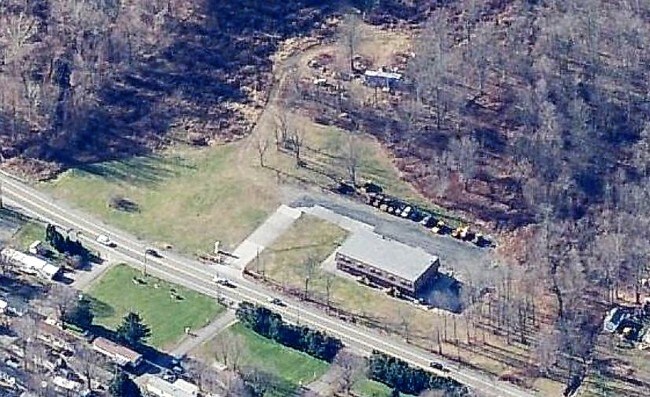

Property Detail
3691 Route 9
372689-007-000-0001-004-000-0000
LAND & WAREHOUSE/OFFICES
Warehouse
Putnam
I
New York
AE The base floodplain where base flood elevations are provided. AE Zones are now used on new format FIRMs instead of A1-A30 Zones.
4.000
2024
11.96 AC
2024
Carmel
010600
Westchester/So Connecticut
10,000 SF
New York-Jersey City-White Plains, NY-NJ
NEARBY LISTINGS FOR SALE OR LEASE
DEMOGRAPHICS near 3691 Route 9
1 mile
3 mile
5 mile
2025 Total Population
512
11,664
44,787
2030 Population
517
11,674
44,984
Pop Growth 2025-2030
+ 0.98%
+ 0.09%
+ 0.44%
Average Age
48
45
44
2025 Total Households
212
4,671
18,223
HH Growth 2025-2030
+ 0.94%
(0.06%)
+ 0.40%
Median Household Inc
$126,042
$99,026
$97,773
Avg Household Size
2.30
2.30
2.30
2025 Avg HH Vehicles
2.00
2.00
2.00
Median Home Value
$694,672
$462,974
$451,651
Median Year Built
1984
1971
1975
Nearby Places
Map Layers
Map Styles
 Street
 Aerial
Transit
 Traffic
 Biking
Places
Listings with unknown addresses are not visible on the map
- Restaurants
- Banks
- Shops
- Fitness
- Groceries
PUBLIC TRANSPORTATION
COMMUTER RAIL
Beacon Station (Hudson Line - Metro-North Commuter Railroad Company (Metro-North))
Drive
Walk
Distance
Beacon Station (Hudson Line - Metro-North Commuter Railroad Company (Metro-North))
13 min
8.7 mi
Breakneck Ridge Station (Hudson Line - Metro-North Commuter Railroad Company (Metro-North))
Drive
Walk
Distance
Breakneck Ridge Station (Hudson Line - Metro-North Commuter Railroad Company (Metro-North))
13 min
9.1 mi
AIRPORT
New York Stewart International
Drive
Walk
Distance
New York Stewart International
26 min
17.2 mi
Freight Ports
Port of New Haven
Drive
Walk
Distance
Port of New Haven
94 min
69.4 mi
SALE & LEASE HISTORY
LISTING DATE
SALE/LEASE

Nov 02, 2017
For Sale
Nearby Properties
Address
Land Use
TOTAL SIZE
Lot Size
Zoning
Address
Land Use
TOTAL SIZE
Lot Size
Zoning
1,240,333 SF
120.58 AC
PI
Address
Land Use
TOTAL SIZE
Lot Size
Zoning
773,000 SF
6.80 AC
PI
Address
Land Use
TOTAL SIZE
Lot Size
Zoning
36.65 AC
R1-20
Address
Land Use
TOTAL SIZE
Lot Size
Zoning
56,704 SF
5.03 AC
PSC
Address
Land Use
TOTAL SIZE
Lot Size
Zoning
118,800 SF
8.46 AC
PI
Address
Land Use
TOTAL SIZE
Lot Size
Zoning
28,362 SF
1,116.34 AC
R4A
Address
Land Use
TOTAL SIZE
Lot Size
Zoning
248,686 SF
0.01 AC
PSC
Address
Land Use
TOTAL SIZE
Lot Size
Zoning
206,064 SF
31.72 AC
PI
Address
Land Use
TOTAL SIZE
Lot Size
Zoning
6.30 AC
PSC
Address
Land Use
TOTAL SIZE
Lot Size
Zoning
99,569 SF
16.10 AC
PSC
Address
Land Use
TOTAL SIZE
Lot Size
Zoning
72,222 SF
7.62 AC
PSC
Address
Land Use
TOTAL SIZE
Lot Size
Zoning
12 AC
R1-10
Address
Land Use
TOTAL SIZE
Lot Size
Zoning
27,472 SF
0.67 AC
LI
Address
Land Use
TOTAL SIZE
Lot Size
Zoning
32,347 SF
17.10 AC
R20
Address
Land Use
TOTAL SIZE
Lot Size
Zoning
133,362 SF
18.85 AC
PSC
Address
Land Use
TOTAL SIZE
Lot Size
Zoning
38,699 SF
3.09 AC
GB
Address
Land Use
TOTAL SIZE
Lot Size
Zoning
117,740 SF
6.34 AC
PSC
Address
Land Use
TOTAL SIZE
Lot Size
Zoning
8,960 SF
6.28 AC
PSC
Address
Land Use
TOTAL SIZE
Lot Size
Zoning
49.90 AC
GB
Address
Land Use
TOTAL SIZE
Lot Size
Zoning
47,968 SF
5.19 AC
GB
Address
Land Use
TOTAL SIZE
Lot Size
Zoning
132,874 SF
13.49 AC
GB
Address
Land Use
TOTAL SIZE
Lot Size
Zoning
26,128 SF
3.43 AC
PI
Address
Land Use
TOTAL SIZE
Lot Size
Zoning
109,900 SF
11.17 AC
PB
Address
Land Use
TOTAL SIZE
Lot Size
Zoning
98,993 SF
3.52 AC
PSC
Address
Land Use
TOTAL SIZE
Lot Size
Zoning
172,413 SF
20.71 AC
HI
Address
Land Use
TOTAL SIZE
Lot Size
Zoning
47,474 SF
8.07 AC
HI
Address
Land Use
TOTAL SIZE
Lot Size
Zoning
51,134 SF
3.78 AC
PI
Address
Land Use
TOTAL SIZE
Lot Size
Zoning
45,867 SF
3.20 AC
PSC
Address
Land Use
TOTAL SIZE
Lot Size
Zoning
494.40 AC
R4A
Address
Land Use
TOTAL SIZE
Lot Size
Zoning
144,000 SF
10.33 AC
HI
The World's #1 Commercial Real Estate Marketplace
Connect with us
© 2026 CoStar Group
The information above has been obtained from sources believed reliable. While we do not doubt its accuracy we have not verified it and make no guarantee, warranty or representation about it. It is your responsibility to independently confirm its accuracy and completeness. Any projections, opinions, assumptions, or estimates used are for example only and do not represent the current or future performance of the property. The value of this transaction to you depends on tax and other factors which should be evaluated by your tax, financial, and legal advisors. You and your advisors should conduct a careful, independent investigation of the property to determine to your satisfaction the suitability of the property for your needs.