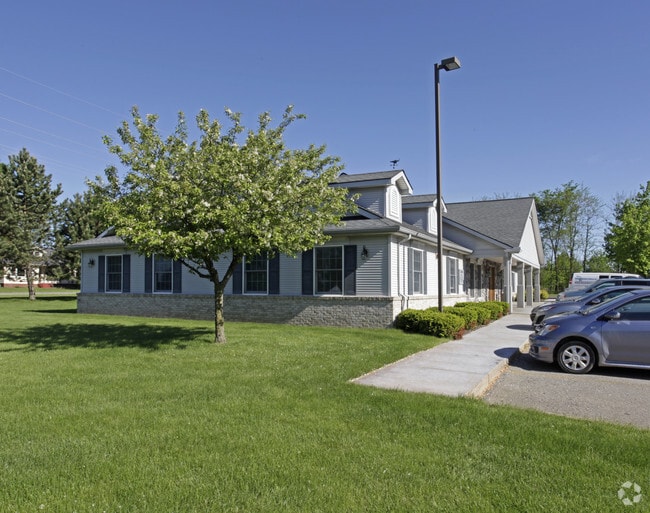
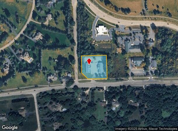
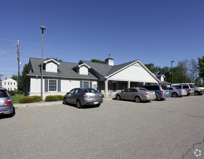
Property Record
3694 Clarkston Rd, Clarkston, MI 48348
NEARBY LISTINGS FOR SALE OR LEASE
Property Detail
3694 Clarkston Rd
Detroit-Warren-Dearborn, MI
Clarkston-Orion Commercial Sub
09-07-477-034
T4N, R10E, SEC 7 CLARKSTON-ORION COMMERCIAL SUB LOTS 10, 11 & 12 2-4-97 FR 005, 006 & 018
Officebuilding
Oakland
X
Michigan
26125C0214F
2,10-12
2024
1.27 AC
2025
St Clair & Lapeer Counties
128600
Detroit
3,948 SF
DEMOGRAPHICS near 3694 Clarkston Rd
1 Mile
3 Mile
5 Mile
2024 Total Population
1,836
24,889
79,532
2029 Population
1,809
24,608
79,058
Pop Growth 2024-2029
(1.47%)
(1.13%)
(0.60%)
Average Age
41
41
41
2024 Total Households
617
9,046
30,289
HH Growth 2024-2029
(1.46%)
(1.15%)
(0.64%)
Median Household Inc
$149,999
$120,256
$101,260
Avg Household Size
2.90
2.70
2.60
2024 Avg HH Vehicles
2.00
2.00
2.00
Median Home Value
$422,656
$375,596
$327,295
Median Year Built
1991
1987
1988
Nearby Places
Map Layers
Map Styles
 Street
 Aerial
- Restaurants
- Banks
- Shops
- Fitness
- Groceries
PUBLIC TRANSPORTATION
COMMUTER RAIL
DRIVE
WALK
Distance
20 min
9.9 mi
AIRPORT
Bishop International
DRIVE
WALK
Distance
Bishop International
51 min
34.0 mi
SALE & LEASE HISTORY
LISTING DATE
SALE/LEASE

May 05, 2025
For Lease
Jun 17, 2020
For Lease
Jun 17, 2020
For Lease
Jun 05, 2017
For Lease
Nearby Properties
Address
Land Use
TOTAL SIZE
Lot Size
Zoning
Address
Land Use
TOTAL SIZE
Lot Size
Zoning
70,710 SF
13.38 AC
BI
Address
Land Use
TOTAL SIZE
Lot Size
Zoning
180,852 SF
40.32 AC
AI
Address
Land Use
TOTAL SIZE
Lot Size
Zoning
207,942 SF
29.20 AC
AI
Address
Land Use
TOTAL SIZE
Lot Size
Zoning
133,226 SF
11.81 AC
Address
Land Use
TOTAL SIZE
Lot Size
Zoning
35,155 SF
87.55 AC
REC
Address
Land Use
TOTAL SIZE
Lot Size
Zoning
182,795 SF
19.39 AC
II
Address
Land Use
TOTAL SIZE
Lot Size
Zoning
33,365 SF
320.73 AC
PRD
Address
Land Use
TOTAL SIZE
Lot Size
Zoning
56,653 SF
7.98 AC
BI
Address
Land Use
TOTAL SIZE
Lot Size
Zoning
40,505 SF
3.46 AC
BV
Address
Land Use
TOTAL SIZE
Lot Size
Zoning
90,189 SF
15.47 AC
Address
Land Use
TOTAL SIZE
Lot Size
Zoning
43,760 SF
4.76 AC
BI
Address
Land Use
TOTAL SIZE
Lot Size
Zoning
81,895 SF
Address
Land Use
TOTAL SIZE
Lot Size
Zoning
27.06 AC
Address
Land Use
TOTAL SIZE
Lot Size
Zoning
9,479 SF
34.57 AC
REC
Address
Land Use
TOTAL SIZE
Lot Size
Zoning
29,530 SF
0.94 AC
Address
Land Use
TOTAL SIZE
Lot Size
Zoning
18,096 SF
5.59 AC
BI
Address
Land Use
TOTAL SIZE
Lot Size
Zoning
14,736 SF
2.27 AC
BI
Address
Land Use
TOTAL SIZE
Lot Size
Zoning
6,576 SF
7.34 AC
BI
Address
Land Use
TOTAL SIZE
Lot Size
Zoning
10,840 SF
1.23 AC
BI
Address
Land Use
TOTAL SIZE
Lot Size
Zoning
27.44 AC
R1R
Address
Land Use
TOTAL SIZE
Lot Size
Zoning
18,065 SF
3.02 AC
BV
Address
Land Use
TOTAL SIZE
Lot Size
Zoning
12,985 SF
2.25 AC
BI
Address
Land Use
TOTAL SIZE
Lot Size
Zoning
41,521 SF
Address
Land Use
TOTAL SIZE
Lot Size
Zoning
5,548 SF
0.92 AC
BI
Address
Land Use
TOTAL SIZE
Lot Size
Zoning
59,564 SF
3.90 AC
II
Address
Land Use
TOTAL SIZE
Lot Size
Zoning
5,087 SF
2.90 AC
BV
Address
Land Use
TOTAL SIZE
Lot Size
Zoning
21,740 SF
66.65 AC
BI
Address
Land Use
TOTAL SIZE
Lot Size
Zoning
10,064 SF
1.71 AC
BI
Address
Land Use
TOTAL SIZE
Lot Size
Zoning
4,285 SF
1.20 AC
BI
Address
Land Use
TOTAL SIZE
Lot Size
Zoning
5,588 SF
0.13 AC
The World's #1 Commercial Real Estate Marketplace
Connect with us
© 2026 CoStar Group
The information above has been obtained from sources believed reliable. While we do not doubt its accuracy we have not verified it and make no guarantee, warranty or representation about it. It is your responsibility to independently confirm its accuracy and completeness. Any projections, opinions, assumptions, or estimates used are for example only and do not represent the current or future performance of the property. The value of this transaction to you depends on tax and other factors which should be evaluated by your tax, financial, and legal advisors. You and your advisors should conduct a careful, independent investigation of the property to determine to your satisfaction the suitability of the property for your needs.