Property Record
3697 Old Deland Rd, Daytona Beach, FL 32124


Current Lease Availabilities
NEARBY LISTINGS FOR SALE OR LEASE
Property Detail
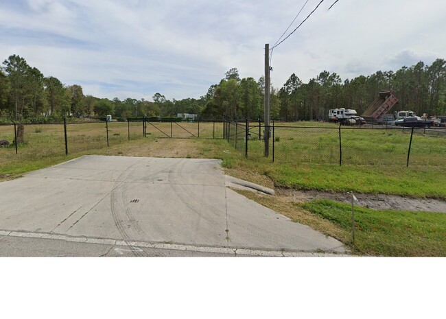
3697 Old Deland Rd
Deltona-Daytona Beach-Ormond Beach, FL
Highridge Estates Mb
6206-01-38-0290
6-16-32 LOTS 29 & 30 BLK 4-N HIGHRIDGE ESTATES MB 11 PG 154 & INC LOTS 1 THRU 8 BLK 6-N HIGHRIDGE ESTATES MB 11 PG 154 & INC ADJ N 1/2 & INC ADJ VACATED ROW BETWEEN LOT 30 BLK 4-N & LOT 1 BLK 6-N SAME SUB PER OR 7497 PG 2877 PER RESOLUTION NO 2018-10
Industrialacreage
Volusia
X
Florida
12127C0350H
29,30
2025
1.28 AC
2026
North Daytona Beach
083205
Deltona/Daytona Beach
DEMOGRAPHICS near 3697 Old Deland Rd
1 Mile
3 Mile
5 Mile
2024 Total Population
932
2,755
13,220
2029 Population
1,001
2,965
14,450
Pop Growth 2024-2029
+ 7.40%
+ 7.62%
+ 9.30%
Average Age
44
44
44
2024 Total Households
334
704
5,454
HH Growth 2024-2029
+ 7.49%
+ 9.09%
+ 9.61%
Median Household Inc
$69,244
$73,124
$72,815
Avg Household Size
2.30
2.30
2.20
2024 Avg HH Vehicles
2.00
2.00
2.00
Median Home Value
$234,210
$363,970
$395,694
Median Year Built
1983
1995
2005
Nearby Places
Map Layers
Map Styles
 Street
 Aerial
- Restaurants
- Banks
- Shops
- Fitness
- Groceries
PUBLIC TRANSPORTATION
AIRPORT
Daytona Beach International
DRIVE
WALK
Distance
Daytona Beach International
10 min
5.8 mi
Orlando Sanford International
DRIVE
WALK
Distance
Orlando Sanford International
51 min
37.3 mi
Freight Ports
Port Canaveral
DRIVE
WALK
Distance
Port Canaveral
86 min
73.4 mi
Nearby Properties
Address
Land Use
TOTAL SIZE
Lot Size
Zoning
Address
Land Use
TOTAL SIZE
Lot Size
Zoning
552,291 SF
489.27 AC
P
Address
Land Use
TOTAL SIZE
Lot Size
Zoning
259,751 SF
200 AC
P
Address
Land Use
TOTAL SIZE
Lot Size
Zoning
105,794 SF
189.29 AC
Address
Land Use
TOTAL SIZE
Lot Size
Zoning
105,707 SF
64.20 AC
P
Address
Land Use
TOTAL SIZE
Lot Size
Zoning
52,162 SF
144.25 AC
01A2
Address
Land Use
TOTAL SIZE
Lot Size
Zoning
90,949 SF
17.94 AC
IPUD
Address
Land Use
TOTAL SIZE
Lot Size
Zoning
90,707 SF
117.95 AC
Address
Land Use
TOTAL SIZE
Lot Size
Zoning
20,446 SF
630.24 AC
C
Address
Land Use
TOTAL SIZE
Lot Size
Zoning
31,978 SF
86.78 AC
R51
Address
Land Use
TOTAL SIZE
Lot Size
Zoning
23,130 SF
50 AC
Address
Land Use
TOTAL SIZE
Lot Size
Zoning
640 AC
C
Address
Land Use
TOTAL SIZE
Lot Size
Zoning
258.80 AC
Address
Land Use
TOTAL SIZE
Lot Size
Zoning
37,986 SF
4.47 AC
P
Address
Land Use
TOTAL SIZE
Lot Size
Zoning
16,526 SF
3.96 AC
01B4
Address
Land Use
TOTAL SIZE
Lot Size
Zoning
14,472 SF
27 AC
A21
Address
Land Use
TOTAL SIZE
Lot Size
Zoning
36,109 SF
9.94 AC
P
Address
Land Use
TOTAL SIZE
Lot Size
Zoning
34,577 SF
14.27 AC
IPUD5
Address
Land Use
TOTAL SIZE
Lot Size
Zoning
49,554 SF
74.50 AC
01A2
Address
Land Use
TOTAL SIZE
Lot Size
Zoning
19,850 SF
12.04 AC
I11
Address
Land Use
TOTAL SIZE
Lot Size
Zoning
510.11 AC
01A2
Address
Land Use
TOTAL SIZE
Lot Size
Zoning
21,971 SF
5 AC
BPUD5
Address
Land Use
TOTAL SIZE
Lot Size
Zoning
32,541 SF
14.20 AC
P
Address
Land Use
TOTAL SIZE
Lot Size
Zoning
6,250 SF
9.48 AC
01I1
Address
Land Use
TOTAL SIZE
Lot Size
Zoning
327.25 AC
C
Address
Land Use
TOTAL SIZE
Lot Size
Zoning
15,733 SF
6.65 AC
P
Address
Land Use
TOTAL SIZE
Lot Size
Zoning
1,927 SF
11.43 AC
Address
Land Use
TOTAL SIZE
Lot Size
Zoning
287.75 AC
C
Address
Land Use
TOTAL SIZE
Lot Size
Zoning
21,339 SF
4.76 AC
01A2
Address
Land Use
TOTAL SIZE
Lot Size
Zoning
Address
Land Use
TOTAL SIZE
Lot Size
Zoning
16,308 SF
427 AC
C
The World's #1 Commercial Real Estate Marketplace
Connect with us
© 2026 CoStar Group
The information above has been obtained from sources believed reliable. While we do not doubt its accuracy we have not verified it and make no guarantee, warranty or representation about it. It is your responsibility to independently confirm its accuracy and completeness. Any projections, opinions, assumptions, or estimates used are for example only and do not represent the current or future performance of the property. The value of this transaction to you depends on tax and other factors which should be evaluated by your tax, financial, and legal advisors. You and your advisors should conduct a careful, independent investigation of the property to determine to your satisfaction the suitability of the property for your needs.