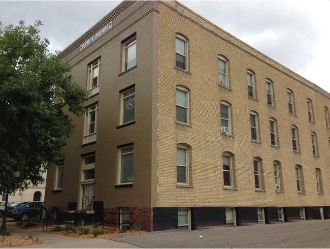
Property Record
37 7Th St N, Fargo, ND 58102
NEARBY LISTINGS FOR SALE OR LEASE
Property Detail
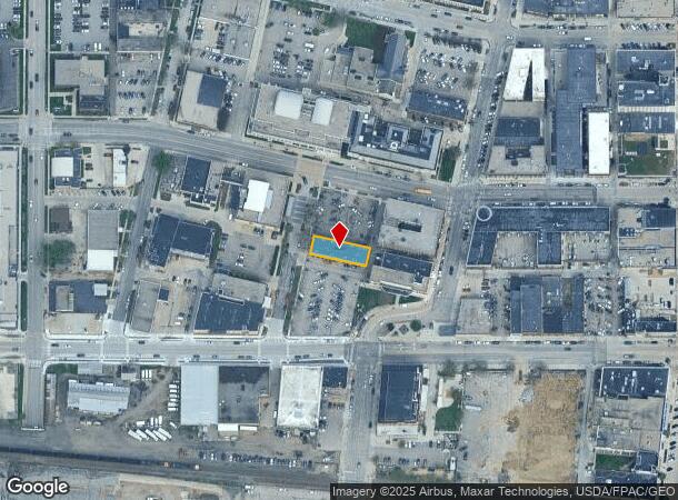
37 7Th St N
Fargo, ND-MN
Roberts
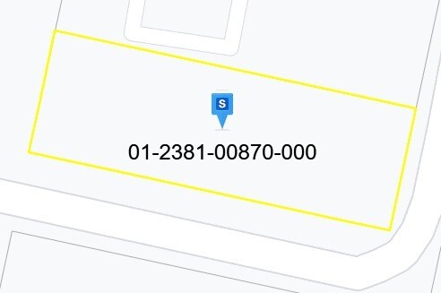
01-2381-00870-000
LOT: 7 BLOCK: 6 ADDITION: ROBERTS - HAGAMANS SUB ADDITIONAL: ROBERTS - HAGAMANS SUB LOT 7 & S 15' LOT 8 BLK 6
Realpropertynec
Cass
X
North Dakota
38017C0593G
7-8
2024
0.15 AC
2024
Downtown Fargo
000700
Other Market Areas
16,200 SF
DEMOGRAPHICS near 37 7Th St N
1 Mile
3 Mile
5 Mile
2024 Total Population
16,497
92,626
167,875
2029 Population
17,808
97,561
177,212
Pop Growth 2024-2029
+ 7.95%
+ 5.33%
+ 5.56%
Average Age
38
37
37
2024 Total Households
8,684
40,009
72,313
HH Growth 2024-2029
+ 8.30%
+ 6.24%
+ 6.31%
Median Household Inc
$37,694
$51,720
$57,302
Avg Household Size
1.80
2.00
2.10
2024 Avg HH Vehicles
2.00
2.00
2.00
Median Home Value
$194,064
$210,348
$232,325
Median Year Built
1956
1971
1984
Nearby Places
Map Layers
Map Styles
 Street
 Aerial
- Restaurants
- Banks
- Shops
- Fitness
- Groceries
PUBLIC TRANSPORTATION
COMMUTER RAIL
Fargo Amtrak Station (Empire Builder - Amtrak)
DRIVE
WALK
Distance
Fargo Amtrak Station (Empire Builder - Amtrak)
2 min
9 min
0.5 mi
AIRPORT
Hector International
DRIVE
WALK
Distance
Hector International
8 min
4.0 mi
Freight Ports
Port Milwaukee
DRIVE
WALK
Distance
Port Milwaukee
629 min
572.3 mi
Nearby Properties
Address
Land Use
TOTAL SIZE
Lot Size
Zoning
Address
Land Use
TOTAL SIZE
Lot Size
Zoning
40.49 AC
Address
Land Use
TOTAL SIZE
Lot Size
Zoning
30.61 AC
Address
Land Use
TOTAL SIZE
Lot Size
Zoning
Address
Land Use
TOTAL SIZE
Lot Size
Zoning
17.38 AC
Address
Land Use
TOTAL SIZE
Lot Size
Zoning
21.81 AC
Address
Land Use
TOTAL SIZE
Lot Size
Zoning
53.42 AC
Address
Land Use
TOTAL SIZE
Lot Size
Zoning
39.01 AC
Address
Land Use
TOTAL SIZE
Lot Size
Zoning
32.98 AC
Address
Land Use
TOTAL SIZE
Lot Size
Zoning
408,617 SF
9.33 AC
GC
Address
Land Use
TOTAL SIZE
Lot Size
Zoning
41.38 AC
Address
Land Use
TOTAL SIZE
Lot Size
Zoning
148.42 AC
Address
Land Use
TOTAL SIZE
Lot Size
Zoning
121,584 SF
5.64 AC
MR3
Address
Land Use
TOTAL SIZE
Lot Size
Zoning
14.53 AC
Address
Land Use
TOTAL SIZE
Lot Size
Zoning
621,097 SF
49.49 AC
LI
Address
Land Use
TOTAL SIZE
Lot Size
Zoning
162,875 SF
12.32 AC
MR3
Address
Land Use
TOTAL SIZE
Lot Size
Zoning
3.39 AC
Address
Land Use
TOTAL SIZE
Lot Size
Zoning
Address
Land Use
TOTAL SIZE
Lot Size
Zoning
107,995 SF
1 AC
DMU
Address
Land Use
TOTAL SIZE
Lot Size
Zoning
5.23 AC
Address
Land Use
TOTAL SIZE
Lot Size
Zoning
2.77 AC
Address
Land Use
TOTAL SIZE
Lot Size
Zoning
0.22 AC
Address
Land Use
TOTAL SIZE
Lot Size
Zoning
999.99 AC
Address
Land Use
TOTAL SIZE
Lot Size
Zoning
3.31 AC
Address
Land Use
TOTAL SIZE
Lot Size
Zoning
0.17 AC
Address
Land Use
TOTAL SIZE
Lot Size
Zoning
4.90 AC
Address
Land Use
TOTAL SIZE
Lot Size
Zoning
2.91 AC
Address
Land Use
TOTAL SIZE
Lot Size
Zoning
163,398 SF
1.92 AC
LC
Address
Land Use
TOTAL SIZE
Lot Size
Zoning
73.98 AC
Address
Land Use
TOTAL SIZE
Lot Size
Zoning
109,174 SF
1.25 AC
UMU
Address
Land Use
TOTAL SIZE
Lot Size
Zoning
6.02 AC
The World's #1 Commercial Real Estate Marketplace
Connect with us
© 2025 CoStar Group
The information above has been obtained from sources believed reliable. While we do not doubt its accuracy we have not verified it and make no guarantee, warranty or representation about it. It is your responsibility to independently confirm its accuracy and completeness. Any projections, opinions, assumptions, or estimates used are for example only and do not represent the current or future performance of the property. The value of this transaction to you depends on tax and other factors which should be evaluated by your tax, financial, and legal advisors. You and your advisors should conduct a careful, independent investigation of the property to determine to your satisfaction the suitability of the property for your needs.