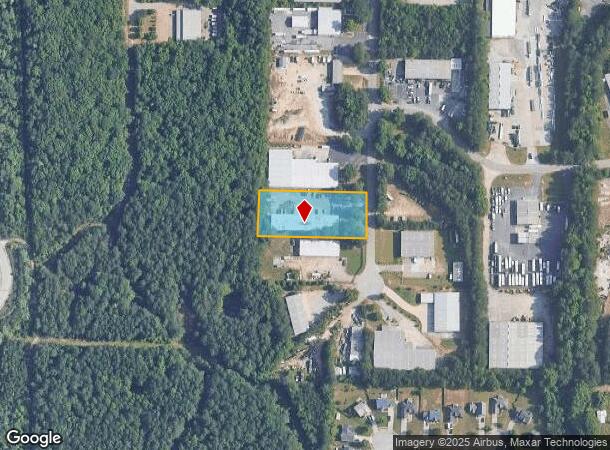
Property Record
37 Bellamy Pl, Stockbridge, GA 30281
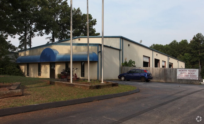
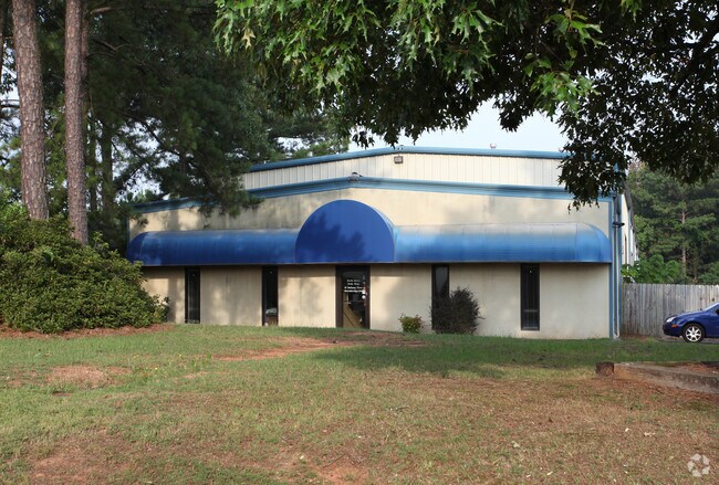
This Property Is For Sale
NEARBY LISTINGS FOR SALE OR LEASE
Property Detail
37 Bellamy Pl
Atlanta-Sandy Springs-Roswell, GA
Bellamy Ind Park
068D-03-036-000
LD: 12LL: 33
Multitenantindustrial
Henry
X
Georgia
13151C0087D
9
2025
1.37 AC
2025
S Clayton/Henry Cnty
070114
Atlanta
45,000 SF
DEMOGRAPHICS near 37 Bellamy Pl
1 Mile
3 Mile
5 Mile
2024 Total Population
2,847
36,946
92,717
2029 Population
3,115
40,128
99,707
Pop Growth 2024-2029
+ 9.41%
+ 8.61%
+ 7.54%
Average Age
36
38
39
2024 Total Households
1,056
13,411
33,069
HH Growth 2024-2029
+ 9.47%
+ 8.62%
+ 7.46%
Median Household Inc
$52,187
$65,790
$70,907
Avg Household Size
2.60
2.70
2.80
2024 Avg HH Vehicles
2.00
2.00
2.00
Median Home Value
$129,762
$221,539
$224,940
Median Year Built
1987
1994
1995
Nearby Places
- Restaurants
- Banks
- Shops
- Fitness
- Groceries
PUBLIC TRANSPORTATION
AIRPORT
Hartsfield - Jackson Atlanta International
DRIVE
WALK
Distance
Hartsfield - Jackson Atlanta International
28 min
18.3 mi
Freight Ports
Georgia Ports - Savannah
DRIVE
WALK
Distance
Georgia Ports - Savannah
258 min
230.0 mi
Nearby Properties
Address
Land Use
TOTAL SIZE
Lot Size
Zoning
Address
Land Use
TOTAL SIZE
Lot Size
Zoning
22,400 SF
45.37 AC
RM
Address
Land Use
TOTAL SIZE
Lot Size
Zoning
476,716 SF
28.93 AC
C2
Address
Land Use
TOTAL SIZE
Lot Size
Zoning
4,010 SF
37.60 AC
C2
Address
Land Use
TOTAL SIZE
Lot Size
Zoning
19,140 SF
40.11 AC
RM
Address
Land Use
TOTAL SIZE
Lot Size
Zoning
21,678 SF
26.44 AC
RM
Address
Land Use
TOTAL SIZE
Lot Size
Zoning
13,072 SF
32.50 AC
RM
Address
Land Use
TOTAL SIZE
Lot Size
Zoning
707,800 SF
27.81 AC
M1
Address
Land Use
TOTAL SIZE
Lot Size
Zoning
25,952 SF
28.88 AC
RM
Address
Land Use
TOTAL SIZE
Lot Size
Zoning
9,264 SF
26.63 AC
RM
Address
Land Use
TOTAL SIZE
Lot Size
Zoning
510,053 SF
39.93 AC
M1
Address
Land Use
TOTAL SIZE
Lot Size
Zoning
25,508 SF
26.03 AC
RM
Address
Land Use
TOTAL SIZE
Lot Size
Zoning
439,225 SF
19.81 AC
M1
Address
Land Use
TOTAL SIZE
Lot Size
Zoning
399,189 SF
29.60 AC
M1
Address
Land Use
TOTAL SIZE
Lot Size
Zoning
269,100 SF
30.64 AC
Address
Land Use
TOTAL SIZE
Lot Size
Zoning
425,476 SF
58.85 AC
PD
Address
Land Use
TOTAL SIZE
Lot Size
Zoning
74,395 SF
49.35 AC
PD
Address
Land Use
TOTAL SIZE
Lot Size
Zoning
111,398 SF
15.54 AC
C2
Address
Land Use
TOTAL SIZE
Lot Size
Zoning
68,500 SF
140.42 AC
R2
Address
Land Use
TOTAL SIZE
Lot Size
Zoning
216,361 SF
27.44 AC
C3
Address
Land Use
TOTAL SIZE
Lot Size
Zoning
1,638 SF
12.79 AC
RM
Address
Land Use
TOTAL SIZE
Lot Size
Zoning
62,142 SF
4.36 AC
C1
Address
Land Use
TOTAL SIZE
Lot Size
Zoning
8,590 SF
11.09 AC
R3
Address
Land Use
TOTAL SIZE
Lot Size
Zoning
466,048 SF
6.51 AC
RA
Address
Land Use
TOTAL SIZE
Lot Size
Zoning
66,194 SF
9.67 AC
C3
Address
Land Use
TOTAL SIZE
Lot Size
Zoning
46,186 SF
9.99 AC
C2
Address
Land Use
TOTAL SIZE
Lot Size
Zoning
46,964 SF
2.72 AC
Address
Land Use
TOTAL SIZE
Lot Size
Zoning
30,888 SF
5.10 AC
Address
Land Use
TOTAL SIZE
Lot Size
Zoning
196,437 SF
7.98 AC
C2
Address
Land Use
TOTAL SIZE
Lot Size
Zoning
25,020 SF
169.25 AC
RA
Address
Land Use
TOTAL SIZE
Lot Size
Zoning
33,993 SF
4.22 AC
C3
The World's #1 Commercial Real Estate Marketplace
Connect with us
© 2025 CoStar Group
The information above has been obtained from sources believed reliable. While we do not doubt its accuracy we have not verified it and make no guarantee, warranty or representation about it. It is your responsibility to independently confirm its accuracy and completeness. Any projections, opinions, assumptions, or estimates used are for example only and do not represent the current or future performance of the property. The value of this transaction to you depends on tax and other factors which should be evaluated by your tax, financial, and legal advisors. You and your advisors should conduct a careful, independent investigation of the property to determine to your satisfaction the suitability of the property for your needs.