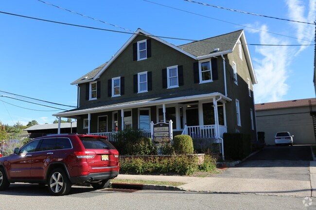
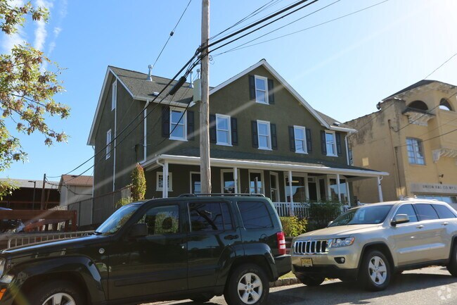
Property Record
37 Dumont Rd, Far Hills, NJ 07931

NEARBY LISTINGS FOR SALE OR LEASE
Property Detail
37 Dumont Rd
07-00015-0000-00002
Somerset
Officebuilding
New Jersey
X
2
34035C0042E
0.13 AC
2024
Route 78 East
2025
Northern New Jersey
052901
Newark, NJ-PA
2,835 SF
DEMOGRAPHICS near 37 Dumont Rd
1 Mile
3 Mile
5 Mile
2024 Total Population
1,160
17,968
48,087
2029 Population
1,106
17,818
47,765
Pop Growth 2024-2029
(4.66%)
(0.83%)
(0.67%)
Average Age
46
43
43
2024 Total Households
447
7,473
18,127
HH Growth 2024-2029
(4.70%)
(0.79%)
(0.71%)
Median Household Inc
$130,978
$148,292
$166,402
Avg Household Size
2.60
2.40
2.60
2024 Avg HH Vehicles
2.00
2.00
2.00
Median Home Value
$790,229
$587,719
$669,426
Median Year Built
1965
1987
1982
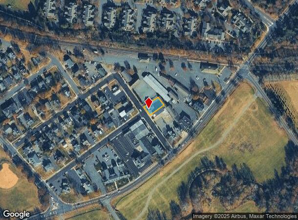
Nearby Places
Map Layers
Map Styles
 Street
 Aerial
- Restaurants
- Banks
- Shops
- Fitness
- Groceries
PUBLIC TRANSPORTATION
COMMUTER RAIL
Far Hills (Morris & Essex Gladstone Branch - NJ Transit Commuter Rail (NJ Transit))
DRIVE
WALK
Distance
Far Hills (Morris & Essex Gladstone Branch - NJ Transit Commuter Rail (NJ Transit))
0 min
3 min
0.2 mi
Peapack (Morris & Essex Gladstone Branch - NJ Transit Commuter Rail (NJ Transit))
DRIVE
WALK
Distance
Peapack (Morris & Essex Gladstone Branch - NJ Transit Commuter Rail (NJ Transit))
4 min
2.5 mi
AIRPORT
Newark Liberty International
DRIVE
WALK
Distance
Newark Liberty International
39 min
31.0 mi
Trenton Mercer
DRIVE
WALK
Distance
Trenton Mercer
60 min
38.7 mi
Freight Ports
New York Container Terminal
DRIVE
WALK
Distance
New York Container Terminal
49 min
34.0 mi
Nearby Properties
Address
Land Use
TOTAL SIZE
Lot Size
Zoning
Address
Land Use
TOTAL SIZE
Lot Size
Zoning
196.68 AC
OR
Address
Land Use
TOTAL SIZE
Lot Size
Zoning
44.48 AC
ORL
Address
Land Use
TOTAL SIZE
Lot Size
Zoning
23.08 AC
OR
Address
Land Use
TOTAL SIZE
Lot Size
Zoning
12.74 AC
PUD
Address
Land Use
TOTAL SIZE
Lot Size
Zoning
13.94 AC
PUD
Address
Land Use
TOTAL SIZE
Lot Size
Zoning
2,848 SF
22.47 AC
ORVM
Address
Land Use
TOTAL SIZE
Lot Size
Zoning
21,500 SF
9.66 AC
E4
Address
Land Use
TOTAL SIZE
Lot Size
Zoning
17.63 AC
OR
Address
Land Use
TOTAL SIZE
Lot Size
Zoning
32,792 SF
14.26 AC
RE
Address
Land Use
TOTAL SIZE
Lot Size
Zoning
2,726 SF
10.01 AC
VN
Address
Land Use
TOTAL SIZE
Lot Size
Zoning
49,786 SF
13.84 AC
VN2
Address
Land Use
TOTAL SIZE
Lot Size
Zoning
67,407 SF
41.85 AC
R1
Address
Land Use
TOTAL SIZE
Lot Size
Zoning
12 AC
P3
Address
Land Use
TOTAL SIZE
Lot Size
Zoning
31.95 AC
R3
Address
Land Use
TOTAL SIZE
Lot Size
Zoning
10,266 SF
3 AC
R10
Address
Land Use
TOTAL SIZE
Lot Size
Zoning
3.90 AC
PUD
Address
Land Use
TOTAL SIZE
Lot Size
Zoning
5,398 SF
4.90 AC
VN
Address
Land Use
TOTAL SIZE
Lot Size
Zoning
60,506 SF
10.44 AC
PUD5
Address
Land Use
TOTAL SIZE
Lot Size
Zoning
3.88 AC
VN
Address
Land Use
TOTAL SIZE
Lot Size
Zoning
5,052 SF
266.92 AC
PUD5
Address
Land Use
TOTAL SIZE
Lot Size
Zoning
22,833 SF
7 AC
R110
Address
Land Use
TOTAL SIZE
Lot Size
Zoning
185.18 AC
P1
Address
Land Use
TOTAL SIZE
Lot Size
Zoning
9.35 AC
OR
Address
Land Use
TOTAL SIZE
Lot Size
Zoning
1,530 SF
3.37 AC
OR
Address
Land Use
TOTAL SIZE
Lot Size
Zoning
23.10 AC
LI
Address
Land Use
TOTAL SIZE
Lot Size
Zoning
3,444 SF
122.02 AC
P
Address
Land Use
TOTAL SIZE
Lot Size
Zoning
40,798 SF
7.01 AC
OR
Address
Land Use
TOTAL SIZE
Lot Size
Zoning
1,300 SF
10.02 AC
E3
Address
Land Use
TOTAL SIZE
Lot Size
Zoning
12,566 SF
4 AC
R10
Address
Land Use
TOTAL SIZE
Lot Size
Zoning
9,090 SF
6.78 AC
R10
The World's #1 Commercial Real Estate Marketplace
Connect with us
© 2025 CoStar Group
The information above has been obtained from sources believed reliable. While we do not doubt its accuracy we have not verified it and make no guarantee, warranty or representation about it. It is your responsibility to independently confirm its accuracy and completeness. Any projections, opinions, assumptions, or estimates used are for example only and do not represent the current or future performance of the property. The value of this transaction to you depends on tax and other factors which should be evaluated by your tax, financial, and legal advisors. You and your advisors should conduct a careful, independent investigation of the property to determine to your satisfaction the suitability of the property for your needs.