Property Record
37 Dykeman Way, Stoughton, MA 02072
NEARBY LISTINGS FOR SALE OR LEASE
Property Detail
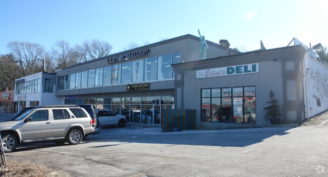
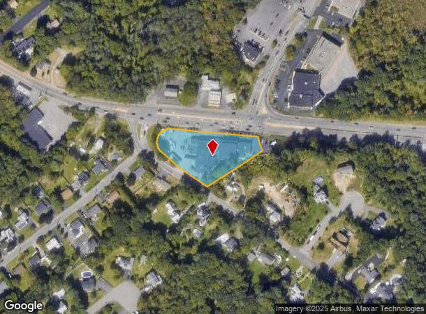
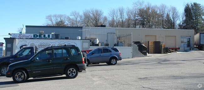
37 Dykeman Way
Regionalshoppingcenterormallwithanchorstore
Norfolk
X
Massachusetts
25021C0214F
1.50 AC
2025
Route 24
2025
Boston
456200
Boston-Cambridge-Newton, MA-NH
37,796 SF
STOU-000090-000093
DEMOGRAPHICS near 37 Dykeman Way
1 Mile
3 Mile
5 Mile
2024 Total Population
2,957
61,144
195,859
2029 Population
2,945
60,473
193,803
Pop Growth 2024-2029
(0.41%)
(1.10%)
(1.05%)
Average Age
42
41
40
2024 Total Households
1,016
22,698
69,623
HH Growth 2024-2029
(0.49%)
(1.24%)
(1.07%)
Median Household Inc
$107,714
$82,676
$88,826
Avg Household Size
2.80
2.60
2.70
2024 Avg HH Vehicles
2.00
2.00
2.00
Median Home Value
$505,319
$424,442
$427,180
Median Year Built
1966
1965
1962
Nearby Places
Map Layers
Map Styles
 Street
 Aerial
- Restaurants
- Banks
- Shops
- Fitness
- Groceries
PUBLIC TRANSPORTATION
COMMUTER RAIL
Stoughton (Providence/Stoughton Line - Massachusetts Bay Transportation Authority Commuter Rail (Purple Line))
DRIVE
WALK
Distance
Stoughton (Providence/Stoughton Line - Massachusetts Bay Transportation Authority Commuter Rail (Purple Line))
6 min
2.3 mi
Montello (Middleborough/Lakeville Line - Massachusetts Bay Transportation Authority Commuter Rail (Purple Line))
DRIVE
WALK
Distance
Montello (Middleborough/Lakeville Line - Massachusetts Bay Transportation Authority Commuter Rail (Purple Line))
8 min
3.6 mi
AIRPORT
General Edward Lawrence Logan International
DRIVE
WALK
Distance
General Edward Lawrence Logan International
33 min
22.3 mi
Rhode Island Tf Green International
DRIVE
WALK
Distance
Rhode Island Tf Green International
65 min
41.6 mi
Nearby Properties
Address
Land Use
TOTAL SIZE
Lot Size
Zoning
Address
Land Use
TOTAL SIZE
Lot Size
Zoning
13.08 AC
HB
Address
Land Use
TOTAL SIZE
Lot Size
Zoning
1,292 SF
36.06 AC
C5
Address
Land Use
TOTAL SIZE
Lot Size
Zoning
403,163 SF
24.58 AC
I
Address
Land Use
TOTAL SIZE
Lot Size
Zoning
8.09 AC
R1C
Address
Land Use
TOTAL SIZE
Lot Size
Zoning
4,524 SF
12.31 AC
R1C
Address
Land Use
TOTAL SIZE
Lot Size
Zoning
214,600 SF
20.30 AC
RU
Address
Land Use
TOTAL SIZE
Lot Size
Zoning
7.27 AC
GB
Address
Land Use
TOTAL SIZE
Lot Size
Zoning
10.10 AC
CSBD
Address
Land Use
TOTAL SIZE
Lot Size
Zoning
86,564 SF
8.45 AC
GBHD
Address
Land Use
TOTAL SIZE
Lot Size
Zoning
379,908 SF
15.14 AC
Address
Land Use
TOTAL SIZE
Lot Size
Zoning
199,072 SF
10.07 AC
HB
Address
Land Use
TOTAL SIZE
Lot Size
Zoning
12.24 AC
I
Address
Land Use
TOTAL SIZE
Lot Size
Zoning
70,216 SF
6.86 AC
7
Address
Land Use
TOTAL SIZE
Lot Size
Zoning
2,600 SF
334.97 AC
R1C
Address
Land Use
TOTAL SIZE
Lot Size
Zoning
1,660 SF
31.95 AC
R1B
Address
Land Use
TOTAL SIZE
Lot Size
Zoning
299,062 SF
22.73 AC
R2
Address
Land Use
TOTAL SIZE
Lot Size
Zoning
34.45 AC
HB
Address
Land Use
TOTAL SIZE
Lot Size
Zoning
289,562 SF
13.59 AC
Address
Land Use
TOTAL SIZE
Lot Size
Zoning
253,912 SF
10.33 AC
R3
Address
Land Use
TOTAL SIZE
Lot Size
Zoning
126,237 SF
20.42 AC
R3
Address
Land Use
TOTAL SIZE
Lot Size
Zoning
128,760 SF
19.51 AC
6
Address
Land Use
TOTAL SIZE
Lot Size
Zoning
285,036 SF
20.45 AC
R3
Address
Land Use
TOTAL SIZE
Lot Size
Zoning
1,204 SF
15.08 AC
R1C
Address
Land Use
TOTAL SIZE
Lot Size
Zoning
1,871 SF
39.63 AC
C2
Address
Land Use
TOTAL SIZE
Lot Size
Zoning
94,356 SF
10 AC
6
Address
Land Use
TOTAL SIZE
Lot Size
Zoning
121,424 SF
11.11 AC
HB
Address
Land Use
TOTAL SIZE
Lot Size
Zoning
130,080 SF
2.82 AC
R3
Address
Land Use
TOTAL SIZE
Lot Size
Zoning
133,108 SF
4.48 AC
R3
Address
Land Use
TOTAL SIZE
Lot Size
Zoning
2,077 SF
5.68 AC
R2
Address
Land Use
TOTAL SIZE
Lot Size
Zoning
190,000 SF
11.42 AC
The World's #1 Commercial Real Estate Marketplace
Connect with us
© 2025 CoStar Group
The information above has been obtained from sources believed reliable. While we do not doubt its accuracy we have not verified it and make no guarantee, warranty or representation about it. It is your responsibility to independently confirm its accuracy and completeness. Any projections, opinions, assumptions, or estimates used are for example only and do not represent the current or future performance of the property. The value of this transaction to you depends on tax and other factors which should be evaluated by your tax, financial, and legal advisors. You and your advisors should conduct a careful, independent investigation of the property to determine to your satisfaction the suitability of the property for your needs.