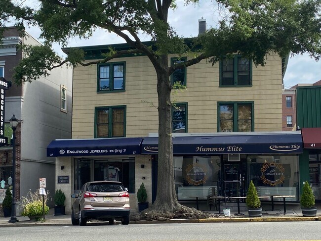
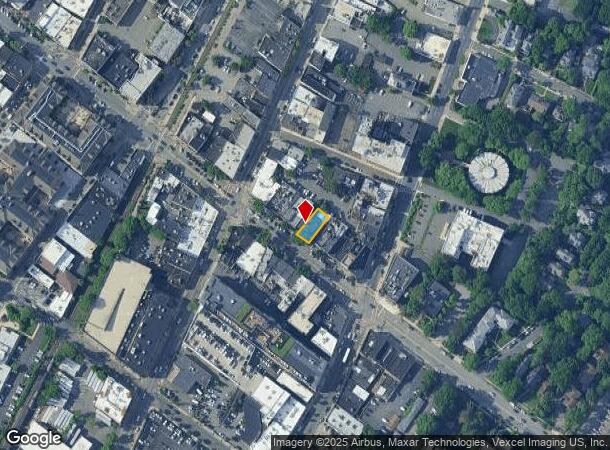
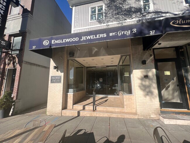
Property Record
37 E Palisade Ave, Englewood, NJ 07631
NEARBY LISTINGS FOR SALE OR LEASE
Property Detail
37 E Palisade Ave
15-01208-0000-00016-01
50X100 STORES & APTS (1208,16)
Commercialnec
Bergen
X
New Jersey
34003C0213H
16.1
2024
0.12 AC
2025
GW Bridge
015401
Northern New Jersey
5,872 SF
New York-Jersey City-White Plains, NY-NJ
DEMOGRAPHICS near 37 E Palisade Ave
1 Mile
3 Mile
5 Mile
2024 Total Population
20,229
158,206
1,099,973
2029 Population
20,225
158,013
1,054,895
Pop Growth 2024-2029
(0.02%)
(0.12%)
(4.10%)
Average Age
40
42
40
2024 Total Households
7,278
57,330
405,153
HH Growth 2024-2029
+ 0.04%
(0.08%)
(4.34%)
Median Household Inc
$76,842
$110,645
$60,842
Avg Household Size
2.60
2.70
2.60
2024 Avg HH Vehicles
2.00
2.00
1.00
Median Home Value
$433,527
$489,298
$480,637
Median Year Built
1955
1957
1950
Nearby Places
Map Layers
Map Styles
 Street
 Aerial
- Restaurants
- Banks
- Shops
- Fitness
- Groceries
PUBLIC TRANSPORTATION
COMMUTER RAIL
Spuyten Duyvil Station (Hudson Line - Metro-North Commuter Railroad Company (Metro-North))
DRIVE
WALK
Distance
Spuyten Duyvil Station (Hudson Line - Metro-North Commuter Railroad Company (Metro-North))
18 min
9.3 mi
AIRPORT
LaGuardia
DRIVE
WALK
Distance
LaGuardia
28 min
15.2 mi
Newark Liberty International
DRIVE
WALK
Distance
Newark Liberty International
25 min
19.2 mi
Westchester County
DRIVE
WALK
Distance
Westchester County
48 min
32.1 mi
Freight Ports
NY - Red Hook Container Terminal
DRIVE
WALK
Distance
NY - Red Hook Container Terminal
39 min
21.5 mi
SALE & LEASE HISTORY
LISTING DATE
SALE/LEASE

Sep 12, 2023
For Lease
Nov 01, 2022
For Lease
Jul 18, 2022
For Lease
Jul 18, 2022
For Sale
Nearby Properties
Address
Land Use
TOTAL SIZE
Lot Size
Zoning
Address
Land Use
TOTAL SIZE
Lot Size
Zoning
111.37 AC
P1
Address
Land Use
TOTAL SIZE
Lot Size
Zoning
24.08 AC
B2-A
Address
Land Use
TOTAL SIZE
Lot Size
Zoning
Address
Land Use
TOTAL SIZE
Lot Size
Zoning
72 AC
P1
Address
Land Use
TOTAL SIZE
Lot Size
Zoning
2.61 AC
D5
Address
Land Use
TOTAL SIZE
Lot Size
Zoning
572,137 SF
14.11 AC
R-D
Address
Land Use
TOTAL SIZE
Lot Size
Zoning
20.07 AC
H
Address
Land Use
TOTAL SIZE
Lot Size
Zoning
74,550 SF
11.28 AC
OI
Address
Land Use
TOTAL SIZE
Lot Size
Zoning
219.71 AC
O
Address
Land Use
TOTAL SIZE
Lot Size
Zoning
42.68 AC
P1
Address
Land Use
TOTAL SIZE
Lot Size
Zoning
13.09 AC
C3
Address
Land Use
TOTAL SIZE
Lot Size
Zoning
100,151 SF
22.13 AC
B2
Address
Land Use
TOTAL SIZE
Lot Size
Zoning
2.55 AC
D5
Address
Land Use
TOTAL SIZE
Lot Size
Zoning
39 AC
P1
Address
Land Use
TOTAL SIZE
Lot Size
Zoning
5.87 AC
R10
Address
Land Use
TOTAL SIZE
Lot Size
Zoning
5.22 AC
APT
Address
Land Use
TOTAL SIZE
Lot Size
Zoning
4.89 AC
R10
Address
Land Use
TOTAL SIZE
Lot Size
Zoning
43.65 AC
PARK
Address
Land Use
TOTAL SIZE
Lot Size
Zoning
4.54 AC
R-M3
Address
Land Use
TOTAL SIZE
Lot Size
Zoning
2.55 AC
RC-1
Address
Land Use
TOTAL SIZE
Lot Size
Zoning
32 AC
P1
Address
Land Use
TOTAL SIZE
Lot Size
Zoning
4.75 AC
R9
Address
Land Use
TOTAL SIZE
Lot Size
Zoning
15.76 AC
B2
Address
Land Use
TOTAL SIZE
Lot Size
Zoning
259.87 AC
PARK
Address
Land Use
TOTAL SIZE
Lot Size
Zoning
2.92 AC
RC-2
Address
Land Use
TOTAL SIZE
Lot Size
Zoning
Address
Land Use
TOTAL SIZE
Lot Size
Zoning
1.22 AC
RC3
Address
Land Use
TOTAL SIZE
Lot Size
Zoning
1.32 AC
R6A
Address
Land Use
TOTAL SIZE
Lot Size
Zoning
140 AC
RS
Address
Land Use
TOTAL SIZE
Lot Size
Zoning
12.68 AC
P1
The World's #1 Commercial Real Estate Marketplace
Connect with us
© 2025 CoStar Group
The information above has been obtained from sources believed reliable. While we do not doubt its accuracy we have not verified it and make no guarantee, warranty or representation about it. It is your responsibility to independently confirm its accuracy and completeness. Any projections, opinions, assumptions, or estimates used are for example only and do not represent the current or future performance of the property. The value of this transaction to you depends on tax and other factors which should be evaluated by your tax, financial, and legal advisors. You and your advisors should conduct a careful, independent investigation of the property to determine to your satisfaction the suitability of the property for your needs.