Property Record
37 Overview Dr, Coventry, RI 02816
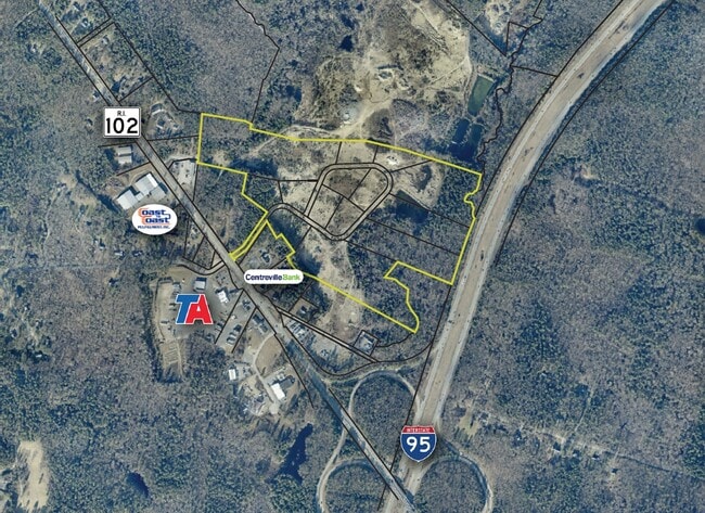
This Property Is For Sale
Property Detail
37 Overview Dr
WGRE-000013-000015-000003
KENT
Vacantlandnec
Rhode Island
INDA
4
B and X Area of moderate flood hazard, usually the area between the limits of the 100-year and 500-year floods.
2.10 AC
2025
Coventry/West Greenwich
2025
Providence
020603
Providence-Warwick, RI-MA
NEARBY LISTINGS FOR SALE OR LEASE
-
-
View all Coventry listings for sale on LoopNet.com
DEMOGRAPHICS near 37 Overview Dr
1 mile
3 mile
5 mile
2024 Total Population
595
3,116
9,794
2029 Population
597
3,114
9,784
Pop Growth 2024-2029
+ 0.34%
(0.06%)
(0.10%)
Average Age
44
44
45
2024 Total Households
215
1,133
3,770
HH Growth 2024-2029
+ 0.47%
(0.26%)
(0.19%)
Median Household Inc
$145,192
$142,349
$127,075
Avg Household Size
2.70
2.70
2.60
2024 Avg HH Vehicles
3.00
3.00
2.00
Median Home Value
$630,081
$606,444
$499,416
Median Year Built
1982
1981
1982
Nearby Places
Map Layers
Map Styles
 Street
 Aerial
Transit
 Traffic
 Biking
Places
Listings with unknown addresses are not visible on the map
- Restaurants
- Banks
- Shops
- Fitness
- Groceries
PUBLIC TRANSPORTATION
AIRPORT
Rhode Island Tf Green International
Drive
Walk
Distance
Rhode Island Tf Green International
30 min
19.8 mi
Freight Ports
Port of Davisville, RI
Drive
Walk
Distance
Port of Davisville, RI
32 min
16.8 mi
Nearby Properties
Address
Land Use
TOTAL SIZE
Lot Size
Zoning
Address
Land Use
TOTAL SIZE
Lot Size
Zoning
4,670 SF
2,295.68 AC
OSPL
Address
Land Use
TOTAL SIZE
Lot Size
Zoning
39.91 AC
RFR2
Address
Land Use
TOTAL SIZE
Lot Size
Zoning
2,080 AC
OSPL
Address
Land Use
TOTAL SIZE
Lot Size
Zoning
50,160 SF
23.40 AC
RE-2
Address
Land Use
TOTAL SIZE
Lot Size
Zoning
33,350 SF
38.50 AC
LI
Address
Land Use
TOTAL SIZE
Lot Size
Zoning
38,724 SF
11.20 AC
RU-4
Address
Land Use
TOTAL SIZE
Lot Size
Zoning
78.83 AC
RFR2
Address
Land Use
TOTAL SIZE
Lot Size
Zoning
102,456 SF
16.07 AC
HB
Address
Land Use
TOTAL SIZE
Lot Size
Zoning
1,679.80 AC
OSPL
Address
Land Use
TOTAL SIZE
Lot Size
Zoning
7,500 SF
8.20 AC
HB
Address
Land Use
TOTAL SIZE
Lot Size
Zoning
12,378 SF
18.10 AC
RFR2
Address
Land Use
TOTAL SIZE
Lot Size
Zoning
5,568 SF
168.83 AC
RFR2
Address
Land Use
TOTAL SIZE
Lot Size
Zoning
8,880 SF
70.82 AC
RFR2
Address
Land Use
TOTAL SIZE
Lot Size
Zoning
15,638 SF
2.04 AC
HB
Address
Land Use
TOTAL SIZE
Lot Size
Zoning
167.50 AC
RFR2
Address
Land Use
TOTAL SIZE
Lot Size
Zoning
10,434 SF
15.50 AC
RFR2
Address
Land Use
TOTAL SIZE
Lot Size
Zoning
10,040 SF
5.96 AC
LI
Address
Land Use
TOTAL SIZE
Lot Size
Zoning
2,054 SF
36.64 AC
RU-4
Address
Land Use
TOTAL SIZE
Lot Size
Zoning
35.60 AC
B
Address
Land Use
TOTAL SIZE
Lot Size
Zoning
23,184 SF
4.01 AC
HB
Address
Land Use
TOTAL SIZE
Lot Size
Zoning
1,482 SF
2.10 AC
HB
Address
Land Use
TOTAL SIZE
Lot Size
Zoning
1,632 SF
7.30 AC
HB
Address
Land Use
TOTAL SIZE
Lot Size
Zoning
4,337 SF
3.80 AC
HB
Address
Land Use
TOTAL SIZE
Lot Size
Zoning
6,231 SF
5.28 AC
NB
Address
Land Use
TOTAL SIZE
Lot Size
Zoning
13,960 SF
12.65 AC
LI
Address
Land Use
TOTAL SIZE
Lot Size
Zoning
1,272 SF
HB
Address
Land Use
TOTAL SIZE
Lot Size
Zoning
6,800 SF
2.25 AC
LB/R
Address
Land Use
TOTAL SIZE
Lot Size
Zoning
7,418 SF
1.90 AC
RFR2
Address
Land Use
TOTAL SIZE
Lot Size
Zoning
11,142 SF
2.93 AC
HB
Address
Land Use
TOTAL SIZE
Lot Size
Zoning
1,322 SF
2.04 AC
LB/R
The World's #1 Commercial Real Estate Marketplace
Connect with us
© 2026 CoStar Group
The information above has been obtained from sources believed reliable. While we do not doubt its accuracy we have not verified it and make no guarantee, warranty or representation about it. It is your responsibility to independently confirm its accuracy and completeness. Any projections, opinions, assumptions, or estimates used are for example only and do not represent the current or future performance of the property. The value of this transaction to you depends on tax and other factors which should be evaluated by your tax, financial, and legal advisors. You and your advisors should conduct a careful, independent investigation of the property to determine to your satisfaction the suitability of the property for your needs.