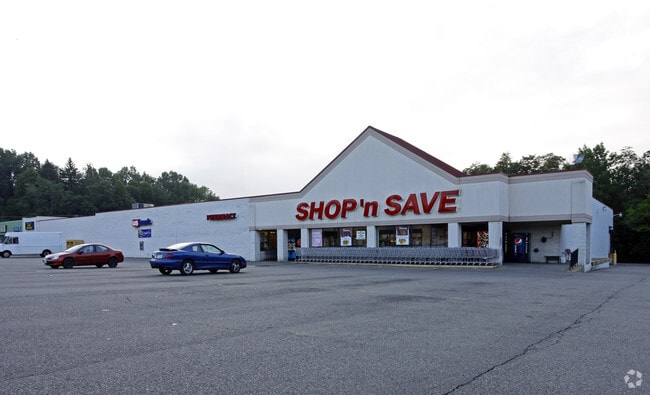
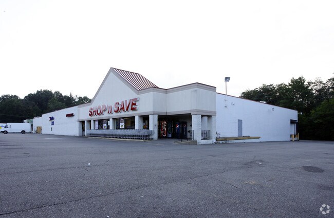
Property Record
37 Ridge Rd, Newton Falls, OH 44444
Property Detail
37 Ridge Rd
Youngstown-Warren, OH
6530 225F2.085 N VILL PT RIDGE ST
53-215402
Trumbull
Supermarket
Ohio
AE The base floodplain where base flood elevations are provided. AE Zones are now used on new format FIRMs instead of A1-A30 Zones.
30
2025
2.09 AC
2025
Trumbull County
933600
Youngstown/Warren/Boardman
35,744 SF
NEARBY LISTINGS FOR SALE OR LEASE
DEMOGRAPHICS near 37 Ridge Rd
1 mile
3 mile
5 mile
2025 Total Population
4,330
8,046
14,903
2030 Population
4,286
7,979
14,905
Pop Growth 2025-2030
(1.02%)
(0.83%)
+ 0.01%
Average Age
44
44
44
2025 Total Households
2,012
3,572
6,398
HH Growth 2025-2030
(1.04%)
(0.84%)
(0.05%)
Median Household Inc
$53,125
$55,314
$56,957
Avg Household Size
2.10
2.20
2.30
2025 Avg HH Vehicles
2.00
2.00
2.00
Median Home Value
$129,143
$155,409
$161,925
Median Year Built
1956
1962
1969
Nearby Places
Map Layers
Map Styles
 Street
 Aerial
Layers
 Traffic
 Biking
Places
Listings with unknown addresses are not visible on the map
- Restaurants
- Banks
- Shops
- Fitness
- Groceries
PUBLIC TRANSPORTATION
AIRPORT
Akron-Canton Regional
Drive
Walk
Distance
Akron-Canton Regional
58 min
44.6 mi
Nearby Properties
Address
Land Use
TOTAL SIZE
Lot Size
Zoning
Address
Land Use
TOTAL SIZE
Lot Size
Zoning
5.32 AC
Address
Land Use
TOTAL SIZE
Lot Size
Zoning
50,236 SF
60 AC
Address
Land Use
TOTAL SIZE
Lot Size
Zoning
Address
Land Use
TOTAL SIZE
Lot Size
Zoning
2,664 SF
10.14 AC
Address
Land Use
TOTAL SIZE
Lot Size
Zoning
13.61 AC
Address
Land Use
TOTAL SIZE
Lot Size
Zoning
5,911 SF
11.38 AC
Address
Land Use
TOTAL SIZE
Lot Size
Zoning
149.87 AC
Address
Land Use
TOTAL SIZE
Lot Size
Zoning
5,928 SF
18.24 AC
Address
Land Use
TOTAL SIZE
Lot Size
Zoning
36,135 SF
3.60 AC
Address
Land Use
TOTAL SIZE
Lot Size
Zoning
672.43 AC
Address
Land Use
TOTAL SIZE
Lot Size
Zoning
1,403 SF
8.22 AC
Address
Land Use
TOTAL SIZE
Lot Size
Zoning
17,563 SF
3.10 AC
Address
Land Use
TOTAL SIZE
Lot Size
Zoning
70,469 SF
4.73 AC
Address
Land Use
TOTAL SIZE
Lot Size
Zoning
35,933 SF
1.31 AC
Address
Land Use
TOTAL SIZE
Lot Size
Zoning
3,456 SF
4.20 AC
Address
Land Use
TOTAL SIZE
Lot Size
Zoning
19,072 SF
2.39 AC
Address
Land Use
TOTAL SIZE
Lot Size
Zoning
6,426 SF
8.92 AC
Address
Land Use
TOTAL SIZE
Lot Size
Zoning
42,216 SF
2.36 AC
Address
Land Use
TOTAL SIZE
Lot Size
Zoning
3,456 SF
3.71 AC
Address
Land Use
TOTAL SIZE
Lot Size
Zoning
11,201 SF
0.99 AC
Address
Land Use
TOTAL SIZE
Lot Size
Zoning
5,840 SF
0.70 AC
Address
Land Use
TOTAL SIZE
Lot Size
Zoning
4,176 SF
41.02 AC
Address
Land Use
TOTAL SIZE
Lot Size
Zoning
848 SF
25.93 AC
Address
Land Use
TOTAL SIZE
Lot Size
Zoning
15,170 SF
2.85 AC
Address
Land Use
TOTAL SIZE
Lot Size
Zoning
13,634 SF
2.55 AC
Address
Land Use
TOTAL SIZE
Lot Size
Zoning
4,991 SF
2.84 AC
Address
Land Use
TOTAL SIZE
Lot Size
Zoning
832 SF
4.81 AC
Address
Land Use
TOTAL SIZE
Lot Size
Zoning
0.36 AC
Address
Land Use
TOTAL SIZE
Lot Size
Zoning
21,500 SF
0.46 AC
The World's #1 Commercial Real Estate Marketplace
Connect with us
© 2026 CoStar Group
The information above has been obtained from sources believed reliable. While we do not doubt its accuracy we have not verified it and make no guarantee, warranty or representation about it. It is your responsibility to independently confirm its accuracy and completeness. Any projections, opinions, assumptions, or estimates used are for example only and do not represent the current or future performance of the property. The value of this transaction to you depends on tax and other factors which should be evaluated by your tax, financial, and legal advisors. You and your advisors should conduct a careful, independent investigation of the property to determine to your satisfaction the suitability of the property for your needs.