Property Record
37 Stanley Rd, Springfield, VT 05156

NEARBY LISTINGS FOR SALE OR LEASE
-
-
View all Springfield listings for sale on LoopNet.com
Property Detail
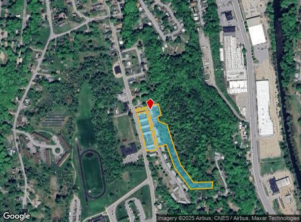
37 Stanley Rd
606-190-13170
030 4 14
Apartment
Windsor
X
Vermont
50027C0736E
6.90 AC
2024
Vermont South Area
2024
Other Market Areas
966600
Claremont-Lebanon, NH-VT
DEMOGRAPHICS near 37 Stanley Rd
1 Mile
3 Mile
5 Mile
2024 Total Population
3,340
7,398
13,996
2029 Population
3,438
7,607
14,410
Pop Growth 2024-2029
+ 2.93%
+ 2.83%
+ 2.96%
Average Age
43
44
45
2024 Total Households
1,438
3,250
6,079
HH Growth 2024-2029
+ 2.85%
+ 2.77%
+ 2.83%
Median Household Inc
$49,896
$55,266
$57,413
Avg Household Size
2.10
2.10
2.20
2024 Avg HH Vehicles
2.00
2.00
2.00
Median Home Value
$138,095
$149,111
$152,047
Median Year Built
1964
1966
1970
Nearby Places
Map Layers
Map Styles
 Street
 Aerial
- Restaurants
- Banks
- Shops
- Fitness
- Groceries
Nearby Properties
Address
Land Use
TOTAL SIZE
Lot Size
Zoning
Address
Land Use
TOTAL SIZE
Lot Size
Zoning
269,420 SF
53.20 AC
Address
Land Use
TOTAL SIZE
Lot Size
Zoning
Address
Land Use
TOTAL SIZE
Lot Size
Zoning
Address
Land Use
TOTAL SIZE
Lot Size
Zoning
16.10 AC
Address
Land Use
TOTAL SIZE
Lot Size
Zoning
51,108 SF
1.70 AC
Address
Land Use
TOTAL SIZE
Lot Size
Zoning
Address
Land Use
TOTAL SIZE
Lot Size
Zoning
36,535 SF
4.70 AC
Address
Land Use
TOTAL SIZE
Lot Size
Zoning
68,265 SF
1.30 AC
Address
Land Use
TOTAL SIZE
Lot Size
Zoning
49,175 SF
16.20 AC
Address
Land Use
TOTAL SIZE
Lot Size
Zoning
9.61 AC
Address
Land Use
TOTAL SIZE
Lot Size
Zoning
2.75 AC
Address
Land Use
TOTAL SIZE
Lot Size
Zoning
Address
Land Use
TOTAL SIZE
Lot Size
Zoning
15.90 AC
Address
Land Use
TOTAL SIZE
Lot Size
Zoning
41,324 SF
0.25 AC
Address
Land Use
TOTAL SIZE
Lot Size
Zoning
1.41 AC
Address
Land Use
TOTAL SIZE
Lot Size
Zoning
12.01 AC
Address
Land Use
TOTAL SIZE
Lot Size
Zoning
Address
Land Use
TOTAL SIZE
Lot Size
Zoning
8.75 AC
Address
Land Use
TOTAL SIZE
Lot Size
Zoning
89,842 SF
8.71 AC
Address
Land Use
TOTAL SIZE
Lot Size
Zoning
Address
Land Use
TOTAL SIZE
Lot Size
Zoning
Address
Land Use
TOTAL SIZE
Lot Size
Zoning
16,645 SF
0.50 AC
Address
Land Use
TOTAL SIZE
Lot Size
Zoning
10,290 SF
0.50 AC
Address
Land Use
TOTAL SIZE
Lot Size
Zoning
228.30 AC
Address
Land Use
TOTAL SIZE
Lot Size
Zoning
4,670 SF
3.13 AC
Address
Land Use
TOTAL SIZE
Lot Size
Zoning
30.80 AC
Address
Land Use
TOTAL SIZE
Lot Size
Zoning
11,084 SF
7 AC
Address
Land Use
TOTAL SIZE
Lot Size
Zoning
159.80 AC
Address
Land Use
TOTAL SIZE
Lot Size
Zoning
19,300 SF
2.68 AC
The World's #1 Commercial Real Estate Marketplace
Connect with us
© 2025 CoStar Group
The information above has been obtained from sources believed reliable. While we do not doubt its accuracy we have not verified it and make no guarantee, warranty or representation about it. It is your responsibility to independently confirm its accuracy and completeness. Any projections, opinions, assumptions, or estimates used are for example only and do not represent the current or future performance of the property. The value of this transaction to you depends on tax and other factors which should be evaluated by your tax, financial, and legal advisors. You and your advisors should conduct a careful, independent investigation of the property to determine to your satisfaction the suitability of the property for your needs.