Property Record
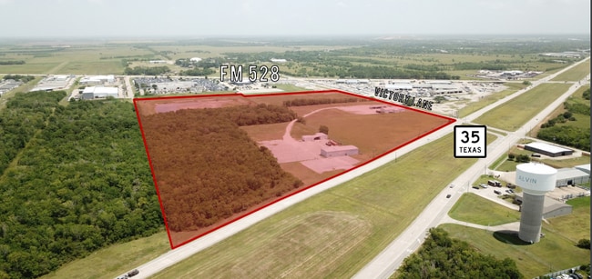
3700 N Highway 35 Byp, Alvin, TX 77511
Property Detail
3700 N Highway 35 Byp
7349-0001-000
A0491 HOOPER & WADE BLOCK 2 TRACT 3A1 ACRES 0.602 (ALVIN)
Commercialnec
Brazoria
AO River or stream flood hazard areas, and areas with a 1% or greater chance of shallow flooding each year. These areas have a 26% chance of flooding over the life of a 30-year mortgage.
Texas
2024
26.03 AC
2025
Southeast Outlier
661400
Houston
9,585 SF
Houston-Pasadena-The Woodlands, TX
NEARBY LISTINGS FOR SALE OR LEASE
DEMOGRAPHICS near 3700 N Highway 35 Byp
1 mile
3 mile
5 mile
2025 Total Population
2,780
25,829
68,978
2030 Population
3,081
28,280
74,592
Pop Growth 2025-2030
+ 10.83%
+ 9.49%
+ 8.14%
Average Age
35
38
38
2025 Total Households
956
9,012
23,727
HH Growth 2025-2030
+ 11.09%
+ 9.78%
+ 8.46%
Median Household Inc
$101,601
$86,849
$91,794
Avg Household Size
2.90
2.80
2.80
2025 Avg HH Vehicles
2.00
2.00
2.00
Median Home Value
$249,313
$256,721
$305,818
Median Year Built
2008
1991
1993
Nearby Places
Map Layers
Map Styles
 Street
 Aerial
Transit
 Traffic
 Biking
Places
Listings with unknown addresses are not visible on the map
- Restaurants
- Banks
- Shops
- Fitness
- Groceries
PUBLIC TRANSPORTATION
AIRPORT
William P Hobby
Drive
Walk
Distance
William P Hobby
27 min
14.7 mi
Freight Ports
Port of Houston
Drive
Walk
Distance
Port of Houston
39 min
22.9 mi
SALE & LEASE HISTORY
LISTING DATE
SALE/LEASE

Aug 07, 2023
For Sale
Nearby Properties
Address
Land Use
TOTAL SIZE
Lot Size
Zoning
Address
Land Use
TOTAL SIZE
Lot Size
Zoning
65,935 SF
81.27 AC
Address
Land Use
TOTAL SIZE
Lot Size
Zoning
39.21 AC
0113
Address
Land Use
TOTAL SIZE
Lot Size
Zoning
84,272 SF
16.93 AC
Address
Land Use
TOTAL SIZE
Lot Size
Zoning
13.56 AC
Address
Land Use
TOTAL SIZE
Lot Size
Zoning
197,506 SF
20.52 AC
Address
Land Use
TOTAL SIZE
Lot Size
Zoning
209,431 SF
17.44 AC
Address
Land Use
TOTAL SIZE
Lot Size
Zoning
116,628 SF
5.90 AC
0011
Address
Land Use
TOTAL SIZE
Lot Size
Zoning
74,780 SF
5.51 AC
0034
Address
Land Use
TOTAL SIZE
Lot Size
Zoning
68,435 SF
5.62 AC
0041
Address
Land Use
TOTAL SIZE
Lot Size
Zoning
110,165 SF
12.32 AC
Address
Land Use
TOTAL SIZE
Lot Size
Zoning
83,344 SF
4.40 AC
0002
Address
Land Use
TOTAL SIZE
Lot Size
Zoning
111,370 SF
11.10 AC
Address
Land Use
TOTAL SIZE
Lot Size
Zoning
90,044 SF
9.62 AC
Address
Land Use
TOTAL SIZE
Lot Size
Zoning
276,750 SF
35.24 AC
Address
Land Use
TOTAL SIZE
Lot Size
Zoning
136,700 SF
9.91 AC
0095
Address
Land Use
TOTAL SIZE
Lot Size
Zoning
147,939 SF
38.36 AC
0026
Address
Land Use
TOTAL SIZE
Lot Size
Zoning
89,466 SF
8.61 AC
0109
Address
Land Use
TOTAL SIZE
Lot Size
Zoning
36,596 SF
14.75 AC
Address
Land Use
TOTAL SIZE
Lot Size
Zoning
32,340 SF
4.38 AC
0001
Address
Land Use
TOTAL SIZE
Lot Size
Zoning
74,406 SF
11.99 AC
Address
Land Use
TOTAL SIZE
Lot Size
Zoning
10,160 SF
1.57 AC
Address
Land Use
TOTAL SIZE
Lot Size
Zoning
108,807 SF
10.01 AC
0001
Address
Land Use
TOTAL SIZE
Lot Size
Zoning
44,501 SF
4.15 AC
Address
Land Use
TOTAL SIZE
Lot Size
Zoning
22,400 SF
2.25 AC
0067
Address
Land Use
TOTAL SIZE
Lot Size
Zoning
57.64 AC
0184
Address
Land Use
TOTAL SIZE
Lot Size
Zoning
16,620 SF
1.59 AC
Address
Land Use
TOTAL SIZE
Lot Size
Zoning
74,002 SF
9.58 AC
Address
Land Use
TOTAL SIZE
Lot Size
Zoning
40,484 SF
1.96 AC
Address
Land Use
TOTAL SIZE
Lot Size
Zoning
25,352 SF
2.29 AC
Address
Land Use
TOTAL SIZE
Lot Size
Zoning
63,530 SF
8.89 AC
0022
The World's #1 Commercial Real Estate Marketplace
Connect with us
© 2026 CoStar Group
The information above has been obtained from sources believed reliable. While we do not doubt its accuracy we have not verified it and make no guarantee, warranty or representation about it. It is your responsibility to independently confirm its accuracy and completeness. Any projections, opinions, assumptions, or estimates used are for example only and do not represent the current or future performance of the property. The value of this transaction to you depends on tax and other factors which should be evaluated by your tax, financial, and legal advisors. You and your advisors should conduct a careful, independent investigation of the property to determine to your satisfaction the suitability of the property for your needs.