Property Record
0 Williston Rd, Northwood, OH 43619
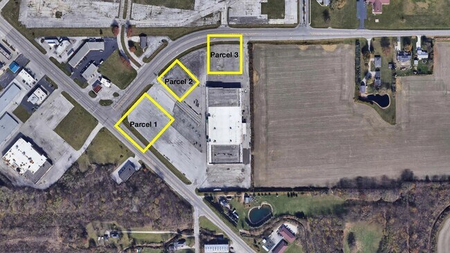

NEARBY LISTINGS FOR SALE OR LEASE
Property Detail
0 Williston Rd
Toledo, OH
S J Lessman Surv #7078
H28-712-030201006003
1.20A PT COM 930.72 NE INTER WOODVILLE & WILLISTON RDS
Commercialacreage
Wood
X
Ohio
39173C0052D
0.92 AC
2023
Perrysburg/Northwood
2024
Toledo
020100
DEMOGRAPHICS near 0 Williston Rd
1 Mile
3 Mile
5 Mile
2024 Total Population
2,522
19,917
65,552
2029 Population
2,527
19,821
65,492
Pop Growth 2024-2029
+ 0.20%
(0.48%)
(0.09%)
Average Age
42
43
40
2024 Total Households
968
8,582
26,872
HH Growth 2024-2029
+ 0.21%
(0.47%)
(0.17%)
Median Household Inc
$72,467
$60,415
$50,115
Avg Household Size
2.50
2.20
2.30
2024 Avg HH Vehicles
2.00
2.00
2.00
Median Home Value
$235,391
$167,116
$131,746
Median Year Built
1975
1972
1962
Nearby Places
Map Layers
Map Styles
 Street
 Aerial
- Restaurants
- Banks
- Shops
- Fitness
- Groceries
PUBLIC TRANSPORTATION
COMMUTER RAIL
DRIVE
WALK
Distance
13 min
6.0 mi
AIRPORT
Eugene F Kranz Toledo Express
DRIVE
WALK
Distance
Eugene F Kranz Toledo Express
44 min
24.1 mi
SALE & LEASE HISTORY
LISTING DATE
SALE/LEASE

Dec 10, 2018
For Sale
Aug 31, 2023
For Sale
Nearby Properties
Address
Land Use
TOTAL SIZE
Lot Size
Zoning
Address
Land Use
TOTAL SIZE
Lot Size
Zoning
605,609 SF
9.66 AC
40-C4
Address
Land Use
TOTAL SIZE
Lot Size
Zoning
313,004 SF
44.54 AC
40-C2
Address
Land Use
TOTAL SIZE
Lot Size
Zoning
226,469 SF
17.38 AC
Address
Land Use
TOTAL SIZE
Lot Size
Zoning
136,090 SF
4 AC
Address
Land Use
TOTAL SIZE
Lot Size
Zoning
127,658 SF
9.01 AC
40-C4
Address
Land Use
TOTAL SIZE
Lot Size
Zoning
73,802 SF
22.50 AC
40-R1
Address
Land Use
TOTAL SIZE
Lot Size
Zoning
22.93 AC
40-R3
Address
Land Use
TOTAL SIZE
Lot Size
Zoning
214,312 SF
35.35 AC
40-C5
Address
Land Use
TOTAL SIZE
Lot Size
Zoning
349,799 SF
51.86 AC
Address
Land Use
TOTAL SIZE
Lot Size
Zoning
102,535 SF
20 AC
40-R2
Address
Land Use
TOTAL SIZE
Lot Size
Zoning
228,251 SF
43.08 AC
10-RD6
Address
Land Use
TOTAL SIZE
Lot Size
Zoning
34 AC
40-C5
Address
Land Use
TOTAL SIZE
Lot Size
Zoning
230,074 SF
142.89 AC
40-M2
Address
Land Use
TOTAL SIZE
Lot Size
Zoning
181,347 SF
14.12 AC
40-R4
Address
Land Use
TOTAL SIZE
Lot Size
Zoning
331,416 SF
30.56 AC
Address
Land Use
TOTAL SIZE
Lot Size
Zoning
199,768 SF
16.15 AC
40-C2
Address
Land Use
TOTAL SIZE
Lot Size
Zoning
77,079 SF
3.87 AC
40-R3
Address
Land Use
TOTAL SIZE
Lot Size
Zoning
91,261 SF
5.47 AC
40-C2
Address
Land Use
TOTAL SIZE
Lot Size
Zoning
106,525 SF
18.90 AC
Address
Land Use
TOTAL SIZE
Lot Size
Zoning
58,281 SF
2.60 AC
40-C2
Address
Land Use
TOTAL SIZE
Lot Size
Zoning
46,267 SF
3.22 AC
40-R3
Address
Land Use
TOTAL SIZE
Lot Size
Zoning
69,259 SF
13.65 AC
40-R2
Address
Land Use
TOTAL SIZE
Lot Size
Zoning
44.33 AC
40-C2
Address
Land Use
TOTAL SIZE
Lot Size
Zoning
93,191 SF
11.13 AC
40-C4
Address
Land Use
TOTAL SIZE
Lot Size
Zoning
104,012 SF
7.14 AC
40-R3
Address
Land Use
TOTAL SIZE
Lot Size
Zoning
66,701 SF
4 AC
40-R3
Address
Land Use
TOTAL SIZE
Lot Size
Zoning
42,888 SF
3.99 AC
40-C5
Address
Land Use
TOTAL SIZE
Lot Size
Zoning
59,212 SF
3.02 AC
40-C2
Address
Land Use
TOTAL SIZE
Lot Size
Zoning
77,884 SF
6.22 AC
40-R3
Address
Land Use
TOTAL SIZE
Lot Size
Zoning
9 AC
40-R4
The World's #1 Commercial Real Estate Marketplace
Connect with us
© 2026 CoStar Group
The information above has been obtained from sources believed reliable. While we do not doubt its accuracy we have not verified it and make no guarantee, warranty or representation about it. It is your responsibility to independently confirm its accuracy and completeness. Any projections, opinions, assumptions, or estimates used are for example only and do not represent the current or future performance of the property. The value of this transaction to you depends on tax and other factors which should be evaluated by your tax, financial, and legal advisors. You and your advisors should conduct a careful, independent investigation of the property to determine to your satisfaction the suitability of the property for your needs.