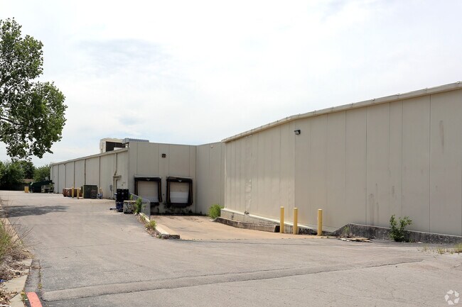
Property Record
3701 S Elm Pl, Broken Arrow, OK 74011


NEARBY LISTINGS FOR SALE OR LEASE
Property Detail
3701 S Elm Pl
Tulsa, OK
Hidden Springs Center Second Replat L1 B
79475-84-26-23920
N244.90 S539.9 LT 1 LESS N90 E550 THEREOF BLK 1
Gymhealthspa
Tulsa
X
Oklahoma
40143C0393M
1
2025
3.46 AC
2025
Southeast Tulsa
007511
Tulsa
73,075 SF
DEMOGRAPHICS near 3701 S Elm Pl
1 Mile
3 Mile
5 Mile
2024 Total Population
10,807
57,079
127,105
2029 Population
11,096
59,099
133,094
Pop Growth 2024-2029
+ 2.67%
+ 3.54%
+ 4.71%
Average Age
38
39
39
2024 Total Households
4,221
21,483
48,257
HH Growth 2024-2029
+ 2.70%
+ 3.57%
+ 4.71%
Median Household Inc
$66,214
$75,821
$78,987
Avg Household Size
2.50
2.60
2.60
2024 Avg HH Vehicles
2.00
2.00
2.00
Median Home Value
$164,134
$189,918
$217,709
Median Year Built
1982
1985
1991
Nearby Places
Map Layers
Map Styles
 Street
 Aerial
- Restaurants
- Banks
- Shops
- Fitness
- Groceries
PUBLIC TRANSPORTATION
AIRPORT
Tulsa International
DRIVE
WALK
Distance
Tulsa International
29 min
19.0 mi
Freight Ports
Tulsa Port of Inola
DRIVE
WALK
Distance
Tulsa Port of Inola
38 min
28.6 mi
SALE & LEASE HISTORY
LISTING DATE
SALE/LEASE

Nov 16, 2021
For Sale
Mar 31, 2017
For Sale
Aug 30, 2021
For Lease
Nearby Properties
Address
Land Use
TOTAL SIZE
Lot Size
Zoning
Address
Land Use
TOTAL SIZE
Lot Size
Zoning
390,154 SF
52.94 AC
A1
Address
Land Use
TOTAL SIZE
Lot Size
Zoning
90,533 SF
29.41 AC
A1
Address
Land Use
TOTAL SIZE
Lot Size
Zoning
75,444 SF
23.92 AC
R1
Address
Land Use
TOTAL SIZE
Lot Size
Zoning
37.23 AC
A1
Address
Land Use
TOTAL SIZE
Lot Size
Zoning
77,260 SF
0.58 AC
R3
Address
Land Use
TOTAL SIZE
Lot Size
Zoning
21,301 SF
3.94 AC
CN
Address
Land Use
TOTAL SIZE
Lot Size
Zoning
84,314 SF
12.05 AC
A1
Address
Land Use
TOTAL SIZE
Lot Size
Zoning
68,478 SF
9.27 AC
R1
Address
Land Use
TOTAL SIZE
Lot Size
Zoning
35,954 SF
27.97 AC
CN
Address
Land Use
TOTAL SIZE
Lot Size
Zoning
67,149 SF
28.56 AC
R2
Address
Land Use
TOTAL SIZE
Lot Size
Zoning
Address
Land Use
TOTAL SIZE
Lot Size
Zoning
39,733 SF
9.36 AC
A1
Address
Land Use
TOTAL SIZE
Lot Size
Zoning
11,601 SF
38.18 AC
RS1
Address
Land Use
TOTAL SIZE
Lot Size
Zoning
55,185 SF
4.83 AC
NCU
Address
Land Use
TOTAL SIZE
Lot Size
Zoning
71,143 SF
4.43 AC
R1
Address
Land Use
TOTAL SIZE
Lot Size
Zoning
28,348 SF
0.90 AC
DM
Address
Land Use
TOTAL SIZE
Lot Size
Zoning
245,436 SF
12.21 AC
RM
Address
Land Use
TOTAL SIZE
Lot Size
Zoning
33,669 SF
4.64 AC
A1
Address
Land Use
TOTAL SIZE
Lot Size
Zoning
28,994 SF
8.96 AC
CG
Address
Land Use
TOTAL SIZE
Lot Size
Zoning
10,140 SF
18.57 AC
R1
Address
Land Use
TOTAL SIZE
Lot Size
Zoning
23,283 SF
3.94 AC
A1
Address
Land Use
TOTAL SIZE
Lot Size
Zoning
28,303 SF
16.76 AC
CN
Address
Land Use
TOTAL SIZE
Lot Size
Zoning
15,616 SF
2.58 AC
IL
Address
Land Use
TOTAL SIZE
Lot Size
Zoning
3,300 SF
40 AC
A1
Address
Land Use
TOTAL SIZE
Lot Size
Zoning
11,800 SF
2.45 AC
A1
Address
Land Use
TOTAL SIZE
Lot Size
Zoning
12,497 SF
3.31 AC
R1
Address
Land Use
TOTAL SIZE
Lot Size
Zoning
222,536 SF
11.31 AC
CN
Address
Land Use
TOTAL SIZE
Lot Size
Zoning
28,226 SF
8.26 AC
CN
Address
Land Use
TOTAL SIZE
Lot Size
Zoning
136,434 SF
19.20 AC
Address
Land Use
TOTAL SIZE
Lot Size
Zoning
30,482 SF
4.43 AC
R1
The World's #1 Commercial Real Estate Marketplace
Connect with us
© 2025 CoStar Group
The information above has been obtained from sources believed reliable. While we do not doubt its accuracy we have not verified it and make no guarantee, warranty or representation about it. It is your responsibility to independently confirm its accuracy and completeness. Any projections, opinions, assumptions, or estimates used are for example only and do not represent the current or future performance of the property. The value of this transaction to you depends on tax and other factors which should be evaluated by your tax, financial, and legal advisors. You and your advisors should conduct a careful, independent investigation of the property to determine to your satisfaction the suitability of the property for your needs.