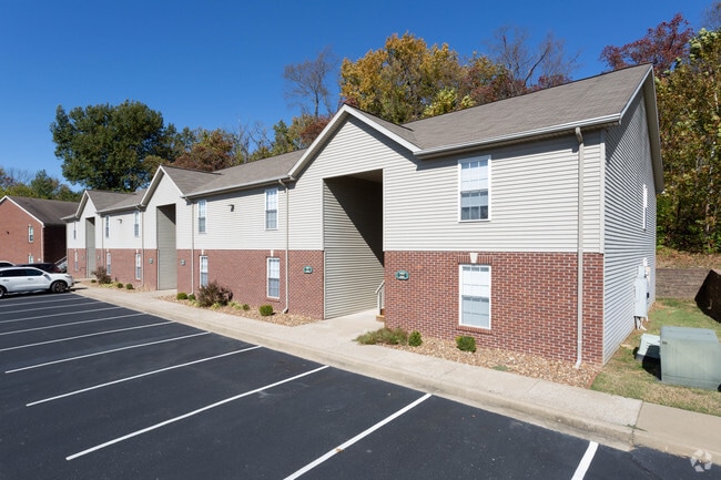
Property Record
3701 Upper Mount Vernon Rd, Evansville, IN 47712

NEARBY LISTINGS FOR SALE OR LEASE
Property Detail
3701 Upper Mount Vernon Rd
82-05-23-018-078.024-025
PINEGROVE BL 4 & PT L 1 BL 3 & PT VAC ALLEY & PT 23-6-11 & PT 22-6-11
Apartment
Vanderburgh
X
Indiana
21101C0080F
1
2024
25.33 AC
2024
Hilltop
003000
Evansville
13,182 SF
Evansville, IN-KY
DEMOGRAPHICS near 3701 Upper Mount Vernon Rd
1 Mile
3 Mile
5 Mile
2024 Total Population
7,539
34,511
87,498
2029 Population
7,526
34,703
88,380
Pop Growth 2024-2029
(0.17%)
+ 0.56%
+ 1.01%
Average Age
39
40
40
2024 Total Households
3,440
15,355
36,463
HH Growth 2024-2029
(0.12%)
+ 0.64%
+ 1.06%
Median Household Inc
$52,516
$47,690
$47,013
Avg Household Size
2.10
2.10
2.20
2024 Avg HH Vehicles
2.00
2.00
2.00
Median Home Value
$122,458
$138,747
$117,257
Median Year Built
1954
1959
1956
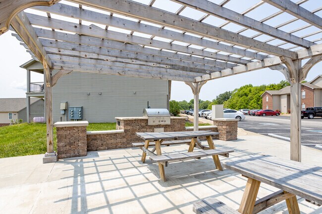
Nearby Places
Map Layers
Map Styles
 Street
 Aerial
- Restaurants
- Banks
- Shops
- Fitness
- Groceries
PUBLIC TRANSPORTATION
AIRPORT
Evansville Regional
DRIVE
WALK
Distance
Evansville Regional
17 min
9.4 mi
Freight Ports
Port of Toledo
DRIVE
WALK
Distance
Port of Toledo
464 min
398.6 mi
SALE & LEASE HISTORY
LISTING DATE
SALE/LEASE

Sep 17, 2018
For Sale
Nearby Properties
Address
Land Use
TOTAL SIZE
Lot Size
Zoning
Address
Land Use
TOTAL SIZE
Lot Size
Zoning
84,660 SF
12.95 AC
Address
Land Use
TOTAL SIZE
Lot Size
Zoning
20,964 SF
1.35 AC
Address
Land Use
TOTAL SIZE
Lot Size
Zoning
15,233 SF
3.31 AC
Address
Land Use
TOTAL SIZE
Lot Size
Zoning
51,342 SF
4.43 AC
Address
Land Use
TOTAL SIZE
Lot Size
Zoning
298 SF
24.29 AC
Address
Land Use
TOTAL SIZE
Lot Size
Zoning
117,580 SF
1.74 AC
Address
Land Use
TOTAL SIZE
Lot Size
Zoning
23,108 SF
2.92 AC
Address
Land Use
TOTAL SIZE
Lot Size
Zoning
92,132 SF
1.68 AC
Address
Land Use
TOTAL SIZE
Lot Size
Zoning
223,202 SF
2.28 AC
Address
Land Use
TOTAL SIZE
Lot Size
Zoning
784,971 SF
15.37 AC
Address
Land Use
TOTAL SIZE
Lot Size
Zoning
19,924 SF
15.63 AC
Address
Land Use
TOTAL SIZE
Lot Size
Zoning
235,153 SF
2.61 AC
Address
Land Use
TOTAL SIZE
Lot Size
Zoning
87,099 SF
2.28 AC
Address
Land Use
TOTAL SIZE
Lot Size
Zoning
205,205 SF
16.85 AC
Address
Land Use
TOTAL SIZE
Lot Size
Zoning
25,595 SF
14.99 AC
Address
Land Use
TOTAL SIZE
Lot Size
Zoning
20,286 SF
4.57 AC
Address
Land Use
TOTAL SIZE
Lot Size
Zoning
1,936 SF
11.70 AC
Address
Land Use
TOTAL SIZE
Lot Size
Zoning
8,440 SF
5.77 AC
Address
Land Use
TOTAL SIZE
Lot Size
Zoning
159,074 SF
1.07 AC
Address
Land Use
TOTAL SIZE
Lot Size
Zoning
331,588 SF
0.96 AC
Address
Land Use
TOTAL SIZE
Lot Size
Zoning
16,832 SF
7.90 AC
Address
Land Use
TOTAL SIZE
Lot Size
Zoning
61,530 SF
12.77 AC
Address
Land Use
TOTAL SIZE
Lot Size
Zoning
118,000 SF
17.17 AC
Address
Land Use
TOTAL SIZE
Lot Size
Zoning
4,441 SF
11.85 AC
3
Address
Land Use
TOTAL SIZE
Lot Size
Zoning
75,109 SF
1.64 AC
Address
Land Use
TOTAL SIZE
Lot Size
Zoning
5,808 SF
12.20 AC
Address
Land Use
TOTAL SIZE
Lot Size
Zoning
2,784 SF
14.47 AC
Address
Land Use
TOTAL SIZE
Lot Size
Zoning
229,140 SF
1.03 AC
Address
Land Use
TOTAL SIZE
Lot Size
Zoning
77,019 SF
0.42 AC
The World's #1 Commercial Real Estate Marketplace
Connect with us
© 2026 CoStar Group
The information above has been obtained from sources believed reliable. While we do not doubt its accuracy we have not verified it and make no guarantee, warranty or representation about it. It is your responsibility to independently confirm its accuracy and completeness. Any projections, opinions, assumptions, or estimates used are for example only and do not represent the current or future performance of the property. The value of this transaction to you depends on tax and other factors which should be evaluated by your tax, financial, and legal advisors. You and your advisors should conduct a careful, independent investigation of the property to determine to your satisfaction the suitability of the property for your needs.