Property Record
3701 W Magnolia Ave, Louisville, KY 40211


NEARBY LISTINGS FOR SALE OR LEASE
Property Detail
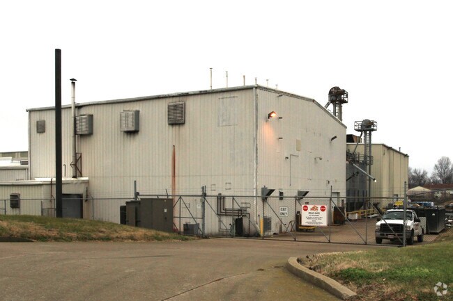
3701 W Magnolia Ave
048F01190000
10.0276 AC ES 38TH ST NS MAGNOLIA 1998 KBTA PENDING
Manufacturinglight
Jefferson
X
Kentucky
21111C0039F
10.03 AC
2025
Old Louisville
2025
Louisville
001200
Louisville/Jefferson County, KY-IN
133,829 SF
DEMOGRAPHICS near 3701 W Magnolia Ave
1 Mile
3 Mile
5 Mile
2024 Total Population
13,672
91,664
215,820
2029 Population
13,768
92,247
216,346
Pop Growth 2024-2029
+ 0.70%
+ 0.64%
+ 0.24%
Average Age
38
38
38
2024 Total Households
5,487
36,990
92,771
HH Growth 2024-2029
+ 0.58%
+ 0.64%
+ 0.30%
Median Household Inc
$29,836
$32,581
$37,914
Avg Household Size
2.40
2.30
2.20
2024 Avg HH Vehicles
1.00
1.00
1.00
Median Home Value
$71,168
$86,345
$134,736
Median Year Built
1949
1949
1950
Nearby Places
Map Layers
Map Styles
 Street
 Aerial
- Restaurants
- Banks
- Shops
- Fitness
- Groceries
PUBLIC TRANSPORTATION
AIRPORT
Louisville Muhammad Ali International
DRIVE
WALK
Distance
Louisville Muhammad Ali International
17 min
10.2 mi
Freight Ports
Port of Toledo
DRIVE
WALK
Distance
Port of Toledo
361 min
309.1 mi
Nearby Properties
Address
Land Use
TOTAL SIZE
Lot Size
Zoning
Address
Land Use
TOTAL SIZE
Lot Size
Zoning
17,916 SF
21.76 AC
EZ1-ENTERP
Address
Land Use
TOTAL SIZE
Lot Size
Zoning
260,488 SF
8.07 AC
EZ1-ENTERP
Address
Land Use
TOTAL SIZE
Lot Size
Zoning
19.50 AC
Address
Land Use
TOTAL SIZE
Lot Size
Zoning
128,020 SF
1.36 AC
Address
Land Use
TOTAL SIZE
Lot Size
Zoning
3,162 SF
23.76 AC
EZ1-ENTERP
Address
Land Use
TOTAL SIZE
Lot Size
Zoning
95,508 SF
3.67 AC
EZ1-ENTERP
Address
Land Use
TOTAL SIZE
Lot Size
Zoning
308 SF
57.16 AC
EZ1-ENTERP
Address
Land Use
TOTAL SIZE
Lot Size
Zoning
270 SF
121 AC
M3-INDUSTR
Address
Land Use
TOTAL SIZE
Lot Size
Zoning
164,677 SF
13.54 AC
EZ1-ENTERP
Address
Land Use
TOTAL SIZE
Lot Size
Zoning
139,200 SF
29.50 AC
EZ1-ENTERP
Address
Land Use
TOTAL SIZE
Lot Size
Zoning
8.74 AC
R7-RESIDEN
Address
Land Use
TOTAL SIZE
Lot Size
Zoning
295,410 SF
15.35 AC
EZ1-ENTERP
Address
Land Use
TOTAL SIZE
Lot Size
Zoning
19,000 SF
12.86 AC
EZ1-ENTERP
Address
Land Use
TOTAL SIZE
Lot Size
Zoning
135,832 SF
5.06 AC
EZ1-ENTERP
Address
Land Use
TOTAL SIZE
Lot Size
Zoning
20,258 SF
60.94 AC
M3-INDUSTR
Address
Land Use
TOTAL SIZE
Lot Size
Zoning
231,530 SF
12.37 AC
EZ1-ENTERP
Address
Land Use
TOTAL SIZE
Lot Size
Zoning
7.11 AC
R7-RESIDEN
Address
Land Use
TOTAL SIZE
Lot Size
Zoning
6,132 SF
10.17 AC
R7-RESIDEN
Address
Land Use
TOTAL SIZE
Lot Size
Zoning
1,440 SF
141.94 AC
M3-INDUSTR
Address
Land Use
TOTAL SIZE
Lot Size
Zoning
206,157 SF
1.88 AC
TNZD-TRADI
Address
Land Use
TOTAL SIZE
Lot Size
Zoning
17,920 SF
0.98 AC
C2-COMMERC
Address
Land Use
TOTAL SIZE
Lot Size
Zoning
81,756 SF
0.75 AC
TNZD-TRADI
Address
Land Use
TOTAL SIZE
Lot Size
Zoning
265,835 SF
15.39 AC
EZ1-ENTERP
Address
Land Use
TOTAL SIZE
Lot Size
Zoning
10,795 SF
3.27 AC
EZ1-ENTERP
Address
Land Use
TOTAL SIZE
Lot Size
Zoning
1,620 SF
16.84 AC
R6-RESIDEN
Address
Land Use
TOTAL SIZE
Lot Size
Zoning
1.75 AC
OR3-OFFICE
Address
Land Use
TOTAL SIZE
Lot Size
Zoning
88,320 SF
46.23 AC
EZ1-ENTERP
Address
Land Use
TOTAL SIZE
Lot Size
Zoning
24,839 SF
25.37 AC
M3-INDUSTR
Address
Land Use
TOTAL SIZE
Lot Size
Zoning
266,400 SF
16.40 AC
EZ1-ENTERP
The World's #1 Commercial Real Estate Marketplace
Connect with us
© 2026 CoStar Group
The information above has been obtained from sources believed reliable. While we do not doubt its accuracy we have not verified it and make no guarantee, warranty or representation about it. It is your responsibility to independently confirm its accuracy and completeness. Any projections, opinions, assumptions, or estimates used are for example only and do not represent the current or future performance of the property. The value of this transaction to you depends on tax and other factors which should be evaluated by your tax, financial, and legal advisors. You and your advisors should conduct a careful, independent investigation of the property to determine to your satisfaction the suitability of the property for your needs.