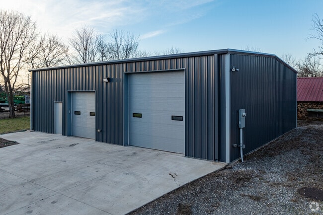
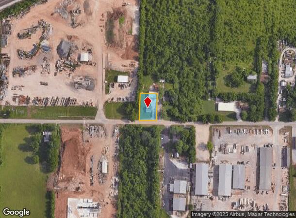
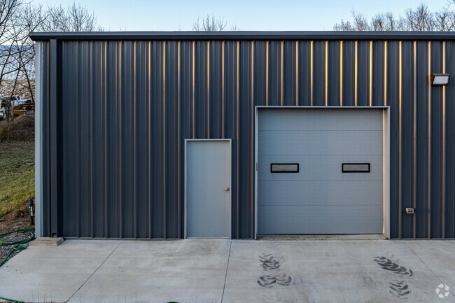
Property Record
3701 W Nichols St, Springfield, MO 65803
NEARBY LISTINGS FOR SALE OR LEASE
Property Detail
3701 W Nichols St
Springfield, MO
Woodfills
13-17-103-011
WOODFILLS SUB DIV BEG 121.4 FT W SE COR LOT 2 BLK I N 175 FT E 110 FT S 175 FTW TO BEG
Commercialnec
Greene
X
Missouri
29077C0326E
2
2025
0.44 AC
2025
Northwest
004304
Springfield
1,054 SF
DEMOGRAPHICS near 3701 W Nichols St
1 Mile
3 Mile
5 Mile
2024 Total Population
4,796
45,743
122,880
2029 Population
4,966
47,867
128,001
Pop Growth 2024-2029
+ 3.54%
+ 4.64%
+ 4.17%
Average Age
40
37
37
2024 Total Households
1,857
19,146
51,962
HH Growth 2024-2029
+ 3.72%
+ 5.04%
+ 4.51%
Median Household Inc
$45,131
$43,247
$42,634
Avg Household Size
2.40
2.30
2.10
2024 Avg HH Vehicles
2.00
2.00
2.00
Median Home Value
$123,070
$117,972
$141,477
Median Year Built
1979
1986
1979
Nearby Places
Map Layers
Map Styles
 Street
 Aerial
- Restaurants
- Banks
- Shops
- Fitness
- Groceries
PUBLIC TRANSPORTATION
AIRPORT
Springfield-Branson Ntl
DRIVE
WALK
Distance
Springfield-Branson Ntl
16 min
5.5 mi
SALE & LEASE HISTORY
LISTING DATE
SALE/LEASE

Jul 20, 2023
For Lease
Nearby Properties
Address
Land Use
TOTAL SIZE
Lot Size
Zoning
Address
Land Use
TOTAL SIZE
Lot Size
Zoning
320,532 SF
33.54 AC
INC
Address
Land Use
TOTAL SIZE
Lot Size
Zoning
23.75 AC
Address
Land Use
TOTAL SIZE
Lot Size
Zoning
22.64 AC
INC
Address
Land Use
TOTAL SIZE
Lot Size
Zoning
11 AC
INC
Address
Land Use
TOTAL SIZE
Lot Size
Zoning
511.19 AC
Address
Land Use
TOTAL SIZE
Lot Size
Zoning
253,781 SF
9.65 AC
INC
Address
Land Use
TOTAL SIZE
Lot Size
Zoning
234,926 SF
9.41 AC
INC
Address
Land Use
TOTAL SIZE
Lot Size
Zoning
102,925 SF
57.24 AC
INC
Address
Land Use
TOTAL SIZE
Lot Size
Zoning
186,125 SF
21.09 AC
INC
Address
Land Use
TOTAL SIZE
Lot Size
Zoning
2.92 AC
INC
Address
Land Use
TOTAL SIZE
Lot Size
Zoning
93,916 SF
7.91 AC
INC
Address
Land Use
TOTAL SIZE
Lot Size
Zoning
29.42 AC
INC
Address
Land Use
TOTAL SIZE
Lot Size
Zoning
65,208 SF
12.40 AC
INC
Address
Land Use
TOTAL SIZE
Lot Size
Zoning
10.76 AC
INC
Address
Land Use
TOTAL SIZE
Lot Size
Zoning
157,773 SF
18.55 AC
INC
Address
Land Use
TOTAL SIZE
Lot Size
Zoning
154,470 SF
16.97 AC
INC
Address
Land Use
TOTAL SIZE
Lot Size
Zoning
16.39 AC
INC
Address
Land Use
TOTAL SIZE
Lot Size
Zoning
20.54 AC
Address
Land Use
TOTAL SIZE
Lot Size
Zoning
Address
Land Use
TOTAL SIZE
Lot Size
Zoning
83,380 SF
7.20 AC
INC
Address
Land Use
TOTAL SIZE
Lot Size
Zoning
Address
Land Use
TOTAL SIZE
Lot Size
Zoning
12.39 AC
Address
Land Use
TOTAL SIZE
Lot Size
Zoning
78,239 SF
10.01 AC
INC
Address
Land Use
TOTAL SIZE
Lot Size
Zoning
Address
Land Use
TOTAL SIZE
Lot Size
Zoning
77,160 SF
6.31 AC
INC
Address
Land Use
TOTAL SIZE
Lot Size
Zoning
55,568 SF
2.13 AC
INC
Address
Land Use
TOTAL SIZE
Lot Size
Zoning
75,000 SF
8.92 AC
INC
Address
Land Use
TOTAL SIZE
Lot Size
Zoning
20,211 SF
2.25 AC
INC.
Address
Land Use
TOTAL SIZE
Lot Size
Zoning
52,772 SF
5.12 AC
INC
Address
Land Use
TOTAL SIZE
Lot Size
Zoning
13.80 AC
C-2
The World's #1 Commercial Real Estate Marketplace
Connect with us
© 2026 CoStar Group
The information above has been obtained from sources believed reliable. While we do not doubt its accuracy we have not verified it and make no guarantee, warranty or representation about it. It is your responsibility to independently confirm its accuracy and completeness. Any projections, opinions, assumptions, or estimates used are for example only and do not represent the current or future performance of the property. The value of this transaction to you depends on tax and other factors which should be evaluated by your tax, financial, and legal advisors. You and your advisors should conduct a careful, independent investigation of the property to determine to your satisfaction the suitability of the property for your needs.