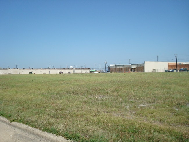
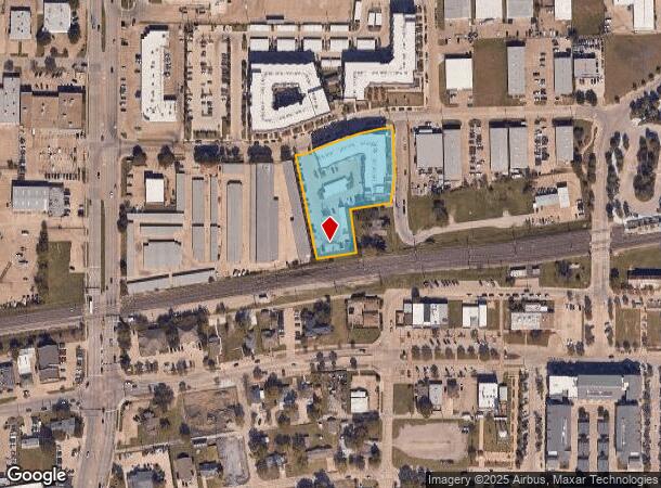
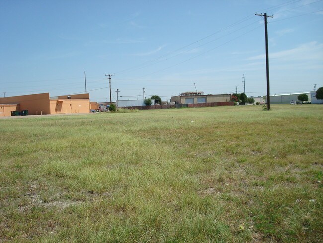
Property Record
3702 Melcer Dr, Rowlett, TX 75088
NEARBY LISTINGS FOR SALE OR LEASE
Property Detail
3702 Melcer Dr
Dallas-Fort Worth-Arlington, TX
Rowlett Station
446820000504R0000
ROWLETT STATION BLK 5 LT 4R ACS 1.7451 INT202200256751 DD09262022 CO-DC 6820000504R00 2CW68200005
Apartment
Dallas
X
Texas
48113C0240K
4r
2024
1.75 AC
2025
Garland
018133
Dallas/Ft Worth
78,017 SF
DEMOGRAPHICS near 3702 Melcer Dr
1 Mile
3 Mile
5 Mile
2024 Total Population
7,665
69,076
209,370
2029 Population
7,698
69,291
211,164
Pop Growth 2024-2029
+ 0.43%
+ 0.31%
+ 0.86%
Average Age
40
39
38
2024 Total Households
2,769
22,869
69,028
HH Growth 2024-2029
+ 0.40%
+ 0.20%
+ 0.79%
Median Household Inc
$92,598
$94,478
$78,219
Avg Household Size
2.70
3.00
3.00
2024 Avg HH Vehicles
2.00
2.00
2.00
Median Home Value
$251,229
$267,945
$247,968
Median Year Built
1985
1992
1986
Nearby Places
Map Layers
Map Styles
 Street
 Aerial
- Restaurants
- Banks
- Shops
- Fitness
- Groceries
PUBLIC TRANSPORTATION
TRANSIT/SUBWAY
Downtown Rowlett (Blue Line - Dallas Area Rapid Transit (DART), DART LIGHT RAIL - BLUE LINE - Dallas Area Rapid Transit (DART))
DRIVE
WALK
Distance
Downtown Rowlett (Blue Line - Dallas Area Rapid Transit (DART), DART LIGHT RAIL - BLUE LINE - Dallas Area Rapid Transit (DART))
1 min
7 min
0.4 mi
AIRPORT
Dallas Love Field
DRIVE
WALK
Distance
Dallas Love Field
39 min
24.4 mi
Dallas-Fort Worth International
DRIVE
WALK
Distance
Dallas-Fort Worth International
47 min
33.9 mi
Freight Ports
Port of Shreveport
DRIVE
WALK
Distance
Port of Shreveport
213 min
192.5 mi
Nearby Properties
Address
Land Use
TOTAL SIZE
Lot Size
Zoning
Address
Land Use
TOTAL SIZE
Lot Size
Zoning
261,164 SF
32.58 AC
Address
Land Use
TOTAL SIZE
Lot Size
Zoning
260,782 SF
16.30 AC
Z77
Address
Land Use
TOTAL SIZE
Lot Size
Zoning
228,458 SF
5.56 AC
Z236
Address
Land Use
TOTAL SIZE
Lot Size
Zoning
427,231 SF
9.96 AC
Z38
Address
Land Use
TOTAL SIZE
Lot Size
Zoning
313,217 SF
3.61 AC
Z205
Address
Land Use
TOTAL SIZE
Lot Size
Zoning
178,125 SF
10.50 AC
Z77
Address
Land Use
TOTAL SIZE
Lot Size
Zoning
77,102 SF
27.47 AC
Z144
Address
Land Use
TOTAL SIZE
Lot Size
Zoning
0.12 AC
Z63
Address
Land Use
TOTAL SIZE
Lot Size
Zoning
43,600 SF
62.86 AC
Z306
Address
Land Use
TOTAL SIZE
Lot Size
Zoning
420,500 SF
33.25 AC
Address
Land Use
TOTAL SIZE
Lot Size
Zoning
261,000 SF
1 AC
Z318
Address
Land Use
TOTAL SIZE
Lot Size
Zoning
271,051 SF
10.28 AC
Z01
Address
Land Use
TOTAL SIZE
Lot Size
Zoning
145,203 SF
12.86 AC
Z239
Address
Land Use
TOTAL SIZE
Lot Size
Zoning
43.27 AC
Z80
Address
Land Use
TOTAL SIZE
Lot Size
Zoning
76,812 SF
9.22 AC
Z144
Address
Land Use
TOTAL SIZE
Lot Size
Zoning
226,800 SF
4.98 AC
Z340
Address
Land Use
TOTAL SIZE
Lot Size
Zoning
151,893 SF
5.40 AC
Z308
Address
Land Use
TOTAL SIZE
Lot Size
Zoning
82,847 SF
4.87 AC
Z236
Address
Land Use
TOTAL SIZE
Lot Size
Zoning
83,154 SF
14.39 AC
Z386
Address
Land Use
TOTAL SIZE
Lot Size
Zoning
140,000 SF
12.76 AC
Address
Land Use
TOTAL SIZE
Lot Size
Zoning
141,200 SF
10.81 AC
Address
Land Use
TOTAL SIZE
Lot Size
Zoning
150,926 SF
9.33 AC
Address
Land Use
TOTAL SIZE
Lot Size
Zoning
52,797 SF
5.41 AC
Z92
Address
Land Use
TOTAL SIZE
Lot Size
Zoning
147.23 AC
Z114
Address
Land Use
TOTAL SIZE
Lot Size
Zoning
0.02 AC
Z236
Address
Land Use
TOTAL SIZE
Lot Size
Zoning
203,983 SF
31.19 AC
Z92
Address
Land Use
TOTAL SIZE
Lot Size
Zoning
65,518 SF
1.34 AC
Z01
Address
Land Use
TOTAL SIZE
Lot Size
Zoning
178,197 SF
4.42 AC
Z239
Address
Land Use
TOTAL SIZE
Lot Size
Zoning
25,700 SF
20.56 AC
SF7
The World's #1 Commercial Real Estate Marketplace
Connect with us
© 2025 CoStar Group
The information above has been obtained from sources believed reliable. While we do not doubt its accuracy we have not verified it and make no guarantee, warranty or representation about it. It is your responsibility to independently confirm its accuracy and completeness. Any projections, opinions, assumptions, or estimates used are for example only and do not represent the current or future performance of the property. The value of this transaction to you depends on tax and other factors which should be evaluated by your tax, financial, and legal advisors. You and your advisors should conduct a careful, independent investigation of the property to determine to your satisfaction the suitability of the property for your needs.