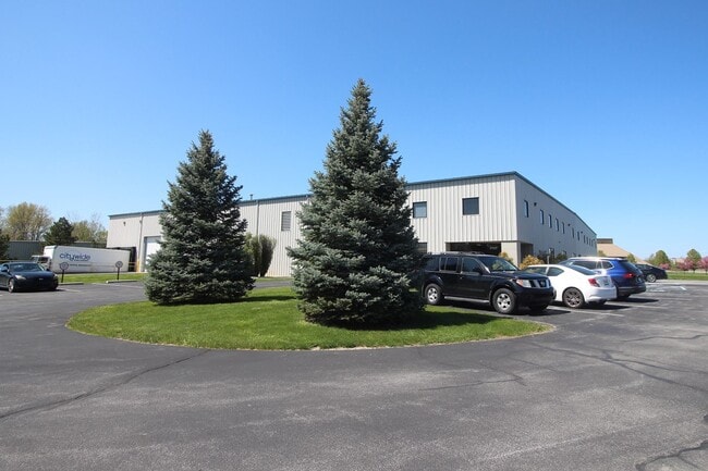
Property Record
3702 Vanguard Dr, Fort Wayne, IN 46809


NEARBY LISTINGS FOR SALE OR LEASE
Property Detail
3702 Vanguard Dr
02-17-04-102-002.000-071
FRL N 478.66 OF S 1521.31 FT OF 275 FT W OF THE W R/W LINE OF AIRPORT DR NW 1/4 SEC 4
Warehouse
Allen
X
Indiana
18179C0050D
29.90 AC
2024
South Fort Wayne
2025
Fort Wayne
011702
Fort Wayne, IN
34,881 SF
DEMOGRAPHICS near 3702 Vanguard Dr
1 Mile
3 Mile
5 Mile
2024 Total Population
1,079
15,926
79,706
2029 Population
1,119
16,492
83,249
Pop Growth 2024-2029
+ 3.71%
+ 3.55%
+ 4.45%
Average Age
41
40
37
2024 Total Households
575
7,170
32,261
HH Growth 2024-2029
+ 3.65%
+ 3.60%
+ 4.40%
Median Household Inc
$38,101
$51,697
$47,514
Avg Household Size
1.90
2.20
2.40
2024 Avg HH Vehicles
1.00
2.00
2.00
Median Home Value
$101,613
$132,981
$129,265
Median Year Built
1966
1968
1962
Nearby Places
Map Layers
Map Styles
 Street
 Aerial
- Restaurants
- Banks
- Shops
- Fitness
- Groceries
PUBLIC TRANSPORTATION
AIRPORT
Fort Wayne International
DRIVE
WALK
Distance
Fort Wayne International
9 min
3.7 mi
Freight Ports
Port of Toledo
DRIVE
WALK
Distance
Port of Toledo
145 min
112.3 mi
SALE & LEASE HISTORY
LISTING DATE
SALE/LEASE

Jun 13, 2024
For Sale
Nearby Properties
Address
Land Use
TOTAL SIZE
Lot Size
Zoning
Address
Land Use
TOTAL SIZE
Lot Size
Zoning
629,415 SF
1,366 AC
Address
Land Use
TOTAL SIZE
Lot Size
Zoning
1,508,236 SF
961.12 AC
Address
Land Use
TOTAL SIZE
Lot Size
Zoning
218,332 SF
400 AC
Address
Land Use
TOTAL SIZE
Lot Size
Zoning
337,548 SF
391.70 AC
Address
Land Use
TOTAL SIZE
Lot Size
Zoning
399,927 SF
283.30 AC
Address
Land Use
TOTAL SIZE
Lot Size
Zoning
285,073 SF
232.70 AC
Address
Land Use
TOTAL SIZE
Lot Size
Zoning
140,400 SF
118.80 AC
Address
Land Use
TOTAL SIZE
Lot Size
Zoning
306,088 SF
24.29 AC
Address
Land Use
TOTAL SIZE
Lot Size
Zoning
150,600 SF
203.60 AC
Address
Land Use
TOTAL SIZE
Lot Size
Zoning
174,432 SF
352.90 AC
Address
Land Use
TOTAL SIZE
Lot Size
Zoning
71,290 SF
238.01 AC
Address
Land Use
TOTAL SIZE
Lot Size
Zoning
120,682 SF
952.12 AC
Address
Land Use
TOTAL SIZE
Lot Size
Zoning
43,122 SF
11.44 AC
Address
Land Use
TOTAL SIZE
Lot Size
Zoning
157,990 SF
568.18 AC
Address
Land Use
TOTAL SIZE
Lot Size
Zoning
97,125 SF
15.21 AC
Address
Land Use
TOTAL SIZE
Lot Size
Zoning
187,552 SF
15.32 AC
Address
Land Use
TOTAL SIZE
Lot Size
Zoning
70,935 SF
204.60 AC
Address
Land Use
TOTAL SIZE
Lot Size
Zoning
172,656 SF
14.44 AC
Address
Land Use
TOTAL SIZE
Lot Size
Zoning
178,278 SF
10.59 AC
Address
Land Use
TOTAL SIZE
Lot Size
Zoning
62,788 SF
186.70 AC
Address
Land Use
TOTAL SIZE
Lot Size
Zoning
140,921 SF
155.50 AC
Address
Land Use
TOTAL SIZE
Lot Size
Zoning
150,600 SF
210.30 AC
Address
Land Use
TOTAL SIZE
Lot Size
Zoning
174,206 SF
10.50 AC
Address
Land Use
TOTAL SIZE
Lot Size
Zoning
156,593 SF
12.27 AC
Address
Land Use
TOTAL SIZE
Lot Size
Zoning
112,000 SF
72.30 AC
Address
Land Use
TOTAL SIZE
Lot Size
Zoning
139,745 SF
10.55 AC
Address
Land Use
TOTAL SIZE
Lot Size
Zoning
88,674 SF
266.03 AC
Address
Land Use
TOTAL SIZE
Lot Size
Zoning
77,504 SF
5.92 AC
Address
Land Use
TOTAL SIZE
Lot Size
Zoning
120,040 SF
64.85 AC
Address
Land Use
TOTAL SIZE
Lot Size
Zoning
126,622 SF
80 AC
The World's #1 Commercial Real Estate Marketplace
Connect with us
© 2025 CoStar Group
The information above has been obtained from sources believed reliable. While we do not doubt its accuracy we have not verified it and make no guarantee, warranty or representation about it. It is your responsibility to independently confirm its accuracy and completeness. Any projections, opinions, assumptions, or estimates used are for example only and do not represent the current or future performance of the property. The value of this transaction to you depends on tax and other factors which should be evaluated by your tax, financial, and legal advisors. You and your advisors should conduct a careful, independent investigation of the property to determine to your satisfaction the suitability of the property for your needs.