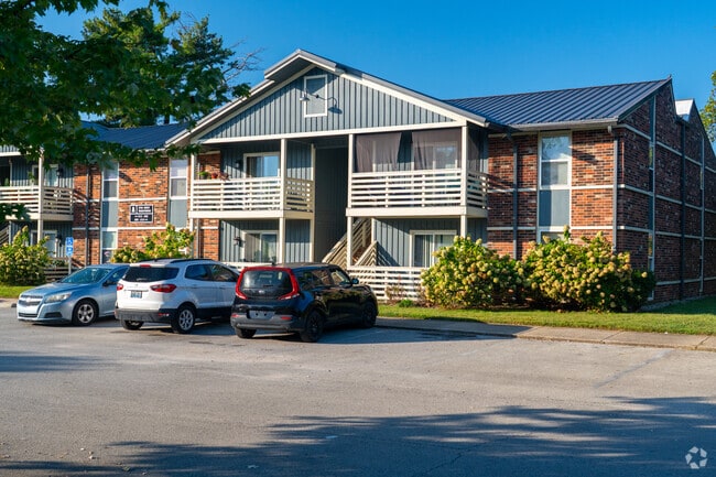
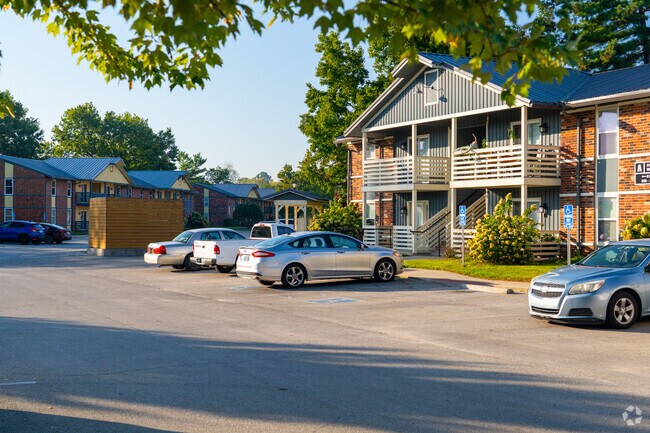
Property Record
3703 W Wheatmore Dr, Louisville, KY 40215

NEARBY LISTINGS FOR SALE OR LEASE
Property Detail
3703 W Wheatmore Dr
Louisville/Jefferson County, KY-IN
Watterson
065J00630000
9.38 AC+- LOT 63 WATTERSON MODEL TOWN SEC 1 PB 33 PG 11
Apartment
Jefferson
X
Kentucky
21111C0056F
63
2025
9.38 AC
2025
Taylor Berry
004301
Louisville
3,144 SF
DEMOGRAPHICS near 3703 W Wheatmore Dr
1 Mile
3 Mile
5 Mile
2024 Total Population
14,945
107,030
233,577
2029 Population
14,835
106,133
232,254
Pop Growth 2024-2029
(0.74%)
(0.84%)
(0.57%)
Average Age
37
38
39
2024 Total Households
5,956
42,952
98,477
HH Growth 2024-2029
(0.77%)
(0.89%)
(0.56%)
Median Household Inc
$38,326
$40,726
$40,866
Avg Household Size
2.40
2.30
2.20
2024 Avg HH Vehicles
1.00
1.00
1.00
Median Home Value
$123,410
$137,441
$151,151
Median Year Built
1958
1956
1955
Nearby Places
Map Layers
Map Styles
 Street
 Aerial
- Restaurants
- Banks
- Shops
- Fitness
- Groceries
PUBLIC TRANSPORTATION
AIRPORT
Louisville Muhammad Ali International
DRIVE
WALK
Distance
Louisville Muhammad Ali International
12 min
5.6 mi
Freight Ports
Port of Toledo
DRIVE
WALK
Distance
Port of Toledo
361 min
310.2 mi
Nearby Properties
Address
Land Use
TOTAL SIZE
Lot Size
Zoning
Address
Land Use
TOTAL SIZE
Lot Size
Zoning
42,228 SF
144.63 AC
R5-RESIDEN
Address
Land Use
TOTAL SIZE
Lot Size
Zoning
Address
Land Use
TOTAL SIZE
Lot Size
Zoning
17,916 SF
21.76 AC
EZ1-ENTERP
Address
Land Use
TOTAL SIZE
Lot Size
Zoning
1,584 SF
4.71 AC
R7-RESIDEN
Address
Land Use
TOTAL SIZE
Lot Size
Zoning
260,488 SF
8.07 AC
EZ1-ENTERP
Address
Land Use
TOTAL SIZE
Lot Size
Zoning
Address
Land Use
TOTAL SIZE
Lot Size
Zoning
58,935 SF
1.92 AC
TNZD-TRADI
Address
Land Use
TOTAL SIZE
Lot Size
Zoning
6.75 AC
M2-INDUSTR
Address
Land Use
TOTAL SIZE
Lot Size
Zoning
19.50 AC
Address
Land Use
TOTAL SIZE
Lot Size
Zoning
22,113 SF
19.01 AC
R4-RESIDEN
Address
Land Use
TOTAL SIZE
Lot Size
Zoning
139,830 SF
Address
Land Use
TOTAL SIZE
Lot Size
Zoning
16.31 AC
OR1-OFFICE
Address
Land Use
TOTAL SIZE
Lot Size
Zoning
3,162 SF
23.76 AC
EZ1-ENTERP
Address
Land Use
TOTAL SIZE
Lot Size
Zoning
17,444 SF
1.47 AC
C2-COMMERC
Address
Land Use
TOTAL SIZE
Lot Size
Zoning
2.62 AC
OR2-OFFICE
Address
Land Use
TOTAL SIZE
Lot Size
Zoning
5,560 SF
Address
Land Use
TOTAL SIZE
Lot Size
Zoning
9,323 SF
31.90 AC
EZ1-ENTERP
Address
Land Use
TOTAL SIZE
Lot Size
Zoning
39,205 SF
15.50 AC
EZ1-ENTERP
Address
Land Use
TOTAL SIZE
Lot Size
Zoning
17,270 SF
4.74 AC
R5-RESIDEN
Address
Land Use
TOTAL SIZE
Lot Size
Zoning
113,404 SF
0.94 AC
TNZD-TRADI
Address
Land Use
TOTAL SIZE
Lot Size
Zoning
308 SF
57.16 AC
EZ1-ENTERP
Address
Land Use
TOTAL SIZE
Lot Size
Zoning
270 SF
121 AC
M3-INDUSTR
Address
Land Use
TOTAL SIZE
Lot Size
Zoning
164,677 SF
13.54 AC
EZ1-ENTERP
Address
Land Use
TOTAL SIZE
Lot Size
Zoning
22,160 SF
3.46 AC
EZ1-ENTERP
Address
Land Use
TOTAL SIZE
Lot Size
Zoning
139,200 SF
29.50 AC
EZ1-ENTERP
Address
Land Use
TOTAL SIZE
Lot Size
Zoning
29.54 AC
R5-RESIDEN
Address
Land Use
TOTAL SIZE
Lot Size
Zoning
13,600 SF
14.89 AC
R7-RESIDEN
Address
Land Use
TOTAL SIZE
Lot Size
Zoning
4,250 SF
2.83 AC
OR1-OFFICE
Address
Land Use
TOTAL SIZE
Lot Size
Zoning
295,410 SF
15.35 AC
EZ1-ENTERP
Address
Land Use
TOTAL SIZE
Lot Size
Zoning
142,900 SF
19.05 AC
EZ1-ENTERP
The World's #1 Commercial Real Estate Marketplace
Connect with us
© 2026 CoStar Group
The information above has been obtained from sources believed reliable. While we do not doubt its accuracy we have not verified it and make no guarantee, warranty or representation about it. It is your responsibility to independently confirm its accuracy and completeness. Any projections, opinions, assumptions, or estimates used are for example only and do not represent the current or future performance of the property. The value of this transaction to you depends on tax and other factors which should be evaluated by your tax, financial, and legal advisors. You and your advisors should conduct a careful, independent investigation of the property to determine to your satisfaction the suitability of the property for your needs.