Property Record
3705 Marlane Dr, Grove City, OH 43123


NEARBY LISTINGS FOR SALE OR LEASE
Property Detail
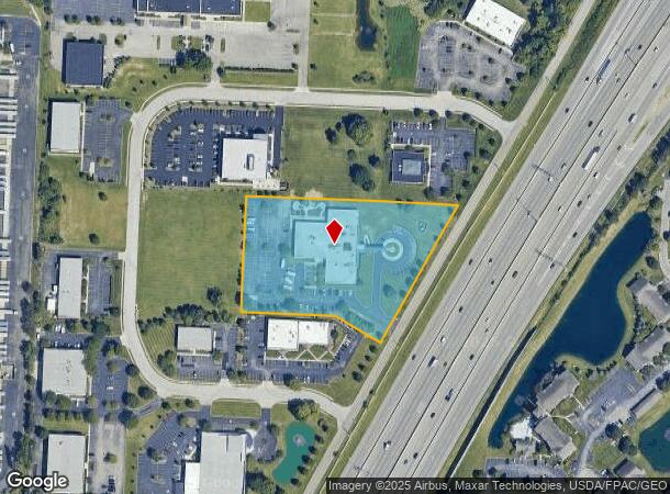
3705 Marlane Dr
040-011532
Partition Of William Miller Farm
Charitableorganization
3705 MARLANE DR ENTRY 6843-8231 3.770 CRES
X
Franklin
39049C0318K
Ohio
0
3.77 AC
2024
Southwest
009756
Columbus
25,232 SF
Columbus, OH
DEMOGRAPHICS near 3705 Marlane Dr
1 Mile
3 Mile
5 Mile
2024 Total Population
2,824
55,228
172,995
2029 Population
2,812
55,397
173,975
Pop Growth 2024-2029
(0.42%)
+ 0.31%
+ 0.57%
Average Age
43
40
38
2024 Total Households
1,187
21,023
66,797
HH Growth 2024-2029
(0.51%)
+ 0.31%
+ 0.50%
Median Household Inc
$86,505
$74,296
$63,741
Avg Household Size
2.20
2.50
2.50
2024 Avg HH Vehicles
2.00
2.00
2.00
Median Home Value
$297,187
$216,701
$188,825
Median Year Built
2002
1989
1971
Nearby Places
Map Layers
Map Styles
 Street
 Aerial
- Restaurants
- Banks
- Shops
- Fitness
- Groceries
PUBLIC TRANSPORTATION
AIRPORT
Rickenbacker International
DRIVE
WALK
Distance
Rickenbacker International
22 min
12.0 mi
John Glenn Columbus International
DRIVE
WALK
Distance
John Glenn Columbus International
24 min
15.5 mi
SALE & LEASE HISTORY
LISTING DATE
SALE/LEASE

Aug 17, 2020
For Lease
Aug 17, 2020
For Sale
Nearby Properties
Address
Land Use
TOTAL SIZE
Lot Size
Zoning
Address
Land Use
TOTAL SIZE
Lot Size
Zoning
844,679 SF
61.71 AC
Address
Land Use
TOTAL SIZE
Lot Size
Zoning
382.42 AC
Address
Land Use
TOTAL SIZE
Lot Size
Zoning
1,058 SF
0.03 AC
Address
Land Use
TOTAL SIZE
Lot Size
Zoning
125,467 SF
20.61 AC
Address
Land Use
TOTAL SIZE
Lot Size
Zoning
928,228 SF
39.80 AC
Address
Land Use
TOTAL SIZE
Lot Size
Zoning
170,028 SF
13.66 AC
Address
Land Use
TOTAL SIZE
Lot Size
Zoning
749,152 SF
41.23 AC
Address
Land Use
TOTAL SIZE
Lot Size
Zoning
128,263 SF
6.59 AC
Address
Land Use
TOTAL SIZE
Lot Size
Zoning
169,252 SF
22.06 AC
Address
Land Use
TOTAL SIZE
Lot Size
Zoning
227,844 SF
21.57 AC
Address
Land Use
TOTAL SIZE
Lot Size
Zoning
493,000 SF
29.55 AC
Address
Land Use
TOTAL SIZE
Lot Size
Zoning
163,629 SF
26.71 AC
Address
Land Use
TOTAL SIZE
Lot Size
Zoning
322,000 SF
22.14 AC
Address
Land Use
TOTAL SIZE
Lot Size
Zoning
408,294 SF
26.64 AC
Address
Land Use
TOTAL SIZE
Lot Size
Zoning
322,000 SF
18.83 AC
Address
Land Use
TOTAL SIZE
Lot Size
Zoning
542,043 SF
30.41 AC
Address
Land Use
TOTAL SIZE
Lot Size
Zoning
404,812 SF
41.33 AC
Address
Land Use
TOTAL SIZE
Lot Size
Zoning
227,576 SF
52.33 AC
Address
Land Use
TOTAL SIZE
Lot Size
Zoning
377,124 SF
19.58 AC
Address
Land Use
TOTAL SIZE
Lot Size
Zoning
399,784 SF
20.86 AC
Address
Land Use
TOTAL SIZE
Lot Size
Zoning
60,893 SF
19.92 AC
Address
Land Use
TOTAL SIZE
Lot Size
Zoning
137,488 SF
13.44 AC
Address
Land Use
TOTAL SIZE
Lot Size
Zoning
150,289 SF
25.19 AC
Address
Land Use
TOTAL SIZE
Lot Size
Zoning
132,379 SF
15.46 AC
Address
Land Use
TOTAL SIZE
Lot Size
Zoning
61,595 SF
9.75 AC
Address
Land Use
TOTAL SIZE
Lot Size
Zoning
146,172 SF
26.42 AC
Address
Land Use
TOTAL SIZE
Lot Size
Zoning
36,877 SF
21.13 AC
Address
Land Use
TOTAL SIZE
Lot Size
Zoning
221,616 SF
10.62 AC
Address
Land Use
TOTAL SIZE
Lot Size
Zoning
81,687 SF
10.19 AC
Address
Land Use
TOTAL SIZE
Lot Size
Zoning
110,447 SF
28.14 AC
The World's #1 Commercial Real Estate Marketplace
Connect with us
© 2025 CoStar Group
The information above has been obtained from sources believed reliable. While we do not doubt its accuracy we have not verified it and make no guarantee, warranty or representation about it. It is your responsibility to independently confirm its accuracy and completeness. Any projections, opinions, assumptions, or estimates used are for example only and do not represent the current or future performance of the property. The value of this transaction to you depends on tax and other factors which should be evaluated by your tax, financial, and legal advisors. You and your advisors should conduct a careful, independent investigation of the property to determine to your satisfaction the suitability of the property for your needs.