Property Record
371 Gause Blvd, Slidell, LA 70458
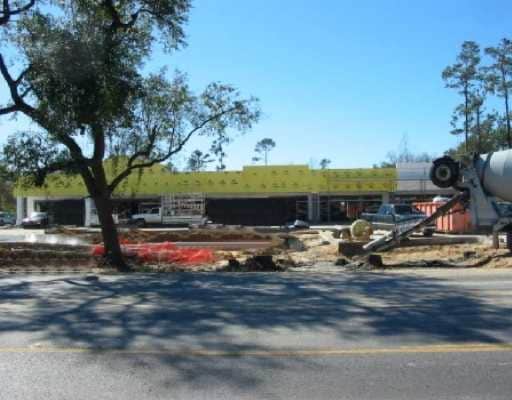

Property Detail
371 Gause Blvd
Slidell-Mandeville-Covington, LA
1.037 ACS DESC AS PARCEL A1-1 SEC 3 9 14 INST NO 1032249 INST NO 1166187 INST NO 1769366
92019
ST TAMMANY
Commercialnec
Louisiana
2025
1.04 AC
2025
Slidell
040900
New Orleans/Metairie/Kenner
7,800 SF
NEARBY LISTINGS FOR SALE OR LEASE
DEMOGRAPHICS near 371 Gause Blvd
1 mile
3 mile
5 mile
2025 Total Population
5,797
46,264
92,098
2030 Population
5,976
47,600
95,064
Pop Growth 2025-2030
+ 3.09%
+ 2.89%
+ 3.22%
Average Age
40
40
40
2025 Total Households
2,269
17,844
35,411
HH Growth 2025-2030
+ 3.09%
+ 2.97%
+ 3.26%
Median Household Inc
$56,908
$65,196
$71,645
Avg Household Size
2.50
2.50
2.50
2025 Avg HH Vehicles
2.00
2.00
2.00
Median Home Value
$193,853
$205,825
$236,793
Median Year Built
1974
1982
1990
Nearby Places
Map Layers
Map Styles
 Street
 Aerial
Transit
 Traffic
 Biking
Places
Listings with unknown addresses are not visible on the map
- Restaurants
- Banks
- Shops
- Fitness
- Groceries
PUBLIC TRANSPORTATION
COMMUTER RAIL
Slidell Amtrak Station (Crescent - Amtrak)
Drive
Walk
Distance
Slidell Amtrak Station (Crescent - Amtrak)
1 min
17 min
0.9 mi
Freight Ports
Port of New Orleans
Drive
Walk
Distance
Port of New Orleans
49 min
36.0 mi
Nearby Properties
Address
Land Use
TOTAL SIZE
Lot Size
Zoning
Address
Land Use
TOTAL SIZE
Lot Size
Zoning
318,479 SF
34.24 AC
Address
Land Use
TOTAL SIZE
Lot Size
Zoning
141,360 SF
30.70 AC
Address
Land Use
TOTAL SIZE
Lot Size
Zoning
120,000 SF
6.75 AC
Address
Land Use
TOTAL SIZE
Lot Size
Zoning
104,000 SF
12.89 AC
Address
Land Use
TOTAL SIZE
Lot Size
Zoning
205,496 SF
27.47 AC
Address
Land Use
TOTAL SIZE
Lot Size
Zoning
151,281 SF
19.39 AC
Address
Land Use
TOTAL SIZE
Lot Size
Zoning
192,685 SF
Address
Land Use
TOTAL SIZE
Lot Size
Zoning
222,530 SF
40 AC
Address
Land Use
TOTAL SIZE
Lot Size
Zoning
85,000 SF
12.23 AC
Address
Land Use
TOTAL SIZE
Lot Size
Zoning
125,000 SF
10.84 AC
Address
Land Use
TOTAL SIZE
Lot Size
Zoning
208,769 SF
1 AC
Address
Land Use
TOTAL SIZE
Lot Size
Zoning
197,221 SF
1.60 AC
Address
Land Use
TOTAL SIZE
Lot Size
Zoning
157,561 SF
10.06 AC
Address
Land Use
TOTAL SIZE
Lot Size
Zoning
62,506 SF
Address
Land Use
TOTAL SIZE
Lot Size
Zoning
137,402 SF
76.02 AC
Address
Land Use
TOTAL SIZE
Lot Size
Zoning
137,402 SF
52.77 AC
Address
Land Use
TOTAL SIZE
Lot Size
Zoning
132,961 SF
12.06 AC
Address
Land Use
TOTAL SIZE
Lot Size
Zoning
144,638 SF
0.88 AC
Address
Land Use
TOTAL SIZE
Lot Size
Zoning
123,155 SF
15 AC
Address
Land Use
TOTAL SIZE
Lot Size
Zoning
122,475 SF
12.88 AC
Address
Land Use
TOTAL SIZE
Lot Size
Zoning
127,681 SF
3 AC
Address
Land Use
TOTAL SIZE
Lot Size
Zoning
59,987 SF
4.29 AC
Address
Land Use
TOTAL SIZE
Lot Size
Zoning
63,135 SF
12.49 AC
Address
Land Use
TOTAL SIZE
Lot Size
Zoning
107,853 SF
8.97 AC
Address
Land Use
TOTAL SIZE
Lot Size
Zoning
105,633 SF
11 AC
Address
Land Use
TOTAL SIZE
Lot Size
Zoning
104,821 SF
10.09 AC
Address
Land Use
TOTAL SIZE
Lot Size
Zoning
84,000 SF
10.84 AC
Address
Land Use
TOTAL SIZE
Lot Size
Zoning
103,645 SF
20 AC
Address
Land Use
TOTAL SIZE
Lot Size
Zoning
115,568 SF
0.21 AC
Address
Land Use
TOTAL SIZE
Lot Size
Zoning
118,344 SF
The World's #1 Commercial Real Estate Marketplace
Connect with us
© 2026 CoStar Group
The information above has been obtained from sources believed reliable. While we do not doubt its accuracy we have not verified it and make no guarantee, warranty or representation about it. It is your responsibility to independently confirm its accuracy and completeness. Any projections, opinions, assumptions, or estimates used are for example only and do not represent the current or future performance of the property. The value of this transaction to you depends on tax and other factors which should be evaluated by your tax, financial, and legal advisors. You and your advisors should conduct a careful, independent investigation of the property to determine to your satisfaction the suitability of the property for your needs.