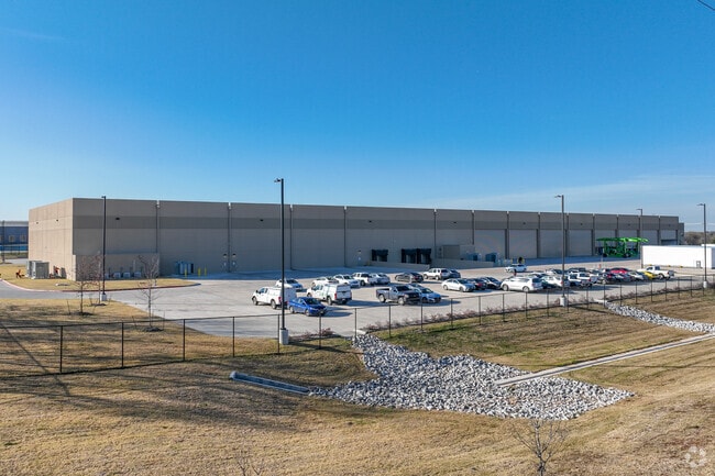
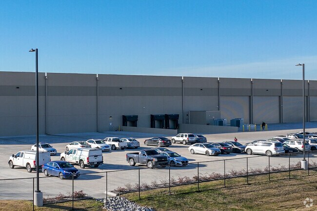
Property Record
371 Tater Brown Rd, Red Oak, TX 75154

Property Detail
371 Tater Brown Rd
Dallas-Fort Worth-Arlington, TX
LOT 10 BLK A PROJECT CARDINAL-REV 12.5140 AC
294767
ELLIS
Commercialnec
Texas
B and X Area of moderate flood hazard, usually the area between the limits of the 100-year and 500-year floods.
10
2024
12.51 AC
2025
Outlying Ellis Cnty
060206
Dallas/Ft Worth
98,724 SF
NEARBY LISTINGS FOR SALE OR LEASE
DEMOGRAPHICS near 371 Tater Brown Rd
1 mile
3 mile
5 mile
2025 Total Population
1,833
34,762
108,735
2030 Population
2,163
39,499
117,930
Pop Growth 2025-2030
+ 18.00%
+ 13.63%
+ 8.46%
Average Age
40
37
37
2025 Total Households
613
11,501
36,741
HH Growth 2025-2030
+ 18.27%
+ 13.89%
+ 8.41%
Median Household Inc
$55,499
$83,810
$79,734
Avg Household Size
2.90
3.00
2.90
2025 Avg HH Vehicles
2.00
2.00
2.00
Median Home Value
$285,999
$329,410
$304,643
Median Year Built
1992
2001
1995
Nearby Places
Map Layers
Map Styles
 Street
 Aerial
Layers
 Traffic
 Biking
Places
Listings with unknown addresses are not visible on the map
- Restaurants
- Banks
- Shops
- Fitness
- Groceries
PUBLIC TRANSPORTATION
AIRPORT
Dallas Love Field
Drive
Walk
Distance
Dallas Love Field
37 min
25.9 mi
Dallas-Fort Worth International
Drive
Walk
Distance
Dallas-Fort Worth International
50 min
39.5 mi
Freight Ports
Port of Shreveport
Drive
Walk
Distance
Port of Shreveport
224 min
207.0 mi
Nearby Properties
Address
Land Use
TOTAL SIZE
Lot Size
Zoning
Address
Land Use
TOTAL SIZE
Lot Size
Zoning
268,416 SF
33.28 AC
Address
Land Use
TOTAL SIZE
Lot Size
Zoning
268,416 SF
19.04 AC
Address
Land Use
TOTAL SIZE
Lot Size
Zoning
268,416 SF
20.02 AC
Address
Land Use
TOTAL SIZE
Lot Size
Zoning
268,416 SF
19.18 AC
Address
Land Use
TOTAL SIZE
Lot Size
Zoning
288,368 SF
86.46 AC
Address
Land Use
TOTAL SIZE
Lot Size
Zoning
316,312 SF
17.09 AC
Address
Land Use
TOTAL SIZE
Lot Size
Zoning
332,510 SF
18.45 AC
Address
Land Use
TOTAL SIZE
Lot Size
Zoning
268,416 SF
22.11 AC
Address
Land Use
TOTAL SIZE
Lot Size
Zoning
345,348 SF
19.22 AC
Address
Land Use
TOTAL SIZE
Lot Size
Zoning
383 SF
56.48 AC
Z07
Address
Land Use
TOTAL SIZE
Lot Size
Zoning
109,500 SF
12.13 AC
Z370
Address
Land Use
TOTAL SIZE
Lot Size
Zoning
80,000 SF
8.37 AC
Address
Land Use
TOTAL SIZE
Lot Size
Zoning
268,416 SF
18.38 AC
Address
Land Use
TOTAL SIZE
Lot Size
Zoning
276,880 SF
14.17 AC
Address
Land Use
TOTAL SIZE
Lot Size
Zoning
327,382 SF
15.68 AC
Address
Land Use
TOTAL SIZE
Lot Size
Zoning
41,390 SF
90.38 AC
Address
Land Use
TOTAL SIZE
Lot Size
Zoning
104,885 SF
8 AC
Address
Land Use
TOTAL SIZE
Lot Size
Zoning
111,715 SF
4.81 AC
Address
Land Use
TOTAL SIZE
Lot Size
Zoning
268,416 SF
18.32 AC
Address
Land Use
TOTAL SIZE
Lot Size
Zoning
268,416 SF
91.89 AC
Address
Land Use
TOTAL SIZE
Lot Size
Zoning
110,065 SF
8.29 AC
Address
Land Use
TOTAL SIZE
Lot Size
Zoning
40,071 SF
15.96 AC
Address
Land Use
TOTAL SIZE
Lot Size
Zoning
159,860 SF
24.03 AC
Address
Land Use
TOTAL SIZE
Lot Size
Zoning
158 SF
27.05 AC
RC
Address
Land Use
TOTAL SIZE
Lot Size
Zoning
268,416 SF
19.64 AC
Address
Land Use
TOTAL SIZE
Lot Size
Zoning
141 SF
20.35 AC
AO
Address
Land Use
TOTAL SIZE
Lot Size
Zoning
91,204 SF
5.04 AC
Address
Land Use
TOTAL SIZE
Lot Size
Zoning
43,164 SF
17.44 AC
Address
Land Use
TOTAL SIZE
Lot Size
Zoning
272,000 SF
38.53 AC
Address
Land Use
TOTAL SIZE
Lot Size
Zoning
46,876 SF
3.01 AC
Z34
The World's #1 Commercial Real Estate Marketplace
Connect with us
© 2026 CoStar Group
The information above has been obtained from sources believed reliable. While we do not doubt its accuracy we have not verified it and make no guarantee, warranty or representation about it. It is your responsibility to independently confirm its accuracy and completeness. Any projections, opinions, assumptions, or estimates used are for example only and do not represent the current or future performance of the property. The value of this transaction to you depends on tax and other factors which should be evaluated by your tax, financial, and legal advisors. You and your advisors should conduct a careful, independent investigation of the property to determine to your satisfaction the suitability of the property for your needs.