Property Record
371 W Loop 335 S, Amarillo, TX 79118

Property Detail
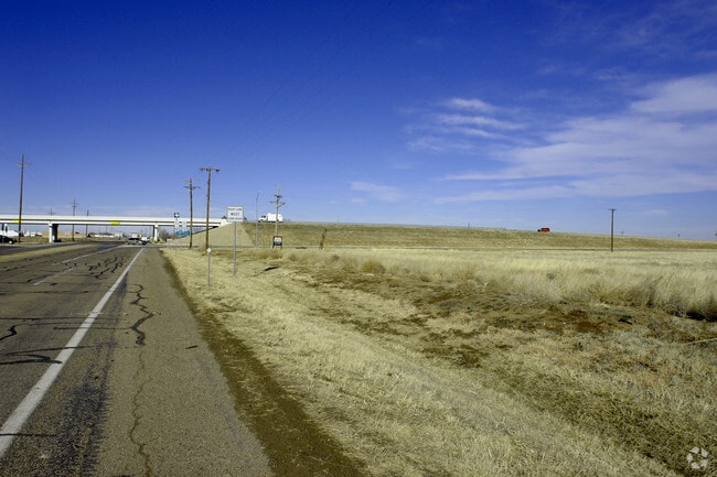
371 W Loop 335 S
Amarillo, TX
KBP PROPERTIES # 2, LOT 02A, BLK 0001, 9.8300 ACRES
R-044-2680-0015-0
RANDALL
Autorepair
Texas
B and X Area of moderate flood hazard, usually the area between the limits of the 100-year and 500-year floods.
2a
2024
9.83 AC
2025
Amarillo
021702
Other Market Areas
27,010 SF
NEARBY LISTINGS FOR SALE OR LEASE
DEMOGRAPHICS near 371 W Loop 335 S
1 mile
3 mile
5 mile
2024 Total Population
169
25,671
96,435
2029 Population
180
27,053
100,833
Pop Growth 2024-2029
+ 6.51%
+ 5.38%
+ 4.56%
Average Age
41
37
39
2024 Total Households
58
9,423
38,899
HH Growth 2024-2029
+ 5.17%
+ 5.43%
+ 4.49%
Median Household Inc
$103,750
$88,666
$74,283
Avg Household Size
2.80
2.60
2.40
2024 Avg HH Vehicles
3.00
2.00
2.00
Median Home Value
$214,286
$212,448
$221,907
Median Year Built
2000
1996
1979
Nearby Places
Map Layers
Map Styles
 Street
 Aerial
Transit
 Traffic
 Biking
Places
Listings with unknown addresses are not visible on the map
- Restaurants
- Banks
- Shops
- Fitness
- Groceries
PUBLIC TRANSPORTATION
AIRPORT
Rick Husband Amarillo International
Drive
Walk
Distance
Rick Husband Amarillo International
18 min
13.6 mi
Freight Ports
Tulsa Port Of Catoosa
Drive
Walk
Distance
Tulsa Port Of Catoosa
400 min
381.6 mi
Nearby Properties
Address
Land Use
TOTAL SIZE
Lot Size
Zoning
Address
Land Use
TOTAL SIZE
Lot Size
Zoning
362,796 SF
49.98 AC
A
Address
Land Use
TOTAL SIZE
Lot Size
Zoning
228,223 SF
20.83 AC
Address
Land Use
TOTAL SIZE
Lot Size
Zoning
112,261 SF
21.82 AC
Address
Land Use
TOTAL SIZE
Lot Size
Zoning
148,486 SF
20.66 AC
Address
Land Use
TOTAL SIZE
Lot Size
Zoning
182,242 SF
20.70 AC
Address
Land Use
TOTAL SIZE
Lot Size
Zoning
210,217 SF
10.49 AC
M11
Address
Land Use
TOTAL SIZE
Lot Size
Zoning
74,960 SF
7 AC
R2
Address
Land Use
TOTAL SIZE
Lot Size
Zoning
204,468 SF
17.56 AC
Address
Land Use
TOTAL SIZE
Lot Size
Zoning
161,321 SF
31 AC
A
Address
Land Use
TOTAL SIZE
Lot Size
Zoning
167,257 SF
12.66 AC
Address
Land Use
TOTAL SIZE
Lot Size
Zoning
68,214 SF
9.06 AC
Address
Land Use
TOTAL SIZE
Lot Size
Zoning
694,915 SF
27.22 AC
Address
Land Use
TOTAL SIZE
Lot Size
Zoning
128,588 SF
23.53 AC
R3
Address
Land Use
TOTAL SIZE
Lot Size
Zoning
266,594 SF
15.39 AC
Address
Land Use
TOTAL SIZE
Lot Size
Zoning
68,970 SF
5.77 AC
MF1
Address
Land Use
TOTAL SIZE
Lot Size
Zoning
40,845 SF
4.59 AC
GR
Address
Land Use
TOTAL SIZE
Lot Size
Zoning
663,313 SF
149.32 AC
Address
Land Use
TOTAL SIZE
Lot Size
Zoning
76,182 SF
42.19 AC
Address
Land Use
TOTAL SIZE
Lot Size
Zoning
42,332 SF
7.44 AC
Address
Land Use
TOTAL SIZE
Lot Size
Zoning
97,796 SF
4 AC
Address
Land Use
TOTAL SIZE
Lot Size
Zoning
46,335 SF
5.05 AC
Address
Land Use
TOTAL SIZE
Lot Size
Zoning
54,038 SF
4.78 AC
MF1
Address
Land Use
TOTAL SIZE
Lot Size
Zoning
56,172 SF
10.03 AC
R2
Address
Land Use
TOTAL SIZE
Lot Size
Zoning
48,092 SF
4.30 AC
R2
Address
Land Use
TOTAL SIZE
Lot Size
Zoning
57,451 SF
7.55 AC
R2
Address
Land Use
TOTAL SIZE
Lot Size
Zoning
42,690 SF
7.22 AC
Address
Land Use
TOTAL SIZE
Lot Size
Zoning
55,089 SF
8.81 AC
R3
Address
Land Use
TOTAL SIZE
Lot Size
Zoning
131,275 SF
9.68 AC
PD
Address
Land Use
TOTAL SIZE
Lot Size
Zoning
181,617 SF
10.97 AC
Address
Land Use
TOTAL SIZE
Lot Size
Zoning
42,450 SF
14.27 AC
The World's #1 Commercial Real Estate Marketplace
Connect with us
© 2026 CoStar Group
The information above has been obtained from sources believed reliable. While we do not doubt its accuracy we have not verified it and make no guarantee, warranty or representation about it. It is your responsibility to independently confirm its accuracy and completeness. Any projections, opinions, assumptions, or estimates used are for example only and do not represent the current or future performance of the property. The value of this transaction to you depends on tax and other factors which should be evaluated by your tax, financial, and legal advisors. You and your advisors should conduct a careful, independent investigation of the property to determine to your satisfaction the suitability of the property for your needs.