Property Record
3710 Regional Pky, Santa Rosa, CA 95403


Property Detail
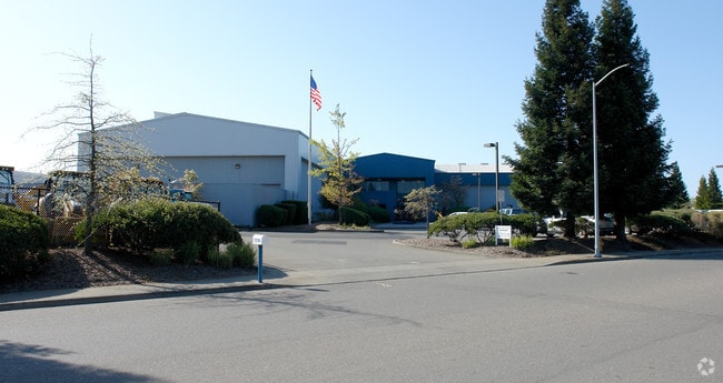
3710 Regional Pky
059-240-057
91 FM 59-240-42 CW 43 & 56 VM 90089763
Heavyindustrial
Sonoma
M240000F
California
C and X Area of minimal flood hazard, usually depicted on FIRMs as above the 500-year flood level.
2-5,8
2024
7.55 AC
2025
Healdsburg/Cloverdale
152702
North Bay/Santa Rosa
42,878 SF
Santa Rosa-Petaluma, CA
NEARBY LISTINGS FOR SALE OR LEASE
DEMOGRAPHICS near 3710 Regional Pky
1 mile
3 mile
5 mile
2025 Total Population
2,050
32,302
94,662
2030 Population
2,004
32,323
95,096
Pop Growth 2025-2030
(2.24%)
+ 0.07%
+ 0.46%
Average Age
46
42
42
2025 Total Households
895
11,736
34,486
HH Growth 2025-2030
(2.23%)
(0.03%)
+ 0.51%
Median Household Inc
$80,000
$112,430
$108,711
Avg Household Size
2.20
2.70
2.60
2025 Avg HH Vehicles
2.00
2.00
2.00
Median Home Value
$238,043
$754,539
$753,967
Median Year Built
1979
1989
1986
Nearby Places
Map Layers
Map Styles
 Street
 Aerial
Transit
 Traffic
 Biking
Places
Listings with unknown addresses are not visible on the map
- Restaurants
- Banks
- Shops
- Fitness
- Groceries
PUBLIC TRANSPORTATION
COMMUTER RAIL
Drive
Walk
Distance
10 min
6.1 mi
Drive
Walk
Distance
10 min
7.1 mi
AIRPORT
Charles M Schulz - Sonoma County
Drive
Walk
Distance
Charles M Schulz - Sonoma County
4 min
1.3 mi
Freight Ports
Port of Richmond
Drive
Walk
Distance
Port of Richmond
71 min
55.2 mi
Nearby Properties
Address
Land Use
TOTAL SIZE
Lot Size
Zoning
Address
Land Use
TOTAL SIZE
Lot Size
Zoning
Address
Land Use
TOTAL SIZE
Lot Size
Zoning
285,710 SF
0.36 AC
Address
Land Use
TOTAL SIZE
Lot Size
Zoning
14.56 AC
Address
Land Use
TOTAL SIZE
Lot Size
Zoning
249,088 SF
10.75 AC
Address
Land Use
TOTAL SIZE
Lot Size
Zoning
46,737 SF
0.12 AC
DA60
Address
Land Use
TOTAL SIZE
Lot Size
Zoning
163,194 SF
15.09 AC
Address
Land Use
TOTAL SIZE
Lot Size
Zoning
126,123 SF
7.66 AC
Address
Land Use
TOTAL SIZE
Lot Size
Zoning
75,540 SF
9.98 AC
Address
Land Use
TOTAL SIZE
Lot Size
Zoning
93,886 SF
5.40 AC
MP2
Address
Land Use
TOTAL SIZE
Lot Size
Zoning
100,186 SF
4.31 AC
Address
Land Use
TOTAL SIZE
Lot Size
Zoning
80,017 SF
0.78 AC
Address
Land Use
TOTAL SIZE
Lot Size
Zoning
14.29 AC
Address
Land Use
TOTAL SIZE
Lot Size
Zoning
232,262 SF
30.69 AC
Address
Land Use
TOTAL SIZE
Lot Size
Zoning
129,726 SF
12.47 AC
Address
Land Use
TOTAL SIZE
Lot Size
Zoning
55,388 SF
30.07 AC
Address
Land Use
TOTAL SIZE
Lot Size
Zoning
70,358 SF
4.51 AC
M1
Address
Land Use
TOTAL SIZE
Lot Size
Zoning
94,768 SF
5.44 AC
R211UA
Address
Land Use
TOTAL SIZE
Lot Size
Zoning
146,448 SF
84.59 AC
Address
Land Use
TOTAL SIZE
Lot Size
Zoning
282,600 SF
6.89 AC
Address
Land Use
TOTAL SIZE
Lot Size
Zoning
195,243 SF
12.31 AC
Address
Land Use
TOTAL SIZE
Lot Size
Zoning
134,209 SF
11.02 AC
Address
Land Use
TOTAL SIZE
Lot Size
Zoning
69,962 SF
4.49 AC
Address
Land Use
TOTAL SIZE
Lot Size
Zoning
80,808 SF
6.92 AC
Address
Land Use
TOTAL SIZE
Lot Size
Zoning
98,033 SF
1.39 AC
Address
Land Use
TOTAL SIZE
Lot Size
Zoning
35,648 SF
2.26 AC
M1
Address
Land Use
TOTAL SIZE
Lot Size
Zoning
107,188 SF
7.59 AC
PC
Address
Land Use
TOTAL SIZE
Lot Size
Zoning
0.18 AC
Address
Land Use
TOTAL SIZE
Lot Size
Zoning
63,890 SF
3.72 AC
Address
Land Use
TOTAL SIZE
Lot Size
Zoning
63,890 SF
4.05 AC
Address
Land Use
TOTAL SIZE
Lot Size
Zoning
42,040 SF
45.09 AC
The World's #1 Commercial Real Estate Marketplace
Connect with us
© 2026 CoStar Group
The information above has been obtained from sources believed reliable. While we do not doubt its accuracy we have not verified it and make no guarantee, warranty or representation about it. It is your responsibility to independently confirm its accuracy and completeness. Any projections, opinions, assumptions, or estimates used are for example only and do not represent the current or future performance of the property. The value of this transaction to you depends on tax and other factors which should be evaluated by your tax, financial, and legal advisors. You and your advisors should conduct a careful, independent investigation of the property to determine to your satisfaction the suitability of the property for your needs.