Property Record
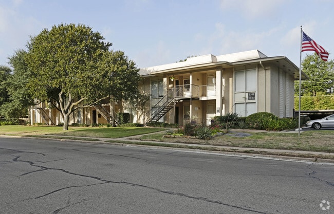
3715 Coker St, Irving, TX 75062


NEARBY LISTINGS FOR SALE OR LEASE
Property Detail
3715 Coker St
Dallas-Fort Worth-Arlington, TX
Northgate West 8
32346500140010100
LEE ESTATES 2ND INST BLK 7 TR 23 ACS 2.62 INT202000206301 DD07312020 CO-DC 2615000702300 1CI26150007
Apartment
Dallas
X
Texas
48113C0305L
23
2024
3.31 AC
2025
Irving
014318
Dallas/Ft Worth
66,504 SF
DEMOGRAPHICS near 3715 Coker St
1 Mile
3 Mile
5 Mile
2024 Total Population
19,106
144,622
241,113
2029 Population
18,792
143,385
239,444
Pop Growth 2024-2029
(1.64%)
(0.86%)
(0.69%)
Average Age
37
35
35
2024 Total Households
6,846
53,866
89,879
HH Growth 2024-2029
(1.83%)
(0.89%)
(0.66%)
Median Household Inc
$67,961
$66,570
$69,400
Avg Household Size
2.70
2.60
2.60
2024 Avg HH Vehicles
2.00
2.00
2.00
Median Home Value
$245,313
$243,343
$253,291
Median Year Built
1969
1981
1985
Nearby Places
Map Layers
Map Styles
 Street
 Aerial
- Restaurants
- Banks
- Shops
- Fitness
- Groceries
PUBLIC TRANSPORTATION
COMMUTER RAIL
Downtown Irving/Heritage Crossing Station (TRINITY RAILWAY - Dallas Area Rapid Transit (DART), Trinity Railway Express - Dallas Area Rapid Transit (DART))
DRIVE
WALK
Distance
Downtown Irving/Heritage Crossing Station (TRINITY RAILWAY - Dallas Area Rapid Transit (DART), Trinity Railway Express - Dallas Area Rapid Transit (DART))
8 min
3.3 mi
West Irving (TRINITY RAILWAY - Dallas Area Rapid Transit (DART), Trinity Railway Express - Dallas Area Rapid Transit (DART))
DRIVE
WALK
Distance
West Irving (TRINITY RAILWAY - Dallas Area Rapid Transit (DART), Trinity Railway Express - Dallas Area Rapid Transit (DART))
10 min
5.8 mi
AIRPORT
Dallas Love Field
DRIVE
WALK
Distance
Dallas Love Field
18 min
10.2 mi
Dallas-Fort Worth International
DRIVE
WALK
Distance
Dallas-Fort Worth International
16 min
10.7 mi
Freight Ports
Port of Shreveport
DRIVE
WALK
Distance
Port of Shreveport
228 min
209.5 mi
Nearby Properties
Address
Land Use
TOTAL SIZE
Lot Size
Zoning
Address
Land Use
TOTAL SIZE
Lot Size
Zoning
1,066,464 SF
4.10 AC
Z392
Address
Land Use
TOTAL SIZE
Lot Size
Zoning
2,496,382 SF
256.13 AC
Z392
Address
Land Use
TOTAL SIZE
Lot Size
Zoning
962,320 SF
23.81 AC
Z198
Address
Land Use
TOTAL SIZE
Lot Size
Zoning
1,520,000 SF
34.76 AC
Z243
Address
Land Use
TOTAL SIZE
Lot Size
Zoning
850,390 SF
16.12 AC
Address
Land Use
TOTAL SIZE
Lot Size
Zoning
346,000 SF
15.52 AC
Z198
Address
Land Use
TOTAL SIZE
Lot Size
Zoning
1,673,367 SF
17.29 AC
Z243
Address
Land Use
TOTAL SIZE
Lot Size
Zoning
1,763,184 SF
11.25 AC
Z393
Address
Land Use
TOTAL SIZE
Lot Size
Zoning
674,817 SF
15.35 AC
Z84
Address
Land Use
TOTAL SIZE
Lot Size
Zoning
631,947 SF
11.95 AC
Z393
Address
Land Use
TOTAL SIZE
Lot Size
Zoning
689,004 SF
25.23 AC
Z243
Address
Land Use
TOTAL SIZE
Lot Size
Zoning
654,829 SF
9.78 AC
Z243
Address
Land Use
TOTAL SIZE
Lot Size
Zoning
735,258 SF
4.83 AC
Z392
Address
Land Use
TOTAL SIZE
Lot Size
Zoning
1,144,971 SF
19.43 AC
Z84
Address
Land Use
TOTAL SIZE
Lot Size
Zoning
729,870 SF
24.42 AC
Z393
Address
Land Use
TOTAL SIZE
Lot Size
Zoning
608,308 SF
7.26 AC
Z198
Address
Land Use
TOTAL SIZE
Lot Size
Zoning
671,349 SF
5.31 AC
Z243
Address
Land Use
TOTAL SIZE
Lot Size
Zoning
724,643 SF
5.15 AC
Z243
Address
Land Use
TOTAL SIZE
Lot Size
Zoning
1,219,380 SF
16.01 AC
Z243
Address
Land Use
TOTAL SIZE
Lot Size
Zoning
717,650 SF
28.32 AC
Z243
Address
Land Use
TOTAL SIZE
Lot Size
Zoning
588,626 SF
6.55 AC
Z84
Address
Land Use
TOTAL SIZE
Lot Size
Zoning
482,696 SF
5.39 AC
Z86
Address
Land Use
TOTAL SIZE
Lot Size
Zoning
253,580 SF
188.04 AC
Z393
Address
Land Use
TOTAL SIZE
Lot Size
Zoning
529,640 SF
5.13 AC
Z393
Address
Land Use
TOTAL SIZE
Lot Size
Zoning
505,823 SF
29.64 AC
Z113
Address
Land Use
TOTAL SIZE
Lot Size
Zoning
558,547 SF
7.39 AC
Z198
Address
Land Use
TOTAL SIZE
Lot Size
Zoning
616,333 SF
6.32 AC
Z393
Address
Land Use
TOTAL SIZE
Lot Size
Zoning
573,495 SF
30.30 AC
Z243
Address
Land Use
TOTAL SIZE
Lot Size
Zoning
851,407 SF
4.91 AC
Z198
Address
Land Use
TOTAL SIZE
Lot Size
Zoning
685,774 SF
7.36 AC
Z198
The World's #1 Commercial Real Estate Marketplace
Connect with us
© 2026 CoStar Group
The information above has been obtained from sources believed reliable. While we do not doubt its accuracy we have not verified it and make no guarantee, warranty or representation about it. It is your responsibility to independently confirm its accuracy and completeness. Any projections, opinions, assumptions, or estimates used are for example only and do not represent the current or future performance of the property. The value of this transaction to you depends on tax and other factors which should be evaluated by your tax, financial, and legal advisors. You and your advisors should conduct a careful, independent investigation of the property to determine to your satisfaction the suitability of the property for your needs.