Property Record
3715 N Valdosta Rd, Valdosta, GA 31602

NEARBY LISTINGS FOR SALE OR LEASE
Property Detail
3715 N Valdosta Rd
0076A-004
Apartments Grp1
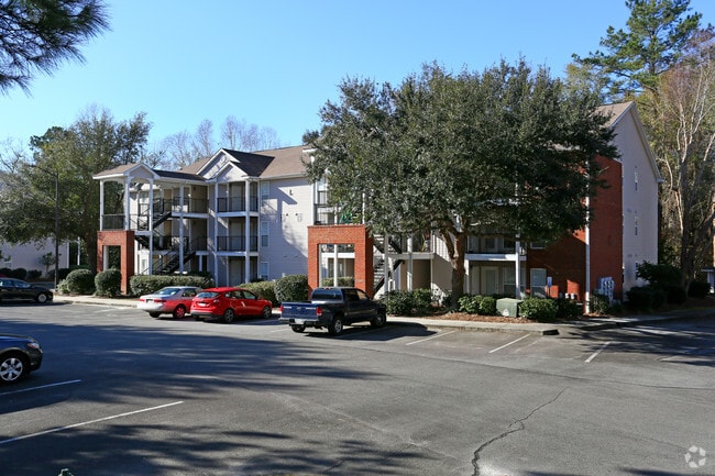
Multifamilydwelling
LINKS APARTMENTS_24.297 ACRES
AE
Lowndes
13027C0190D
Georgia
2024
24.30 AC
2024
Valdosta/Lake Park
010302
Other Market Areas
1,728 SF
Valdosta, GA
DEMOGRAPHICS near 3715 N Valdosta Rd
1 Mile
3 Mile
5 Mile
2024 Total Population
2,519
34,506
71,662
2029 Population
2,582
35,616
74,244
Pop Growth 2024-2029
+ 2.50%
+ 3.22%
+ 3.60%
Average Age
43
35
35
2024 Total Households
1,074
13,686
27,833
HH Growth 2024-2029
+ 2.51%
+ 3.38%
+ 3.78%
Median Household Inc
$74,191
$48,219
$40,261
Avg Household Size
2.30
2.30
2.40
2024 Avg HH Vehicles
2.00
2.00
2.00
Median Home Value
$260,110
$198,200
$172,670
Median Year Built
1988
1989
1990
Nearby Places
Map Layers
Map Styles
 Street
 Aerial
- Restaurants
- Banks
- Shops
- Fitness
- Groceries
PUBLIC TRANSPORTATION
AIRPORT
Valdosta Regional
DRIVE
WALK
Distance
Valdosta Regional
16 min
8.4 mi
Freight Ports
Georgia Ports - Brunswick
DRIVE
WALK
Distance
Georgia Ports - Brunswick
159 min
119.3 mi
Nearby Properties
Address
Land Use
TOTAL SIZE
Lot Size
Zoning
Address
Land Use
TOTAL SIZE
Lot Size
Zoning
459,770 SF
31.50 AC
C-H
Address
Land Use
TOTAL SIZE
Lot Size
Zoning
39,024 SF
18.04 AC
P-D
Address
Land Use
TOTAL SIZE
Lot Size
Zoning
115,460 SF
13.09 AC
R-M
Address
Land Use
TOTAL SIZE
Lot Size
Zoning
4,878 SF
14.83 AC
R-P
Address
Land Use
TOTAL SIZE
Lot Size
Zoning
15.75 AC
R-P
Address
Land Use
TOTAL SIZE
Lot Size
Zoning
19,825 SF
16.93 AC
R-M
Address
Land Use
TOTAL SIZE
Lot Size
Zoning
2,574 SF
12 AC
R-P
Address
Land Use
TOTAL SIZE
Lot Size
Zoning
185,727 SF
20.33 AC
C-H
Address
Land Use
TOTAL SIZE
Lot Size
Zoning
68,592 SF
14.39 AC
C-H
Address
Land Use
TOTAL SIZE
Lot Size
Zoning
32,886 SF
5.45 AC
C-C
Address
Land Use
TOTAL SIZE
Lot Size
Zoning
114,922 SF
11.38 AC
C-C
Address
Land Use
TOTAL SIZE
Lot Size
Zoning
104,423 SF
2.62 AC
C-H
Address
Land Use
TOTAL SIZE
Lot Size
Zoning
142,140 SF
24.29 AC
DR-10
Address
Land Use
TOTAL SIZE
Lot Size
Zoning
101,792 SF
14.09 AC
C-H
Address
Land Use
TOTAL SIZE
Lot Size
Zoning
24,928 SF
10 AC
R-M
Address
Land Use
TOTAL SIZE
Lot Size
Zoning
89,977 SF
11.16 AC
C-H
Address
Land Use
TOTAL SIZE
Lot Size
Zoning
3,845 SF
14.13 AC
C-H
Address
Land Use
TOTAL SIZE
Lot Size
Zoning
40,800 SF
5.83 AC
R-P
Address
Land Use
TOTAL SIZE
Lot Size
Zoning
53,880 SF
8.01 AC
C-H,C-C
Address
Land Use
TOTAL SIZE
Lot Size
Zoning
50,016 SF
3.79 AC
C-C
Address
Land Use
TOTAL SIZE
Lot Size
Zoning
88,545 SF
9.09 AC
C-H
Address
Land Use
TOTAL SIZE
Lot Size
Zoning
80,062 SF
3 AC
C-H
Address
Land Use
TOTAL SIZE
Lot Size
Zoning
574 SF
7.28 AC
PPD
Address
Land Use
TOTAL SIZE
Lot Size
Zoning
55,599 SF
4.14 AC
C-H
Address
Land Use
TOTAL SIZE
Lot Size
Zoning
93,032 SF
2.80 AC
C-H
Address
Land Use
TOTAL SIZE
Lot Size
Zoning
78,048 SF
9.18 AC
R-P
Address
Land Use
TOTAL SIZE
Lot Size
Zoning
13,056 SF
9.41 AC
R-M
Address
Land Use
TOTAL SIZE
Lot Size
Zoning
59,044 SF
8.35 AC
C-C
Address
Land Use
TOTAL SIZE
Lot Size
Zoning
56,759 SF
5.74 AC
C-H
The World's #1 Commercial Real Estate Marketplace
Connect with us
© 2026 CoStar Group
The information above has been obtained from sources believed reliable. While we do not doubt its accuracy we have not verified it and make no guarantee, warranty or representation about it. It is your responsibility to independently confirm its accuracy and completeness. Any projections, opinions, assumptions, or estimates used are for example only and do not represent the current or future performance of the property. The value of this transaction to you depends on tax and other factors which should be evaluated by your tax, financial, and legal advisors. You and your advisors should conduct a careful, independent investigation of the property to determine to your satisfaction the suitability of the property for your needs.