Property Record
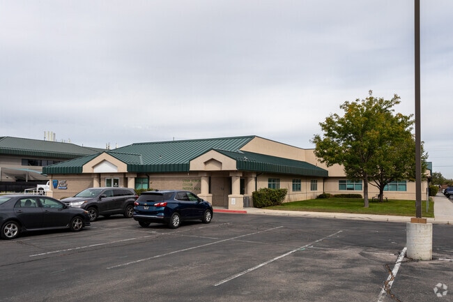
3715 W 4100 S, West Valley City, UT 84120


NEARBY LISTINGS FOR SALE OR LEASE
Property Detail
3715 W 4100 S
21-05-126-016-0000
BEG S 89^5325 W 495 FT & S 0^0635 E 212.67 FT FR N 1/4 COR SEC 5, T 2S, R 1W, SLM; S 0^0635 E 446.38 FT; W 207.82FT; N 446.14 FT; N 89^5602 E 206.97 FT TO BEG. 2.12 AC M OR L. 8640-5049
Medicalbuilding
Salt Lake
X
Utah
49035C0290G
2.12 AC
2024
West Valley/Lake Park
2025
Salt Lake City
113536
Salt Lake City-Murray, UT
24,250 SF
DEMOGRAPHICS near 3715 W 4100 S
1 Mile
3 Mile
5 Mile
2024 Total Population
21,771
164,835
320,685
2029 Population
21,934
166,613
324,089
Pop Growth 2024-2029
+ 0.75%
+ 1.08%
+ 1.06%
Average Age
37
36
36
2024 Total Households
6,268
50,220
98,627
HH Growth 2024-2029
+ 0.67%
+ 1.07%
+ 1.07%
Median Household Inc
$81,348
$71,052
$74,752
Avg Household Size
3.30
3.10
3.10
2024 Avg HH Vehicles
2.00
2.00
2.00
Median Home Value
$363,605
$332,826
$350,151
Median Year Built
1974
1978
1984
Nearby Places
Map Layers
Map Styles
 Street
 Aerial
- Restaurants
- Banks
- Shops
- Fitness
- Groceries
PUBLIC TRANSPORTATION
AIRPORT
Salt Lake City International
DRIVE
WALK
Distance
Salt Lake City International
13 min
7.8 mi
Freight Ports
Port of Stockton
DRIVE
WALK
Distance
Port of Stockton
713 min
694.3 mi
SALE & LEASE HISTORY
LISTING DATE
SALE/LEASE

Sep 13, 2024
For Lease
Mar 01, 2018
For Lease
Nearby Properties
Address
Land Use
TOTAL SIZE
Lot Size
Zoning
Address
Land Use
TOTAL SIZE
Lot Size
Zoning
895,175 SF
28.95 AC
SSD-X
Address
Land Use
TOTAL SIZE
Lot Size
Zoning
828,269 SF
9.06 AC
RM
Address
Land Use
TOTAL SIZE
Lot Size
Zoning
673,062 SF
15.84 AC
RM
Address
Land Use
TOTAL SIZE
Lot Size
Zoning
329,306 SF
14.67 AC
5005
Address
Land Use
TOTAL SIZE
Lot Size
Zoning
185,436 SF
25.23 AC
RM
Address
Land Use
TOTAL SIZE
Lot Size
Zoning
382,335 SF
63.87 AC
OS
Address
Land Use
TOTAL SIZE
Lot Size
Zoning
195,790 SF
14.32 AC
RM
Address
Land Use
TOTAL SIZE
Lot Size
Zoning
123,864 SF
6.75 AC
C-2
Address
Land Use
TOTAL SIZE
Lot Size
Zoning
178,102 SF
15.95 AC
C-3
Address
Land Use
TOTAL SIZE
Lot Size
Zoning
432,730 SF
13.03 AC
R-M
Address
Land Use
TOTAL SIZE
Lot Size
Zoning
76,096 SF
17.30 AC
RM
Address
Land Use
TOTAL SIZE
Lot Size
Zoning
187,717 SF
15.02 AC
R-M
Address
Land Use
TOTAL SIZE
Lot Size
Zoning
401,887 SF
3.51 AC
RM
Address
Land Use
TOTAL SIZE
Lot Size
Zoning
63,758 SF
13.93 AC
RM
Address
Land Use
TOTAL SIZE
Lot Size
Zoning
29.13 AC
C-2
Address
Land Use
TOTAL SIZE
Lot Size
Zoning
289,725 SF
8.42 AC
1108
Address
Land Use
TOTAL SIZE
Lot Size
Zoning
250,027 SF
8.46 AC
PF
Address
Land Use
TOTAL SIZE
Lot Size
Zoning
89,239 SF
14.78 AC
RM
Address
Land Use
TOTAL SIZE
Lot Size
Zoning
381,105 SF
2.88 AC
CC
Address
Land Use
TOTAL SIZE
Lot Size
Zoning
57,772 SF
8.09 AC
MU
Address
Land Use
TOTAL SIZE
Lot Size
Zoning
304,366 SF
2.71 AC
M
Address
Land Use
TOTAL SIZE
Lot Size
Zoning
180,383 SF
4.77 AC
MXD
Address
Land Use
TOTAL SIZE
Lot Size
Zoning
46,874 SF
16.35 AC
RM
Address
Land Use
TOTAL SIZE
Lot Size
Zoning
603,730 SF
31.77 AC
PO
Address
Land Use
TOTAL SIZE
Lot Size
Zoning
393,809 SF
2.86 AC
CC
Address
Land Use
TOTAL SIZE
Lot Size
Zoning
449,868 SF
22.27 AC
M
Address
Land Use
TOTAL SIZE
Lot Size
Zoning
330,834 SF
7.60 AC
R-1-8
Address
Land Use
TOTAL SIZE
Lot Size
Zoning
60,960 SF
10.55 AC
RM
Address
Land Use
TOTAL SIZE
Lot Size
Zoning
131,500 SF
75.92 AC
R-1-10
Address
Land Use
TOTAL SIZE
Lot Size
Zoning
74,439 SF
27.33 AC
M
The World's #1 Commercial Real Estate Marketplace
Connect with us
© 2026 CoStar Group
The information above has been obtained from sources believed reliable. While we do not doubt its accuracy we have not verified it and make no guarantee, warranty or representation about it. It is your responsibility to independently confirm its accuracy and completeness. Any projections, opinions, assumptions, or estimates used are for example only and do not represent the current or future performance of the property. The value of this transaction to you depends on tax and other factors which should be evaluated by your tax, financial, and legal advisors. You and your advisors should conduct a careful, independent investigation of the property to determine to your satisfaction the suitability of the property for your needs.