Property Record
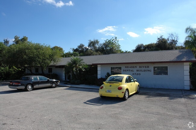
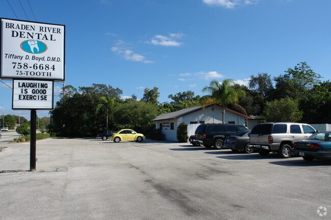
3720 53Rd Ave E, Bradenton, FL 34203


Property Detail
3720 53Rd Ave E
17671-0025-6
THE E 225 FT OF THE FOLLOWING: COM AT THE NE COR OF SEC 17, TWN 35S, RNG 18E; TH S 0 DEG 24 MIN 19 SEC W, 40 FT TO THE S R/W LN OF HWY 70 (ONECO RD) FOR A POB; TH W ALG SD R/W
Medicalbuilding
Manatee
PR-M PROFE
Florida
AE The base floodplain where base flood elevations are provided. AE Zones are now used on new format FIRMs instead of A1-A30 Zones.
1.31 AC
2024
Manatee
2025
Tampa/St Petersburg
000805
North Port-Bradenton-Sarasota, FL
2,973 SF
NEARBY LISTINGS FOR SALE OR LEASE
DEMOGRAPHICS near 3720 53Rd Ave E
1 mile
3 mile
5 mile
2025 Total Population
9,439
61,548
189,436
2030 Population
10,487
68,502
210,417
Pop Growth 2025-2030
+ 11.10%
+ 11.30%
+ 11.08%
Average Age
47
46
45
2025 Total Households
3,897
24,895
80,935
HH Growth 2025-2030
+ 11.24%
+ 11.66%
+ 11.34%
Median Household Inc
$93,987
$72,883
$65,907
Avg Household Size
2.40
2.40
2.20
2025 Avg HH Vehicles
2.00
2.00
2.00
Median Home Value
$410,089
$378,784
$355,594
Median Year Built
1997
1994
1988
Nearby Places
Map Layers
Map Styles
 Street
 Aerial
Transit
 Traffic
 Biking
Places
Listings with unknown addresses are not visible on the map
- Restaurants
- Banks
- Shops
- Fitness
- Groceries
PUBLIC TRANSPORTATION
AIRPORT
Sarasota/Bradenton International
Drive
Walk
Distance
Sarasota/Bradenton International
15 min
8.2 mi
Freight Ports
Port Manatee
Drive
Walk
Distance
Port Manatee
28 min
17.2 mi
Nearby Properties
Address
Land Use
TOTAL SIZE
Lot Size
Zoning
Address
Land Use
TOTAL SIZE
Lot Size
Zoning
385,610 SF
32.65 AC
RMF-6 MULT
Address
Land Use
TOTAL SIZE
Lot Size
Zoning
241,504 SF
27.72 AC
A GENERAL
Address
Land Use
TOTAL SIZE
Lot Size
Zoning
375,171 SF
20 AC
PD-MU
Address
Land Use
TOTAL SIZE
Lot Size
Zoning
238,774 SF
15.56 AC
A-1 SUBURB
Address
Land Use
TOTAL SIZE
Lot Size
Zoning
115,400 SF
22.55 AC
LM LIGHT M
Address
Land Use
TOTAL SIZE
Lot Size
Zoning
187,000 SF
8.93 AC
Address
Land Use
TOTAL SIZE
Lot Size
Zoning
214,350 SF
16.07 AC
LM LIGHT M
Address
Land Use
TOTAL SIZE
Lot Size
Zoning
296,983 SF
34.84 AC
PD-MU
Address
Land Use
TOTAL SIZE
Lot Size
Zoning
163,394 SF
15.49 AC
PD-MU
Address
Land Use
TOTAL SIZE
Lot Size
Zoning
901,196 SF
48.54 AC
LM LIGHT M
Address
Land Use
TOTAL SIZE
Lot Size
Zoning
145,200 SF
8.66 AC
Address
Land Use
TOTAL SIZE
Lot Size
Zoning
126,505 SF
20 AC
RSF-2
Address
Land Use
TOTAL SIZE
Lot Size
Zoning
419,956 SF
18.46 AC
LM LIGHT M
Address
Land Use
TOTAL SIZE
Lot Size
Zoning
145,200 SF
8.99 AC
Address
Land Use
TOTAL SIZE
Lot Size
Zoning
10,389 SF
57.58 AC
PD-RV
Address
Land Use
TOTAL SIZE
Lot Size
Zoning
124,129 SF
23.29 AC
PDC
Address
Land Use
TOTAL SIZE
Lot Size
Zoning
143,582 SF
14.42 AC
LM LIGHT M
Address
Land Use
TOTAL SIZE
Lot Size
Zoning
231,364 SF
27.50 AC
PD-PI
Address
Land Use
TOTAL SIZE
Lot Size
Zoning
310,215 SF
134.06 AC
A GENERAL
Address
Land Use
TOTAL SIZE
Lot Size
Zoning
220,685 SF
27.21 AC
PD-C
Address
Land Use
TOTAL SIZE
Lot Size
Zoning
322,364 SF
32.93 AC
HM HEAVY M
Address
Land Use
TOTAL SIZE
Lot Size
Zoning
234,818 SF
18.20 AC
BR_R-2
Address
Land Use
TOTAL SIZE
Lot Size
Zoning
141,244 SF
18.08 AC
LM,HM
Address
Land Use
TOTAL SIZE
Lot Size
Zoning
201,632 SF
7.23 AC
A-1 SUBURB
Address
Land Use
TOTAL SIZE
Lot Size
Zoning
121,899 SF
9.88 AC
HM HEAVY M
Address
Land Use
TOTAL SIZE
Lot Size
Zoning
10,094 SF
51.90 AC
PD-RV
Address
Land Use
TOTAL SIZE
Lot Size
Zoning
45,160 SF
12.66 AC
HM HEAVY M
Address
Land Use
TOTAL SIZE
Lot Size
Zoning
313,540 SF
10.51 AC
LM LIGHT M
Address
Land Use
TOTAL SIZE
Lot Size
Zoning
92,466 SF
18.80 AC
A-1 SUBURB
Address
Land Use
TOTAL SIZE
Lot Size
Zoning
89,912 SF
5.05 AC
The World's #1 Commercial Real Estate Marketplace
Connect with us
© 2026 CoStar Group
The information above has been obtained from sources believed reliable. While we do not doubt its accuracy we have not verified it and make no guarantee, warranty or representation about it. It is your responsibility to independently confirm its accuracy and completeness. Any projections, opinions, assumptions, or estimates used are for example only and do not represent the current or future performance of the property. The value of this transaction to you depends on tax and other factors which should be evaluated by your tax, financial, and legal advisors. You and your advisors should conduct a careful, independent investigation of the property to determine to your satisfaction the suitability of the property for your needs.