Property Record
3720 E Sunshine St, Springfield, MO 65809
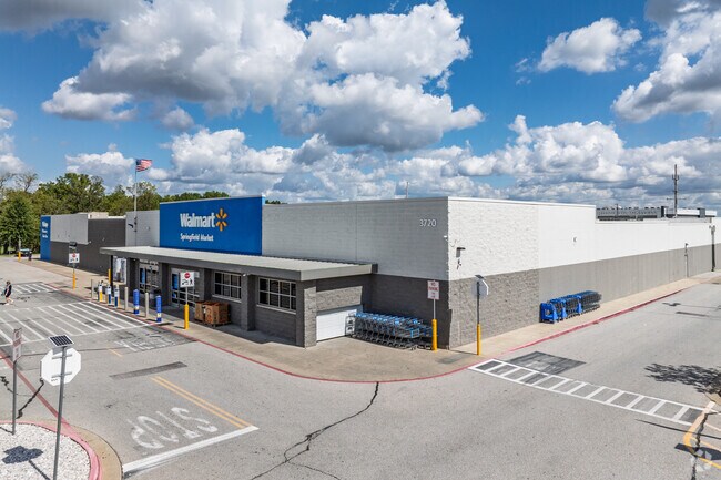

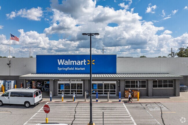
Property Detail
3720 E Sunshine St
Springfield, MO
WAL-MART SUBDIVISION LOT 2
12-34-201-132
Greene
Supermarket
Missouri
INC
2
B and X Area of moderate flood hazard, usually the area between the limits of the 100-year and 500-year floods.
7.32 AC
2025
Southeast
2025
Springfield
003802
NEARBY LISTINGS FOR SALE OR LEASE
DEMOGRAPHICS near 3720 E Sunshine St
1 mile
3 mile
5 mile
2025 Total Population
8,730
43,584
110,949
2030 Population
8,912
44,514
113,683
Pop Growth 2025-2030
+ 2.08%
+ 2.13%
+ 2.46%
Average Age
42
41
39
2025 Total Households
3,876
19,676
49,739
HH Growth 2025-2030
+ 2.17%
+ 2.26%
+ 2.66%
Median Household Inc
$65,217
$65,227
$54,801
Avg Household Size
2.20
2.20
2.00
2025 Avg HH Vehicles
2.00
2.00
2.00
Median Home Value
$338,130
$279,559
$249,966
Median Year Built
1980
1976
1976
Nearby Places
Map Layers
Map Styles
 Street
 Aerial
Layers
 Traffic
 Biking
Places
Listings with unknown addresses are not visible on the map
- Restaurants
- Banks
- Shops
- Fitness
- Groceries
PUBLIC TRANSPORTATION
AIRPORT
Springfield-Branson Ntl
Drive
Walk
Distance
Springfield-Branson Ntl
30 min
18.4 mi
Nearby Properties
Address
Land Use
TOTAL SIZE
Lot Size
Zoning
Address
Land Use
TOTAL SIZE
Lot Size
Zoning
343,758 SF
29.81 AC
INC
Address
Land Use
TOTAL SIZE
Lot Size
Zoning
210,374 SF
24.37 AC
INC
Address
Land Use
TOTAL SIZE
Lot Size
Zoning
779,221 SF
45.03 AC
INC
Address
Land Use
TOTAL SIZE
Lot Size
Zoning
18.35 AC
Address
Land Use
TOTAL SIZE
Lot Size
Zoning
224,730 SF
19.99 AC
INC
Address
Land Use
TOTAL SIZE
Lot Size
Zoning
10.29 AC
INC.
Address
Land Use
TOTAL SIZE
Lot Size
Zoning
51.65 AC
INC
Address
Land Use
TOTAL SIZE
Lot Size
Zoning
211,041 SF
19.13 AC
INC
Address
Land Use
TOTAL SIZE
Lot Size
Zoning
25.51 AC
INC
Address
Land Use
TOTAL SIZE
Lot Size
Zoning
4.63 AC
O-2
Address
Land Use
TOTAL SIZE
Lot Size
Zoning
17.07 AC
INC.
Address
Land Use
TOTAL SIZE
Lot Size
Zoning
108,153 SF
7.37 AC
INC.
Address
Land Use
TOTAL SIZE
Lot Size
Zoning
324,341 SF
43 AC
INC
Address
Land Use
TOTAL SIZE
Lot Size
Zoning
16.73 AC
Address
Land Use
TOTAL SIZE
Lot Size
Zoning
70,500 SF
7.20 AC
INC
Address
Land Use
TOTAL SIZE
Lot Size
Zoning
2.69 AC
INC
Address
Land Use
TOTAL SIZE
Lot Size
Zoning
26,240 SF
2.39 AC
INC.
Address
Land Use
TOTAL SIZE
Lot Size
Zoning
2 AC
INC.
Address
Land Use
TOTAL SIZE
Lot Size
Zoning
162,312 SF
7.84 AC
INC
Address
Land Use
TOTAL SIZE
Lot Size
Zoning
Address
Land Use
TOTAL SIZE
Lot Size
Zoning
66,686 SF
1.91 AC
INC
Address
Land Use
TOTAL SIZE
Lot Size
Zoning
323,771 SF
31.48 AC
INC
Address
Land Use
TOTAL SIZE
Lot Size
Zoning
2.96 AC
INC.
Address
Land Use
TOTAL SIZE
Lot Size
Zoning
90,644 SF
7.60 AC
INC
Address
Land Use
TOTAL SIZE
Lot Size
Zoning
91,885 SF
13.29 AC
INC
Address
Land Use
TOTAL SIZE
Lot Size
Zoning
76,774 SF
7.35 AC
INC
Address
Land Use
TOTAL SIZE
Lot Size
Zoning
129,662 SF
4.49 AC
INC.
Address
Land Use
TOTAL SIZE
Lot Size
Zoning
48,139 SF
5.75 AC
INC
Address
Land Use
TOTAL SIZE
Lot Size
Zoning
2.52 AC
INC.
Address
Land Use
TOTAL SIZE
Lot Size
Zoning
177,549 SF
12.70 AC
INC
The World's #1 Commercial Real Estate Marketplace
Connect with us
© 2026 CoStar Group
The information above has been obtained from sources believed reliable. While we do not doubt its accuracy we have not verified it and make no guarantee, warranty or representation about it. It is your responsibility to independently confirm its accuracy and completeness. Any projections, opinions, assumptions, or estimates used are for example only and do not represent the current or future performance of the property. The value of this transaction to you depends on tax and other factors which should be evaluated by your tax, financial, and legal advisors. You and your advisors should conduct a careful, independent investigation of the property to determine to your satisfaction the suitability of the property for your needs.