Property Record
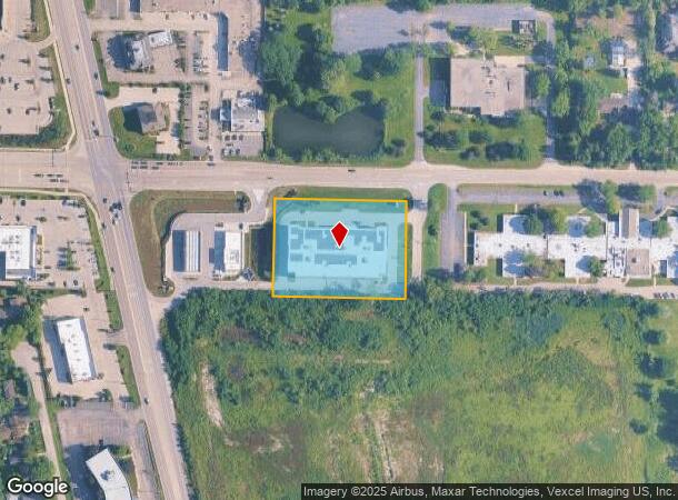
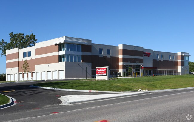
3725 Deerfield Rd, Riverwoods, IL 60015

NEARBY LISTINGS FOR SALE OR LEASE
-
-
View all Riverwoods listings for sale on LoopNet.com
Property Detail
3725 Deerfield Rd
Chicago-Naperville-Elgin, IL-IN-WI
Riverwoods Retail Development Sub
15-35-105-003
RIVERWOODS RETAIL DEVELOPMENT SUB; LOT 2
Commercialbuilding
Lake
AE
Illinois
17097C0266K
2
2023
2.03 AC
2024
Central North
864524
Chicago
DEMOGRAPHICS near 3725 Deerfield Rd
1 Mile
3 Mile
5 Mile
2024 Total Population
5,549
80,053
202,589
2029 Population
5,505
78,674
198,555
Pop Growth 2024-2029
(0.79%)
(1.72%)
(1.99%)
Average Age
39
42
42
2024 Total Households
2,290
30,305
76,168
HH Growth 2024-2029
(0.79%)
(1.87%)
(2.23%)
Median Household Inc
$94,969
$100,916
$110,101
Avg Household Size
2.30
2.50
2.60
2024 Avg HH Vehicles
1.00
2.00
2.00
Median Home Value
$325,199
$368,369
$409,783
Median Year Built
1982
1981
1978
Nearby Places
Map Layers
Map Styles
 Street
 Aerial
- Restaurants
- Banks
- Shops
- Fitness
- Groceries
PUBLIC TRANSPORTATION
COMMUTER RAIL
Buffalo Grove Station (North Central Service - Northeast Illinois Regional Commuter Railroad (Metra))
DRIVE
WALK
Distance
Buffalo Grove Station (North Central Service - Northeast Illinois Regional Commuter Railroad (Metra))
3 min
1.4 mi
Wheeling Station (North Central Service - Northeast Illinois Regional Commuter Railroad (Metra))
DRIVE
WALK
Distance
Wheeling Station (North Central Service - Northeast Illinois Regional Commuter Railroad (Metra))
6 min
3.1 mi
AIRPORT
Chicago O'Hare International
DRIVE
WALK
Distance
Chicago O'Hare International
25 min
16.5 mi
Chicago Midway International
DRIVE
WALK
Distance
Chicago Midway International
52 min
29.9 mi
Freight Ports
Port Milwaukee
DRIVE
WALK
Distance
Port Milwaukee
76 min
63.6 mi
Nearby Properties
Address
Land Use
TOTAL SIZE
Lot Size
Zoning
Address
Land Use
TOTAL SIZE
Lot Size
Zoning
6,783,684 SF
69.84 AC
Address
Land Use
TOTAL SIZE
Lot Size
Zoning
65.17 AC
Address
Land Use
TOTAL SIZE
Lot Size
Zoning
301,050 SF
11.22 AC
Address
Land Use
TOTAL SIZE
Lot Size
Zoning
864,590 SF
2.64 AC
Address
Land Use
TOTAL SIZE
Lot Size
Zoning
21.58 AC
Address
Land Use
TOTAL SIZE
Lot Size
Zoning
Address
Land Use
TOTAL SIZE
Lot Size
Zoning
24.64 AC
Address
Land Use
TOTAL SIZE
Lot Size
Zoning
18.40 AC
Address
Land Use
TOTAL SIZE
Lot Size
Zoning
315,160 SF
15.50 AC
Address
Land Use
TOTAL SIZE
Lot Size
Zoning
1,049,337 SF
24.57 AC
Address
Land Use
TOTAL SIZE
Lot Size
Zoning
8.21 AC
Address
Land Use
TOTAL SIZE
Lot Size
Zoning
653,040 SF
7.96 AC
Address
Land Use
TOTAL SIZE
Lot Size
Zoning
Address
Land Use
TOTAL SIZE
Lot Size
Zoning
8,586,994 SF
10.41 AC
Address
Land Use
TOTAL SIZE
Lot Size
Zoning
14.26 AC
Address
Land Use
TOTAL SIZE
Lot Size
Zoning
188,987 SF
6.65 AC
Address
Land Use
TOTAL SIZE
Lot Size
Zoning
12.58 AC
Address
Land Use
TOTAL SIZE
Lot Size
Zoning
Address
Land Use
TOTAL SIZE
Lot Size
Zoning
Address
Land Use
TOTAL SIZE
Lot Size
Zoning
Address
Land Use
TOTAL SIZE
Lot Size
Zoning
13.53 AC
Address
Land Use
TOTAL SIZE
Lot Size
Zoning
186,646 SF
26.69 AC
Address
Land Use
TOTAL SIZE
Lot Size
Zoning
349,846 SF
5.11 AC
Address
Land Use
TOTAL SIZE
Lot Size
Zoning
13.88 AC
Address
Land Use
TOTAL SIZE
Lot Size
Zoning
221,786 SF
6.33 AC
Address
Land Use
TOTAL SIZE
Lot Size
Zoning
46.27 AC
Address
Land Use
TOTAL SIZE
Lot Size
Zoning
20.03 AC
Address
Land Use
TOTAL SIZE
Lot Size
Zoning
362,944 SF
12.74 AC
Address
Land Use
TOTAL SIZE
Lot Size
Zoning
Address
Land Use
TOTAL SIZE
Lot Size
Zoning
840 SF
2.37 AC
The World's #1 Commercial Real Estate Marketplace
Connect with us
© 2025 CoStar Group
The information above has been obtained from sources believed reliable. While we do not doubt its accuracy we have not verified it and make no guarantee, warranty or representation about it. It is your responsibility to independently confirm its accuracy and completeness. Any projections, opinions, assumptions, or estimates used are for example only and do not represent the current or future performance of the property. The value of this transaction to you depends on tax and other factors which should be evaluated by your tax, financial, and legal advisors. You and your advisors should conduct a careful, independent investigation of the property to determine to your satisfaction the suitability of the property for your needs.