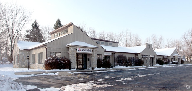
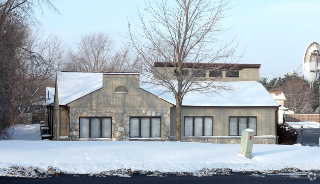
Property Record
3725 E Southport Rd, Indianapolis, IN 46227

NEARBY LISTINGS FOR SALE OR LEASE
Property Detail
3725 E Southport Rd
49-15-17-102-009.000-500
PT NE1/4 NE1/4 S17 T14 R4 BEG 351.12FT W & 182.41FTSE OF NE COR SE 144.63FT W 293.41FT N 108.76FT E194.08FT NE 40.13FT TO BEG .69AC
Officebuilding
Marion
X
Indiana
18097C0261G
0.69 AC
2023
Edgewood/South County
2024
Indianapolis
380901
Indianapolis-Carmel-Anderson, IN
8,382 SF
DEMOGRAPHICS near 3725 E Southport Rd
1 Mile
3 Mile
5 Mile
2024 Total Population
7,658
85,933
210,879
2029 Population
7,480
85,163
211,171
Pop Growth 2024-2029
(2.32%)
(0.90%)
+ 0.14%
Average Age
39
38
38
2024 Total Households
2,842
34,651
82,105
HH Growth 2024-2029
(2.36%)
(0.80%)
+ 0.23%
Median Household Inc
$72,596
$62,284
$67,067
Avg Household Size
2.60
2.40
2.50
2024 Avg HH Vehicles
2.00
2.00
2.00
Median Home Value
$201,842
$188,906
$191,503
Median Year Built
1976
1979
1980
Nearby Places
Map Layers
Map Styles
 Street
 Aerial
- Restaurants
- Banks
- Shops
- Fitness
- Groceries
PUBLIC TRANSPORTATION
COMMUTER RAIL
DRIVE
WALK
Distance
15 min
9.6 mi
AIRPORT
Indianapolis International
DRIVE
WALK
Distance
Indianapolis International
34 min
18.7 mi
SALE & LEASE HISTORY
LISTING DATE
SALE/LEASE

Sep 08, 2017
For Lease
Nov 20, 2023
For Lease
Jan 17, 2019
For Lease
Nearby Properties
Address
Land Use
TOTAL SIZE
Lot Size
Zoning
Address
Land Use
TOTAL SIZE
Lot Size
Zoning
295,161 SF
70.54 AC
Address
Land Use
TOTAL SIZE
Lot Size
Zoning
31,217 SF
105.06 AC
ZO01
Address
Land Use
TOTAL SIZE
Lot Size
Zoning
5,846 SF
43.64 AC
ZO01
Address
Land Use
TOTAL SIZE
Lot Size
Zoning
56,520 SF
35.65 AC
Address
Land Use
TOTAL SIZE
Lot Size
Zoning
3,586 SF
30.28 AC
ZO01
Address
Land Use
TOTAL SIZE
Lot Size
Zoning
5,576 SF
14.15 AC
ZO01
Address
Land Use
TOTAL SIZE
Lot Size
Zoning
3,286 SF
26.39 AC
Address
Land Use
TOTAL SIZE
Lot Size
Zoning
81,996 SF
8.56 AC
Address
Land Use
TOTAL SIZE
Lot Size
Zoning
19,927 SF
28.82 AC
ZO01
Address
Land Use
TOTAL SIZE
Lot Size
Zoning
181,458 SF
6 AC
Address
Land Use
TOTAL SIZE
Lot Size
Zoning
6,786 SF
45.81 AC
Address
Land Use
TOTAL SIZE
Lot Size
Zoning
1,362 SF
6.66 AC
ZO01
Address
Land Use
TOTAL SIZE
Lot Size
Zoning
3,782 SF
44.43 AC
ZO01
Address
Land Use
TOTAL SIZE
Lot Size
Zoning
21,784 SF
30.75 AC
ZO01
Address
Land Use
TOTAL SIZE
Lot Size
Zoning
5,401 SF
21.94 AC
ZO01
Address
Land Use
TOTAL SIZE
Lot Size
Zoning
2,911 SF
24.62 AC
ZO01
Address
Land Use
TOTAL SIZE
Lot Size
Zoning
23,040 SF
9.28 AC
ZO01
Address
Land Use
TOTAL SIZE
Lot Size
Zoning
4,478 SF
12.05 AC
Address
Land Use
TOTAL SIZE
Lot Size
Zoning
226,129 SF
18.69 AC
ZO01
Address
Land Use
TOTAL SIZE
Lot Size
Zoning
110,598 SF
22.82 AC
ZO01
Address
Land Use
TOTAL SIZE
Lot Size
Zoning
1,102 SF
9.98 AC
Address
Land Use
TOTAL SIZE
Lot Size
Zoning
352,000 SF
22.72 AC
ZO01
Address
Land Use
TOTAL SIZE
Lot Size
Zoning
99,178 SF
18.04 AC
Address
Land Use
TOTAL SIZE
Lot Size
Zoning
155,088 SF
20.85 AC
ZO01
Address
Land Use
TOTAL SIZE
Lot Size
Zoning
3,935 SF
36.09 AC
ZO01
Address
Land Use
TOTAL SIZE
Lot Size
Zoning
3,793 SF
23.47 AC
ZO01
Address
Land Use
TOTAL SIZE
Lot Size
Zoning
2,320 SF
7.92 AC
ZO01
Address
Land Use
TOTAL SIZE
Lot Size
Zoning
4,476 SF
12.18 AC
Address
Land Use
TOTAL SIZE
Lot Size
Zoning
3,296 SF
21 AC
Address
Land Use
TOTAL SIZE
Lot Size
Zoning
3,202 SF
18.62 AC
ZO01
The World's #1 Commercial Real Estate Marketplace
Connect with us
© 2026 CoStar Group
The information above has been obtained from sources believed reliable. While we do not doubt its accuracy we have not verified it and make no guarantee, warranty or representation about it. It is your responsibility to independently confirm its accuracy and completeness. Any projections, opinions, assumptions, or estimates used are for example only and do not represent the current or future performance of the property. The value of this transaction to you depends on tax and other factors which should be evaluated by your tax, financial, and legal advisors. You and your advisors should conduct a careful, independent investigation of the property to determine to your satisfaction the suitability of the property for your needs.