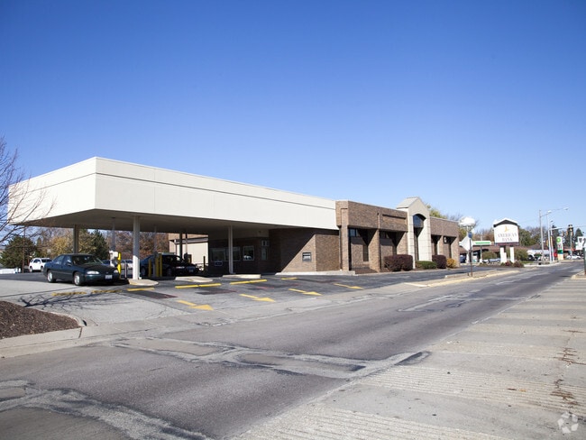
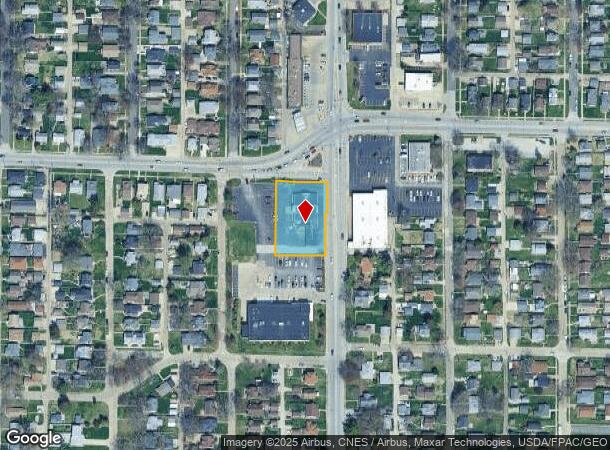
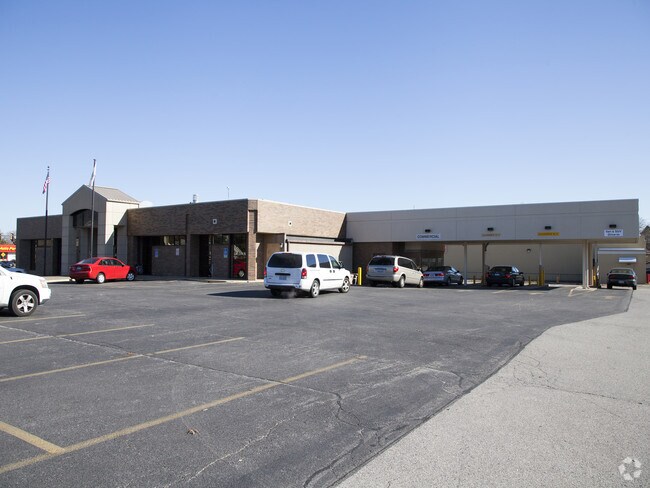
Property Record
3730 18Th Ave, Rock Island, IL 61201
NEARBY LISTINGS FOR SALE OR LEASE
-
-
-
-
-
-
-
No Photo
-
View all Rock Island listings for sale on LoopNet.com
Property Detail
3730 18Th Ave
Davenport-Moline-Rock Island, IA-IL
A Kilcoins Add
16-01-410-012
SUPVR ASST MAP LOT 405 SHEET 8 A KILCOINS ADD 1 STORY
Commercialnec
Rock Island
X
Illinois
19163C0500F
405
2024
1.48 AC
2024
Greater Rock Island
022900
Davenport/Moline/Rock Island
5,690 SF
DEMOGRAPHICS near 3730 18Th Ave
1 Mile
3 Mile
5 Mile
2024 Total Population
16,630
70,920
160,291
2029 Population
16,226
69,829
157,988
Pop Growth 2024-2029
(2.43%)
(1.54%)
(1.44%)
Average Age
39
39
40
2024 Total Households
6,389
30,288
68,309
HH Growth 2024-2029
(2.61%)
(1.49%)
(1.47%)
Median Household Inc
$55,146
$48,809
$54,111
Avg Household Size
2.20
2.20
2.20
2024 Avg HH Vehicles
2.00
2.00
2.00
Median Home Value
$102,006
$116,059
$134,657
Median Year Built
1948
1948
1953
Nearby Places
Map Layers
Map Styles
 Street
 Aerial
- Restaurants
- Banks
- Shops
- Fitness
- Groceries
PUBLIC TRANSPORTATION
AIRPORT
Quad Cities International
DRIVE
WALK
Distance
Quad Cities International
14 min
6.0 mi
Freight Ports
Port Milwaukee
DRIVE
WALK
Distance
Port Milwaukee
241 min
208.1 mi
Nearby Properties
Address
Land Use
TOTAL SIZE
Lot Size
Zoning
Address
Land Use
TOTAL SIZE
Lot Size
Zoning
197,194 SF
5.14 AC
Address
Land Use
TOTAL SIZE
Lot Size
Zoning
3,500 SF
1.54 AC
Address
Land Use
TOTAL SIZE
Lot Size
Zoning
190,832 SF
3.88 AC
Address
Land Use
TOTAL SIZE
Lot Size
Zoning
61,623 SF
2.18 AC
Address
Land Use
TOTAL SIZE
Lot Size
Zoning
76,853 SF
0.56 AC
Address
Land Use
TOTAL SIZE
Lot Size
Zoning
76,808 SF
1.94 AC
Address
Land Use
TOTAL SIZE
Lot Size
Zoning
104,415 SF
5.89 AC
Address
Land Use
TOTAL SIZE
Lot Size
Zoning
9,658 SF
8.07 AC
Address
Land Use
TOTAL SIZE
Lot Size
Zoning
153,329 SF
2.35 AC
Address
Land Use
TOTAL SIZE
Lot Size
Zoning
96,529 SF
3.52 AC
Address
Land Use
TOTAL SIZE
Lot Size
Zoning
72,554 SF
0.38 AC
Address
Land Use
TOTAL SIZE
Lot Size
Zoning
65,958 SF
15.04 AC
Address
Land Use
TOTAL SIZE
Lot Size
Zoning
10,724 SF
1.51 AC
Address
Land Use
TOTAL SIZE
Lot Size
Zoning
32,725 SF
0.99 AC
Address
Land Use
TOTAL SIZE
Lot Size
Zoning
72,173 SF
0.66 AC
Address
Land Use
TOTAL SIZE
Lot Size
Zoning
172,527 SF
1.10 AC
Address
Land Use
TOTAL SIZE
Lot Size
Zoning
159,973 SF
0.87 AC
Address
Land Use
TOTAL SIZE
Lot Size
Zoning
56,333 SF
1.08 AC
Address
Land Use
TOTAL SIZE
Lot Size
Zoning
49,622 SF
0.66 AC
Address
Land Use
TOTAL SIZE
Lot Size
Zoning
61,126 SF
1.57 AC
Address
Land Use
TOTAL SIZE
Lot Size
Zoning
67,439 SF
2.02 AC
Address
Land Use
TOTAL SIZE
Lot Size
Zoning
2,595,576 SF
185.35 AC
MIL
Address
Land Use
TOTAL SIZE
Lot Size
Zoning
133,712 SF
2.31 AC
Address
Land Use
TOTAL SIZE
Lot Size
Zoning
4.30 AC
RI
Address
Land Use
TOTAL SIZE
Lot Size
Zoning
68,808 SF
2.28 AC
Address
Land Use
TOTAL SIZE
Lot Size
Zoning
13,766 SF
2.35 AC
Address
Land Use
TOTAL SIZE
Lot Size
Zoning
7,200 SF
Address
Land Use
TOTAL SIZE
Lot Size
Zoning
7.86 AC
Address
Land Use
TOTAL SIZE
Lot Size
Zoning
42,300 SF
0.27 AC
Address
Land Use
TOTAL SIZE
Lot Size
Zoning
31,534 SF
1.10 AC
The World's #1 Commercial Real Estate Marketplace
Connect with us
© 2025 CoStar Group
The information above has been obtained from sources believed reliable. While we do not doubt its accuracy we have not verified it and make no guarantee, warranty or representation about it. It is your responsibility to independently confirm its accuracy and completeness. Any projections, opinions, assumptions, or estimates used are for example only and do not represent the current or future performance of the property. The value of this transaction to you depends on tax and other factors which should be evaluated by your tax, financial, and legal advisors. You and your advisors should conduct a careful, independent investigation of the property to determine to your satisfaction the suitability of the property for your needs.