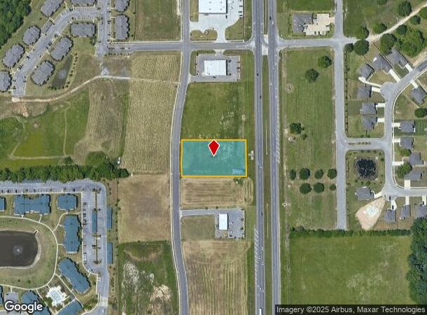
Property Record
3731 Malcolm Dr, Montgomery, AL 36116

NEARBY LISTINGS FOR SALE OR LEASE
Property Detail
3731 Malcolm Dr
Montgomery, AL
Berkshire Commercial 1A
09-09-32-2-000-004.008
0909322000004008
Storebuilding
Montgomery
X
Alabama
01101C0233H
4a
2025
1.20 AC
2025
North Montgomery
005609
Montgomery
14,091 SF
DEMOGRAPHICS near 3731 Malcolm Dr
1 Mile
3 Mile
5 Mile
2024 Total Population
4,240
41,209
93,489
2029 Population
3,973
39,812
90,207
Pop Growth 2024-2029
(6.30%)
(3.39%)
(3.51%)
Average Age
38
37
38
2024 Total Households
1,985
17,500
39,709
HH Growth 2024-2029
(6.70%)
(3.55%)
(3.61%)
Median Household Inc
$75,833
$66,931
$60,630
Avg Household Size
2.10
2.30
2.30
2024 Avg HH Vehicles
2.00
2.00
2.00
Median Home Value
$297,488
$227,635
$184,812
Median Year Built
2000
1994
1989
Nearby Places
Map Layers
Map Styles
 Street
 Aerial
- Restaurants
- Banks
- Shops
- Fitness
- Groceries
PUBLIC TRANSPORTATION
AIRPORT
Montgomery Regional (Dannelly Field)
DRIVE
WALK
Distance
Montgomery Regional (Dannelly Field)
34 min
19.1 mi
SALE & LEASE HISTORY
LISTING DATE
SALE/LEASE

Sep 24, 2016
For Sale
Mar 16, 2017
For Sale
Nearby Properties
Address
Land Use
TOTAL SIZE
Lot Size
Zoning
Address
Land Use
TOTAL SIZE
Lot Size
Zoning
4,998 SF
27.50 AC
R-65-M
Address
Land Use
TOTAL SIZE
Lot Size
Zoning
16,400 SF
28.35 AC
R-65-M
Address
Land Use
TOTAL SIZE
Lot Size
Zoning
4,597 SF
12.36 AC
PUD
Address
Land Use
TOTAL SIZE
Lot Size
Zoning
129,776 SF
6.13 AC
PUD
Address
Land Use
TOTAL SIZE
Lot Size
Zoning
15,932 SF
25.50 AC
R-60-M
Address
Land Use
TOTAL SIZE
Lot Size
Zoning
47,292 SF
63.99 AC
Address
Land Use
TOTAL SIZE
Lot Size
Zoning
76,996 SF
15.51 AC
B-3
Address
Land Use
TOTAL SIZE
Lot Size
Zoning
38,646 SF
12.26 AC
PUD
Address
Land Use
TOTAL SIZE
Lot Size
Zoning
23,642 SF
13.70 AC
PUD
Address
Land Use
TOTAL SIZE
Lot Size
Zoning
57,408 SF
24.61 AC
Address
Land Use
TOTAL SIZE
Lot Size
Zoning
180,684 SF
21.94 AC
PUD
Address
Land Use
TOTAL SIZE
Lot Size
Zoning
1,554 SF
18.26 AC
R-75-M
Address
Land Use
TOTAL SIZE
Lot Size
Zoning
10,317 SF
16.70 AC
AGR-1
Address
Land Use
TOTAL SIZE
Lot Size
Zoning
127,082 SF
7.81 AC
PUD
Address
Land Use
TOTAL SIZE
Lot Size
Zoning
2,885 SF
14 AC
R-75-M
Address
Land Use
TOTAL SIZE
Lot Size
Zoning
201,515 SF
4.46 AC
Address
Land Use
TOTAL SIZE
Lot Size
Zoning
30.36 AC
PUD
Address
Land Use
TOTAL SIZE
Lot Size
Zoning
123,098 SF
60.33 AC
AGR-1
Address
Land Use
TOTAL SIZE
Lot Size
Zoning
30,536 SF
18.06 AC
AGR-1
Address
Land Use
TOTAL SIZE
Lot Size
Zoning
1,964 SF
13.40 AC
R-75-M
Address
Land Use
TOTAL SIZE
Lot Size
Zoning
56,446 SF
18.67 AC
PUD
Address
Land Use
TOTAL SIZE
Lot Size
Zoning
125,121 SF
12.28 AC
PUD
Address
Land Use
TOTAL SIZE
Lot Size
Zoning
2,679 SF
10.77 AC
R-75-M
Address
Land Use
TOTAL SIZE
Lot Size
Zoning
21,634 SF
6.64 AC
Address
Land Use
TOTAL SIZE
Lot Size
Zoning
31,521 SF
6.98 AC
PUD
Address
Land Use
TOTAL SIZE
Lot Size
Zoning
7,683 SF
8.11 AC
PUD
Address
Land Use
TOTAL SIZE
Lot Size
Zoning
49,810 SF
12.40 AC
B-2
Address
Land Use
TOTAL SIZE
Lot Size
Zoning
14,409 SF
16.01 AC
B-3
Address
Land Use
TOTAL SIZE
Lot Size
Zoning
62,852 SF
2.46 AC
PUD
Address
Land Use
TOTAL SIZE
Lot Size
Zoning
89,675 SF
10.58 AC
PUD
The World's #1 Commercial Real Estate Marketplace
Connect with us
© 2025 CoStar Group
The information above has been obtained from sources believed reliable. While we do not doubt its accuracy we have not verified it and make no guarantee, warranty or representation about it. It is your responsibility to independently confirm its accuracy and completeness. Any projections, opinions, assumptions, or estimates used are for example only and do not represent the current or future performance of the property. The value of this transaction to you depends on tax and other factors which should be evaluated by your tax, financial, and legal advisors. You and your advisors should conduct a careful, independent investigation of the property to determine to your satisfaction the suitability of the property for your needs.