Property Record
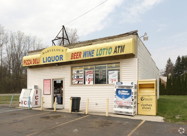
37312 Eureka Rd, Romulus, MI 48174


Property Detail
37312 Eureka Rd
80-115-99-0018-000
29V3A2 THE EAST 70 FT OF THE WEST 214 FT OF THE SOUTH 180 FT OF THE SW 1/4 OF SEC 29 0.29 ACRE
Conveniencestore
Wayne
C2-GEN
Michigan
B and X Area of moderate flood hazard, usually the area between the limits of the 100-year and 500-year floods.
0018
2025
0.24 AC
2025
Airport District
586300
Detroit
1,500 SF
Detroit-Warren-Dearborn, MI
NEARBY LISTINGS FOR SALE OR LEASE
DEMOGRAPHICS near 37312 Eureka Rd
1 mile
3 mile
5 mile
2025 Total Population
1,434
12,278
48,905
2030 Population
1,406
12,195
48,261
Pop Growth 2025-2030
(1.95%)
(0.68%)
(1.32%)
Average Age
43
43
41
2025 Total Households
548
4,957
19,699
HH Growth 2025-2030
(2.19%)
(0.73%)
(1.38%)
Median Household Inc
$87,500
$74,272
$75,712
Avg Household Size
2.60
2.40
2.40
2025 Avg HH Vehicles
2.00
2.00
2.00
Median Home Value
$185,337
$248,268
$241,902
Median Year Built
1963
1970
1976
Nearby Places
Map Layers
Map Styles
 Street
 Aerial
Transit
 Traffic
 Biking
Places
Listings with unknown addresses are not visible on the map
- Restaurants
- Banks
- Shops
- Fitness
- Groceries
PUBLIC TRANSPORTATION
AIRPORT
Detroit Metro Wayne County
Drive
Walk
Distance
Detroit Metro Wayne County
11 min
4.9 mi
Windsor International
Drive
Walk
Distance
Windsor International
53 min
32.1 mi
Freight Ports
Drive
Walk
Distance
57 min
45.4 mi
Nearby Properties
Address
Land Use
TOTAL SIZE
Lot Size
Zoning
Address
Land Use
TOTAL SIZE
Lot Size
Zoning
752,400 SF
72.97 AC
PDA
Address
Land Use
TOTAL SIZE
Lot Size
Zoning
516,762 SF
51.63 AC
PDA
Address
Land Use
TOTAL SIZE
Lot Size
Zoning
500,240 SF
M1-LIG
Address
Land Use
TOTAL SIZE
Lot Size
Zoning
146,562 SF
M2-GEN
Address
Land Use
TOTAL SIZE
Lot Size
Zoning
500,240 SF
55.95 AC
M2-GEN
Address
Land Use
TOTAL SIZE
Lot Size
Zoning
1,141,765 SF
154.21 AC
M2-GEN
Address
Land Use
TOTAL SIZE
Lot Size
Zoning
600,000 SF
M1-LIG
Address
Land Use
TOTAL SIZE
Lot Size
Zoning
199,922 SF
30.86 AC
M2-GEN
Address
Land Use
TOTAL SIZE
Lot Size
Zoning
250,263 SF
18.81 AC
RM-MLTI
Address
Land Use
TOTAL SIZE
Lot Size
Zoning
462,840 SF
45.66 AC
PDA
Address
Land Use
TOTAL SIZE
Lot Size
Zoning
87,000 SF
18.02 AC
Address
Land Use
TOTAL SIZE
Lot Size
Zoning
129,260 SF
5.25 AC
AP-AIRPORT
Address
Land Use
TOTAL SIZE
Lot Size
Zoning
88,790 SF
M2-GEN
Address
Land Use
TOTAL SIZE
Lot Size
Zoning
M1-LIG
Address
Land Use
TOTAL SIZE
Lot Size
Zoning
119,319 SF
10.23 AC
RM MULT
Address
Land Use
TOTAL SIZE
Lot Size
Zoning
201,184 SF
10.22 AC
M-2/PDA
Address
Land Use
TOTAL SIZE
Lot Size
Zoning
338,896 SF
14.35 AC
M2-GEN
Address
Land Use
TOTAL SIZE
Lot Size
Zoning
101,200 SF
5.54 AC
AP-AIRPORT
Address
Land Use
TOTAL SIZE
Lot Size
Zoning
65,518 SF
20.77 AC
R1A-S.F
Address
Land Use
TOTAL SIZE
Lot Size
Zoning
105,000 SF
15.26 AC
M2-GEN
Address
Land Use
TOTAL SIZE
Lot Size
Zoning
87,000 SF
17.20 AC
B1 LOCA
Address
Land Use
TOTAL SIZE
Lot Size
Zoning
88,790 SF
10.48 AC
M2-GEN
Address
Land Use
TOTAL SIZE
Lot Size
Zoning
79,895 SF
12.56 AC
M2-GEN
Address
Land Use
TOTAL SIZE
Lot Size
Zoning
174,163 SF
17.87 AC
M1 LIG
Address
Land Use
TOTAL SIZE
Lot Size
Zoning
157,099 SF
28.92 AC
M2-GEN
Address
Land Use
TOTAL SIZE
Lot Size
Zoning
117,695 SF
21.72 AC
M2-GEN
Address
Land Use
TOTAL SIZE
Lot Size
Zoning
88.62 AC
M1-LIG
Address
Land Use
TOTAL SIZE
Lot Size
Zoning
84,016 SF
8.44 AC
M2-GEN
Address
Land Use
TOTAL SIZE
Lot Size
Zoning
47.09 AC
I2 HEAV
Address
Land Use
TOTAL SIZE
Lot Size
Zoning
45,934 SF
35.95 AC
M2 GEN
The World's #1 Commercial Real Estate Marketplace
Connect with us
© 2026 CoStar Group
The information above has been obtained from sources believed reliable. While we do not doubt its accuracy we have not verified it and make no guarantee, warranty or representation about it. It is your responsibility to independently confirm its accuracy and completeness. Any projections, opinions, assumptions, or estimates used are for example only and do not represent the current or future performance of the property. The value of this transaction to you depends on tax and other factors which should be evaluated by your tax, financial, and legal advisors. You and your advisors should conduct a careful, independent investigation of the property to determine to your satisfaction the suitability of the property for your needs.